Sunday, June 13, 2010

Utah Road Trip - May 2010


Utah sign, originally uploaded by kimberzy.

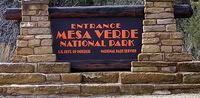
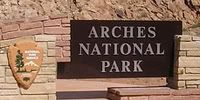
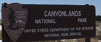
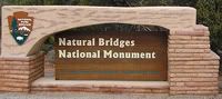
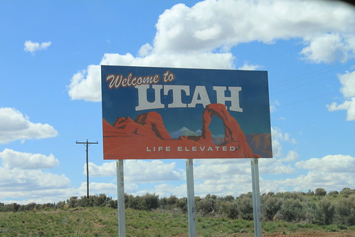
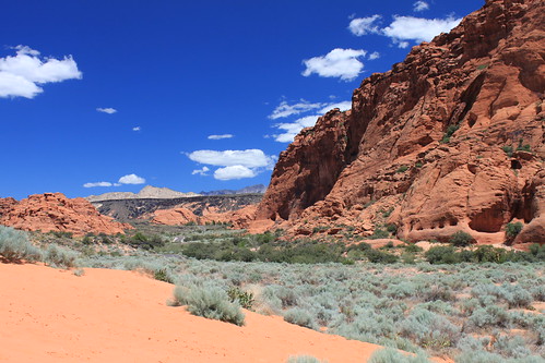
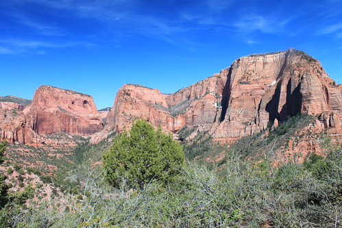
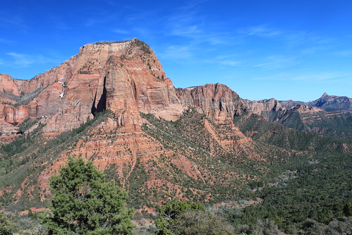
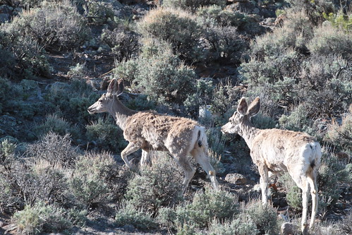
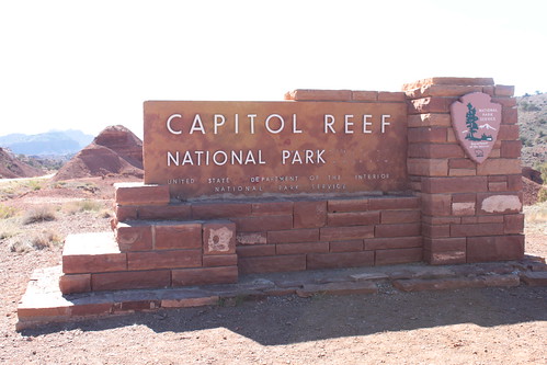
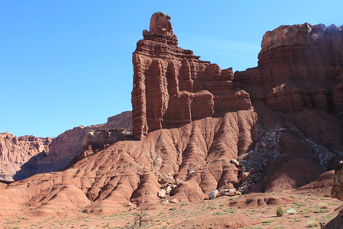
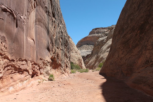
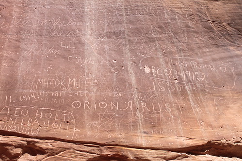
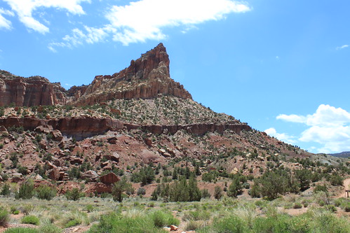
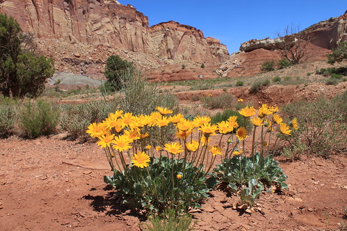
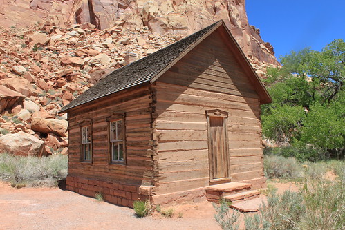
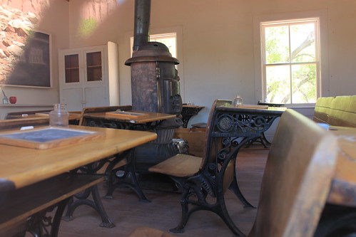
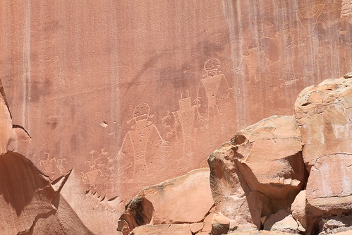
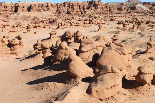
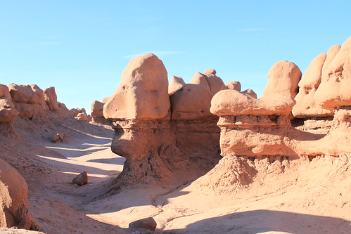
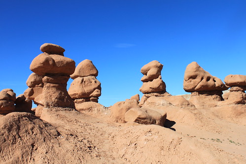
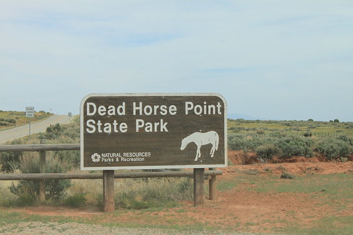
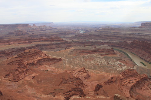
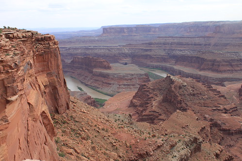
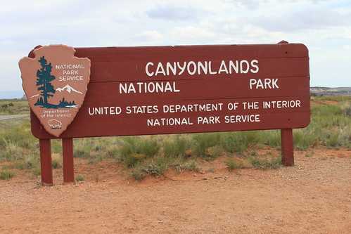
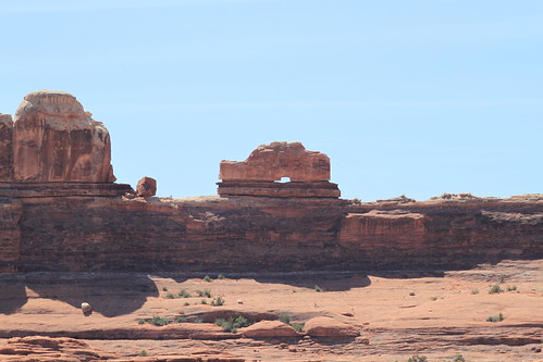
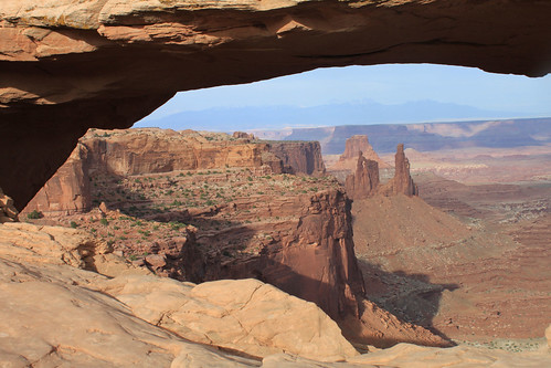
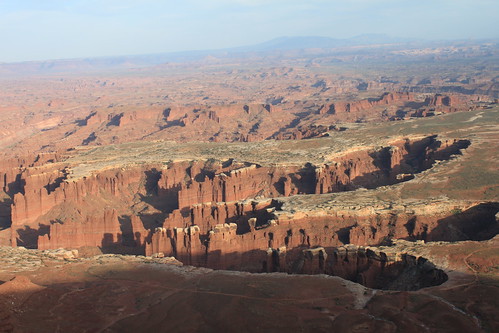
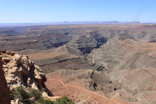
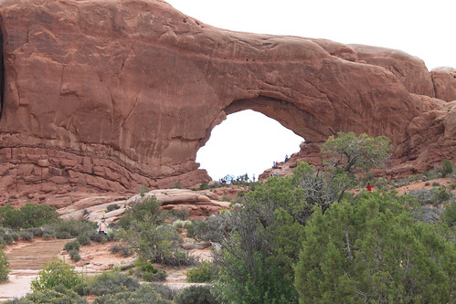
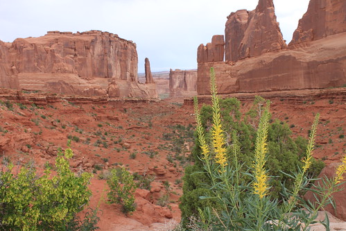
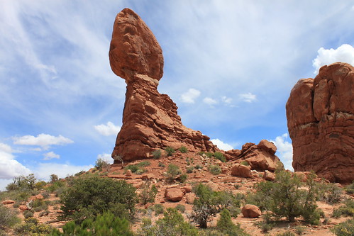
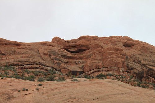
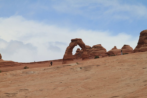
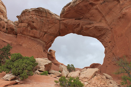
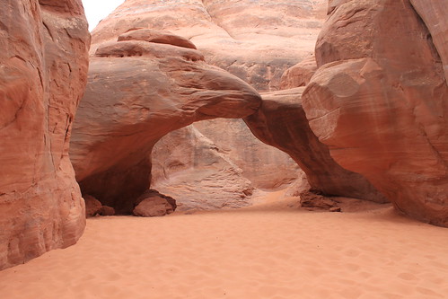
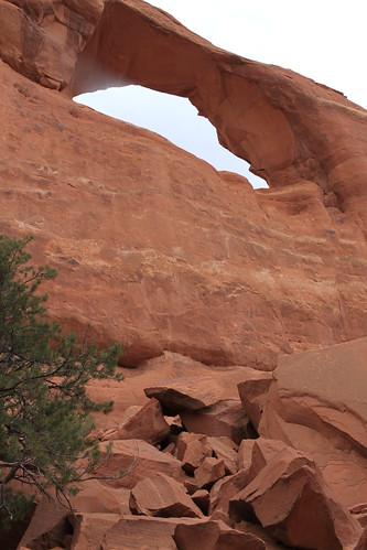
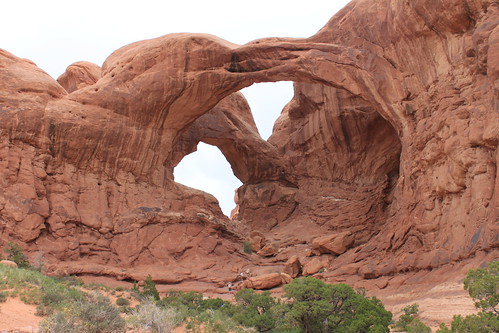
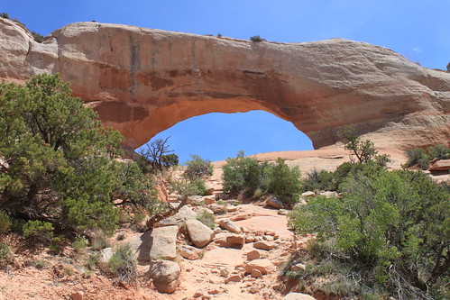
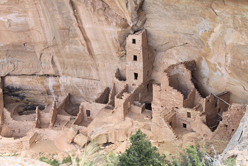
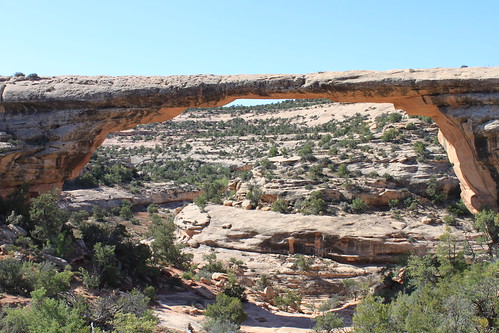
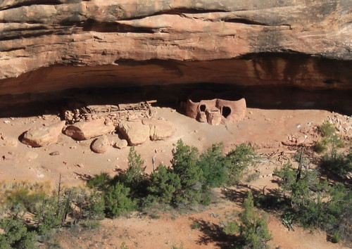
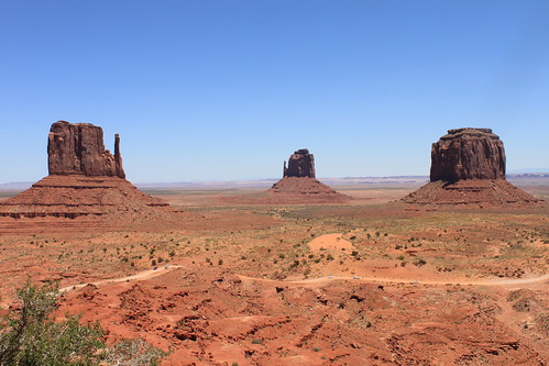
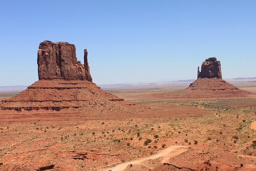
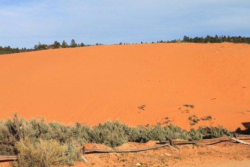
On May 15, 2010, I headed out for St George, Utah, the first stop on my road trip. I visited Snow Canyon State Park and Zion's Kolob Canyon on this day. The next day, I traveled to Capitol Reef National Park and Goblin Valley State Park, where I camped out for the night. That was a nice warm nite, with the skies dark and full of stars. On May 17th, I made my way to Moab, Utah, where I stayed 2 nights, visiting Canyonlands National Park (both The Island In The Sky and The Needles Districts), Dead Horse Point State Park and Newspaper Rock State Park. The next day, it was off to Arches National Park, where I was met by cloudy skies and thunderstorms. On May 19, 2010, I visited Mesa Verde National Park and Hovenweep National Monument , and camped out at Devil's Canyon Campground near Blanding, Utah. That was a cold night! Brr! The last full day of my trip, I visited Natural Bridges National Monument, Monument Valley (by way of the Moki Dugway), Navajo National Monuement, Johnson Canyon, and Coral Pink Sand Dunes State Park, where I camped out. On the 21st, I made my way back home. It was an awesome trip! I posted pics and more details of the trip below. Enjoy!

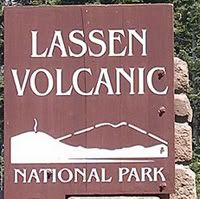
I plan on visiting Mt Lassen National Park in July, and will probably go to the eastern Sierras before then. Maybe a return trip to Arches in September...perhaps. We shall see.

Til next time, happy trails!!!

Snow Canyon State Park - Sand Dunes area - May 15, 2010

On the first day of my road trip, I visited Snow Canyon State Park. It was a very warm day, with blue skies and loads of sunshine. The red Navajo Sandstone, topped with an overlay of black lava rock, made this place very unique looking from most of the parks I have been to.

The park was created in 1958, being originally called DIxie State Park, and later being renamed Snow Canyon State Park after two pioneering leaders, Lorenzo and Erastus Snow. Several movies have been filmed here, including Butch Cassidy and the Sundance Kid, The Electric Horseman, and Jeremiah Johnson.

Links to Check Out:
Utah State Parks: Snow Canyon State Park
Wikipedia: Snow Canyon State Park
My Flickr Photo Album: Snow Canyon State Park

Snow Canyon State Park - bird


Snow Canyon SP -bird, originally uploaded by kimberzy.

I am not sure what kind of bird this is, but he was singing his little heart out from atop the branch of this bush.

Snow Canyon State Park - Long Nosed Leopard Lizard (2)

This little guy was standing on the asphalt, with his little feet in the air, like he was trying to cool them off. It was a pretty warm day in the park!

Zion Ntl Park - Kolob Canyon - May 15, 2010

Kolob Canyon is part of Zion National Park, though not as well known or not as often visited. It is located right off of Hwy 15, about 30 or so miles north of St George, Utah.

Kolob Canyon gets its reddish coloring from the Navajo Sandstone. The word "Kolob" is from Mormon scripture meaning "residence closest to heaven."

I made a brief visit here on the 1st evening of my road trip and got to take a short hike on the Timber Creek Overlook Trail. This trail is about 1 mile round trip with an elevation gain of about 100 feet. The view from the end of the trail is amazing. I can see why the canyon got its name.

Links to check out :
Utah.com: Kolob Canyon
Wikipedia: Geology of Kolob Canyon and Zion Canyon
My Flickr Photo Album: Zion National Park

Zion National Park - Kolob Canyon - May 15, 2010

A nice view of Kolob Canyon from the Timber Creek Overlook Trail

Utah - Mule Deer


Utah - Mule Deer (2), originally uploaded by kimberzy.

I saw a whole lot of deer along Hwy 24 on the way to Capitol Reef National Park.

Capitol Reef National Park - May 16, 2010

I arrived at Capitol Reef National Park in the morning. The weather was perfect: blue skies, a few clouds in the sky, and plenty of sunshine, and not too hot. I took in a hike at Capitol Gorge Trail, saw the Fremont Petroglyphs and walked around Fruita. And of course, took plenty of photographs.

On August 2, 1937, President Roosevelt made this area a National Monument, and on December 18, 1971, President Nixon made it a National Park.

Capitol Reef National Park is located near the town of Torrey, Utah, and it comprises of 378 square miles of canyons, monoliths, ridges and buttes. About 75 miles of the Waterpocket Fold is preserved within the park's boundaries.

Links to Check Out:
NPS: Capitol Reef National Park: History and Culture
My Flickr Photo Album: Capitol Reef National Park

Capitol Reef Ntl Park - Chimney Rock

Early morning sun shines on Chimney Rock in Capitol Reef National Park.

Capitol Reef Ntl Park - Utah Penstemon

Capitol Reef Ntl Park - Claret Cup Cactus

Capitol Reef Ntl Park - Capitol Gorge Trail - May 16, 2010


Capitol Reef Ntl Park - (72), originally uploaded by kimberzy.

I enjoyed a nice hike in Capitol Gorge in the morning. It was fairly cool in the morning, so the lack of good shade wasn't a bother. The trail was level and a little rocky in places, but overall, it was a nice 2 1/2 mile walk. Along the trail, you can see names of early Mormon pioneers who carved their names in the rock.

Link to Check Out:
NPS: Capitol Reef Trail Guide

Capitol Reef Ntl Park - Pioneer Register - May 16, 2010

Early Mormon pioneers carved their names into the sandstone in Capitol Gorge to mark their travels. Their names can be seen along the Capitol Gorge Trail (about a 2 1/2 mile round trip hike on a level, slightly rocky, trail).

Capitol Reef Ntl Park - Eph Hanks Tower - May 16, 2010

This rock formation in Capitol Reef National Park is named after Ephraim Hanks, a prominent member of the 19th-Century Latter Day Saint movement, a Mormon pioneer and a well known leader in the early settlement of Utah.

Capitol Reef Ntl Park - Nakedstems - May 16, 2010

A lot of wildflowers were in bloom in Capitol Reef, including these flowers, called Nakedstems.

Capitol Reef Ntl Park - Fruita Schoolhouse - May 16, 2010

Fruita was founded in 1880 by Mormons under the name "Junction." Later on in around 1902, it became known as Fruita. It was once dubbed "the Eden of Wayne County" due to its large fruit orchards.

In 1896, this one-room schoolhouse was built. It was also used for religious services and dances. It was restored by the National Park Service in 1966.

Link to Check Out:
Wikipedia" Fruita

Capitol Reef Ntl Park - Fruita Schoolhouse - May 16, 2010

Looking thru the window of the Fruita Schoolhouse

Capitol Reef Ntl Park - May 16, 2010

The Fremont Petroglyphs were carved into the canyon walls in Capitol Reef National Park by the Fremont people who inhabited the area nearly 1,000 years ago

Goblin Valley State Park - May 16, 2010


I camped out here at Goblin Valley State Park on May 16, 2010. It was a good thing I had reservations, as you can see, the campground was full.

I had an awesome time hiking amongst the "Goblins" in the park. I walked for 2 hours around Goblin Valley. It seemed like there was something new to see around every turn.

Goblin Valley was first discovered by cowboys searching for cattle. Then, in the 1920's, Arthur Chaffin, who owned and operated the Hite Ferry on the Colorado River, came across this place, which he dubbed "Mushroom Valley," while searching for an alternate route between Green River and Cainsville. On August 24, 1964, Goblin Valley was designated as a state park.

Goblin Valley State Park is located in Emery County between the towns of Hanksville and Green River, Utah.

Links to Check Out:

Utah.com: Goblin Valley State Park

Goblin Valley State Park - May 16, 2010

Relaxing after a long, 2 hour walk amongst the "Goblins." Sat here and watched the sun go down.

Me and my shadow - Goblin Valley State Park - May 16, 2010


Goblin Valley State Park - May 16, 2010


Goblin Valley SP (9), originally uploaded by kimberzy.

An afternoon hike in Goblin Valley State Park

Goblin Valley State Park - May 16, 2010


Goblin Valley SP (40), originally uploaded by kimberzy.

Walking amongst the "goblins" in Goblin Valley State Park

Goblin Valley State Park - May 16, 2010


Goblin Valley SP (17), originally uploaded by kimberzy.

"Goblins" in Goblin Valley State Park

Dead Horse Point State Park - May 17, 2010


Dead Horse Point SP - (12), originally uploaded by kimberzy.

I visited Dead Horse Point State Park on May 17, 2010. The park is on the way to Canyonlands' Island In The Sky District, so of course I had to stop by and check it out. Of course, the skies had started to cloud up by the afternoon, so the few phots I took were not all that great. Still, the views from the overlook were amazing! 2,000 feet below, lies the Colorado River, which is the force that carved out these canyons. It looked like a smaller version of The Grand Canyon.

The park was named Dead Horse Point after an old story detailing about how a group of unwanted Mustangs was left corralled on the mesa top and ultimately died of thirst. Whether this story is true or not is unknown.

Links to Check Out:
Utah.com: Dead Horse Point State Park
State Parks- Utah: Dead Horse Point State Park
My Flickr Photo Album: Dead Horse Point State Park

Dead Horse Point State Park - May 17, 2010


Dead Horse Point SP -, originally uploaded by kimberzy.

A view from an overlook at Dead Horse Point State Park

Dead Horse Point State Park - May 17, 2010


Dead Horse Point SP - (4), originally uploaded by kimberzy.

A view from Dead Horse Point State Park

Canyonlands Ntl Park - May 17, 2010

I visited Canyonlands National Park on May 17, 2010. First, I went to the Needles District and later on in the day, I went to the Island In The Sky District. The morning was nice and sunny, but it started clouding up in the afternoon. I did a hike at the Needles (Pothole Point) and then at Island In The Sky, I did the Mesa Arch hike. Both were short hikes, as I only had a day to visit these 2 parts of the park.

Canyonlands National Park preserves a landscape carved out by the Colorado River and its tributaties. Features such as mesas, canyons and buttes can be found here. The park consists of four parts, or "districts:" The Island In The Sky, The Needles, The Maze and the rivers themselves. The Needles and Island In The Sky can be easily accessed, while The Maze District is more rugged and remote and requires a 4WD vehicle.

Canyonlands National Park is located near the town of Moab, Utah, with Island in The Sky being just north of Moab and The Needles being just south of it.

Links to Check Out:
NPS: Canyonlands National Park
Wikipedia: Canyonlands National Park
My Flickr Photo Album: Canyonlands National Park

Saturday, June 12, 2010

Canyonlands Ntl Park - Needles District - Wooden Shoe Arch

This arch is in Canyonlands National Park's Needles District. It is named Wooden Shoe Arch as it resembles a wooden shoe (dontcha think? the more I look at it, the more I see it)

Canyonlands Ntl Park - Isle In The Sky - Mesa Arch - May 17, 2010

This is a picture of the view looking thru Mesa Arch. This was a nice end fo a long day. What a view!!

This arch can be seen after a short hike (1/2 mile round trip) up a short hill (I think there is about a 100 foot or so elevation gain).

Canyonlands Ntl Park - Isle In The Sky - May 17, 2010

A view of Canyonlands in the late afternoon

Friday, June 11, 2010

Muley Point


Muley Point (3), originally uploaded by kimberzy.

Muley Point is a scenic overlook located in Utah, near the beginning of Moki Dugway off of Rte 261. It can be reached at the end of a 5-mile dirt road. From this viewpoint, you can see the San Juan RIver where it cuts into the canyon below. You can see Monument Valley in the distance.

Moki Dugway is a steep, dirt road that winds its way down the mountain. This road eventually leads to the town of Mexican Hat, Utah. The speed limit is 5 mph, and for good reason. The road is dirt, so it is kind of rough, and it is steep....a 10% grade that descends 1100 feet in 3 miles. RV's are not recommended on this road as the switchbacks have sharp turns and the road is rather narrow. Despite the rough going (and the tailgating car behind me), I found this road to be a lot less scary than I initially thought it would be. It was actually pretty cool....and what a view!

Links to Check Out:
Muley Point
Moki Dugway

Arches National Park - May 18, 2010


Arches Ntl Park - (2), originally uploaded by kimberzy.

I visited Arches National Park on May 18, 2010. The day was overcast but still warm. I was pretty disappointed that I didn't have better weather, or at least some sunshine! Not only that, but I also had an upset tummy, which made taking a longer hike nearly impossible (since there aren't any bathrooms on the trails - lol). I did manage a few short hikes, including Sand Dune Arch, Broken Arch, Skyline Arch, Double Arch, and The Windows trails. I didn't get to go to Landscape Arch (the longest arch in the park and in the world for that matter), because I could not find a place to park in the parking lot...not one spot. Ugh. I really wanted to go to that one. Photo ops were many, but the cloudy skies didn't make for very pretty pictures.

On the hike to Broken Arch, I got caught in a cloudburst and took shelter under an alcove to wait it out. And then when I was at Park Avenue, it started to sprinkle again. When I was at the Delicate Arch viewpoint, I could hear thunder rumbling, so I took that as a cue to go back to the hotel room in Moab. Not long after I got back to the room, it started pouring....with thunder and lightning. I love to watch the lightning, but it sure put a damper (no pun intended) on my trip to the park.

The park is every bit as beautiful as I thought it would be, and hopefully, next time I go, I will have some sunshine and blue skies!

Link to Check Out:
NPS: Arches National Park
My Flickr Photo Album: Arches National Park

Thursday, June 10, 2010

Arches Ntl Park - Park Avenue - Prince's Plume - May 18, 2010


Arches National Park is located in Utah, near the town of Moab. It is home to over 2,000 natural sandstone arches and many other unusual rock formations, such as fins, spires and balanced rocks. The arches in the park range from the smallest (to be considered an 'arch', the opening has to have a span of at least 3 feet), to the longest, Landscape Arch, which has a span of 306 feet from base to base, making it the longest arch in the world.


Links to Check Out:
NPS: Arches National Park
Wikipedia: Arches National Park

Wednesday, June 09, 2010

Arches Ntl Park - Balanced Rock - May 18, 2010

There aren't just arches in Arches National Park, of course. Balanced Rock is an example of a hoodoo (such as those seen in Bryce Canyon). The rock is not balanced on top of the pedestal, as it looks like in the picture. It is actually attached to it. The large boulder is comprised of harder rock (Entrada's Slick Rock member) than the pedestal is made of (Entrada's Dewey Bridge member). The whole structure is 128 feet tall. The boulder weighs approximately 3577 tons (which is the equivalent of 1600 cars!).

Link to Check Out:
Wikipedia: Balanced Rock

Arches Ntl Park - Pothole Arch - May 18, 2010


Arches Ntl Park - Pothole Arch, originally uploaded by kimberzy.

This is an example of a, you guessed it, pothole arch, which is formed by erosion from above. Water running down the edge of the cliff wore a depression (or pothole) into the rock and created the arch. This arch has a span of 90 feet and is 30 feet high, and it is visible from the road.

Arches Ntl Park - Delicate Arch - May 18, 2010

I didn't go on the trail to this arch, since it had begun to cloud up and rumbles of thunder could be heard in the distance. My feet were also starting to feel the miles of hikes I had already put in prior to my arrival here. ( I got caught in a cloudburst on the trail to Broken Arch a little earlier). About an hour after I went to this viewpoint, it started to pour, along with thunder and lightning (it's a good thing I opted not to go - lol). Next time for sure!!!

This is probably the most-recognized of all the arches in the park. It is 52 feet tall and formed out of Entrada Sandstone.

Link to check out:
Wikipedia: Delicate Arch

Arches Ntl Park - Broken Arch - May 18, 2010

You can get to this arch by a 1.3 mile round trip hike along a mostly level trail (although there is not much shade along the way). As you see, the arch is not broken, but there is a crack in it. One can only wonder how long it will remain standing before its inevitable collapse.

Broken Arch is 59 ft long and 43 ft tall.

Link to Check Out:
Arches National Park

Arches Ntl Park - Sand Dune Arch - May 18, 2010

The trail to this arch is short (about .3 miles round trip) and is easy, although there is some deep sand (which can creep into your shoes - lol).

Arches Ntl Park - Skyline Arch - May 18, 2010

The hike to this arch is a very easy .4 mile round trip walk along a pretty flat trail. On a night in November 1940, a large chunk fell out of the arch, which doubled the size of the opening. As you can see in the photo, a large pile of rocks lies at the base of the arch - perhaps pieces of the old arch.

The Skyline Arch opening has a span of 71 feet.

Link to check out:
NPS: Skyline Arch


Arches Ntl Park - Double Arch - May 18, 2010


Arches Ntl Park - Double Arch, originally uploaded by kimberzy.

Double Arch - The hike to this pair of arches is a very easy 1/2 mile round trip along a relatively flat trail.

This set of arches is one of the more prominent features in the park, due to its unusual formation. It is a pothole arch, which is formed by water erosion from above rather than the more usual erosion from the side. This area was used as the backdrop for the opening scene of Indiana Jones and The Last Crusade.

Link to Check Out:
Wikipedia: Broken Arch

Utah - Wilson Arch


Utah - Wilson Arch (5), originally uploaded by kimberzy.

This arch is easily visible from Hwy 191, about 20 or so miles south of Moab, Utah. This arch was named after a pioneer named Joe Wilson.

The arch is formed out of Entrada Sandstone and has a span of 91 feet and a height of 46 feet.

Mesa Verde Ntl Park - May 19, 2010


Mesa Verde Ntl Park - (5), originally uploaded by kimberzy.

I went to Mesa Verde National Park on a whim. It was only a few hours from where I had camped, so I thought, "what the heck?" (lol).

They were doing construction on the road, so the going was slow. I was still able to drive along the scenic loop and stop at the viewpoints, including this one.

Mesa Verde National Park was established as a national park on June 29, 1906. The park preserves many ancient cliff dwellings, pit houses, pueblos, masonry towers and farming structures of the ancient Puebloan people, who made Mesa Verde their home from about A.D. 550 to 1300. The cliff dwellings of Mesa Verde and some of the best preserved in North America.

I didn't have enough time to go up close to the cliff dwellings this time around, but you can see them quite well from the many viewpoints on the scenic loop drive.

Links to Check out:
NPS - Mesa Verde National Park
My Flickr Photo Album: Mesa Verde National Park

Sunday, June 06, 2010

Natural Bridges Ntl Monument - Owachomo Bridge - May 20, 2010

I decided to visit Natural Bridges National Monument on the way to Monument Valley. I only had time to do 2 short hikes...to Owachomo Bridge and the hike to Horsecollar Ruin. The other hikes in the park were simply too long (and strenuous) to do in an hour or 2, since my time was pretty limited here. I did have a great time at the park nonetheless.

Natural Bridges National Monument is located in southeast Utah, near the town of Blanding. It is home to 3 natural bridges. (The Natural Arch and Bridge Society defines a natural bridge as a type of arch that is primarily water formed). The bridges went through a few name changes over the years, first being named President, Senator and Congressman. Next they were renamed Augusta, Caroline and Edwin, before finally being renamed in 1909 to Sipapu, Kachina and Owachomo.

The hike to Owachomo Bridge was short, but fairly steep, but it is the easiest of the 3 bridge trails: It is about 1/2 mile round trip with an elevation change of about 200 feet.

Owachomo means "rock mound" in Hopi and is named after the rock formation on top of the southeast end of the bridge.

The hike to the Horsecollar Ruin Overlook is about .6 miles round trip and is fairly level with minimal elevation change.

Links to Check Out:
NPS - Natural Bridges National Monument
My Flickr Photo Album: Natural Bridges National Monument

Natural Bridges Ntl Monument - Horsecollar Ruin - May 20, 2010

Horsecollar Ruin is one of the best preserved Puebloan sites in the area, and is named so since the doorways resemble horsecollars. It was discovered in the 1880's.

Monument Valley Navajo Tribal Park - May 20, 2010

I made it to Monument Valley a little after noon. It was pretty warm outside and not a cloud in the sky. I had lunch at The View Restaurant and got a few souvenirs at the gift shop. I didn't make the full loop drive, but I was still able to take this nice landscape shot right outside the gift shop. I think the next time I go I will take a guided tour.

Monument Valley is located near Goulding, UT, and The park is located on the Navajo Nation Reservation, and its sandstone formations have been the backdrop for many motion pictures. The Navajo name for the park is Tsé Bii' Ndzisgaii (Valley of the Rocks).

The park lies within the borders of the Colorado Plateau, an area of land which is largely centered on the Four Corners region of the US (consisting of northern Arizona and New Mexico, and southern Utah and Colorado). The Colorado Plateau is also home of several other parks including The Grand Canyon, Bryce Canyon, Capitol Reef and Zion National Parks. The brilliant red color of the landscape is the result of iron oxide exposed in the weathered siltstone, while the darker bluish-gray rocks get their color from maganese oxide.

This is one of my favorite parks to visit. I don't think any picture gives it justice. It is one of those places which you simply need to see to fully appreciate its beauty.

Links to check out:
Navajo Nation Parks - Monument Valley
My Flickr Photo Album:Monument Valley

Monument Valley Navajo Tribal Park - May 20, 2010

West and East Mittens

Johnson Canyon - Gunsmoke Set - May 20, 2010

Some of the old buildings used on the set of the TV show "Gunsmoke" are still standing in Johnson Canyon in Utah. The buildings are clearly in a sad state, but were still pretty neat to see. My dad would have loved to see them, as he is a big fan of western tv shows and films.

Johnson Canyon is located off of Hwy 89 near Kanab, Utah. The area in and around Kanab is often referred to as Utah's Little Hollywood, as over 100 movies have been filmed in the area, including "The Outlaw Josey Wales." Several sets from movies can be found at Frontier Movie Town in Kanab.

The Gunsmoke set is on private property, but can be easily viewed from the roadside.

Link to check out:
Utah's Little Hollywood

Coral Pink Sand Dunes State Park - May 20, 2010

I stayed here the last nite of my trip at the campground. The weather was great and I slept like a log. Didn't get a chance to really go exploring though, since I arrived late in the day and left early in the morning for home.

The park is located in Utah near Zion National Park, between Mt Carmel Junction and Kanab. It is more of an OHV park, since the sand dunes are open to OHV's. But there are hiking opportunities as well. Like the name says, the sand dunes are a kind of coral pink color, which is a striking contrast between the blue skies and green pine trees. Truly a photographer's dream. I wish I was able to get some more pictures of the park, but I just ran out of time. Maybe next time.

Link to check out:
Coral Pink Sand Dunes State Park