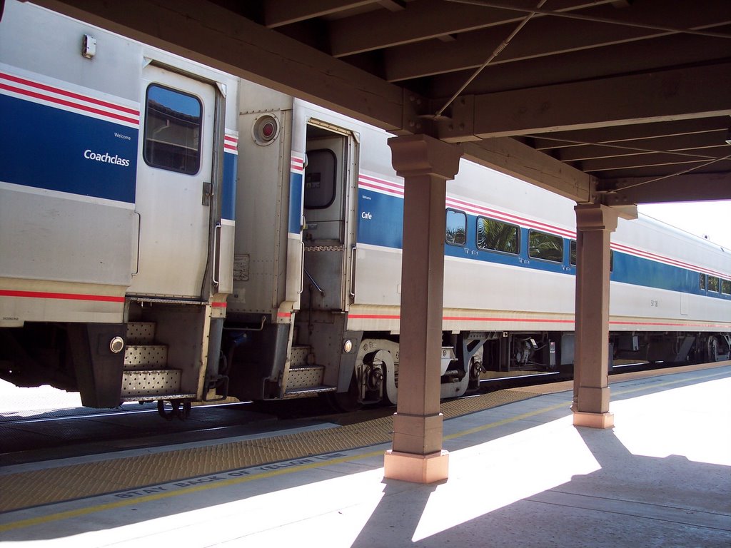
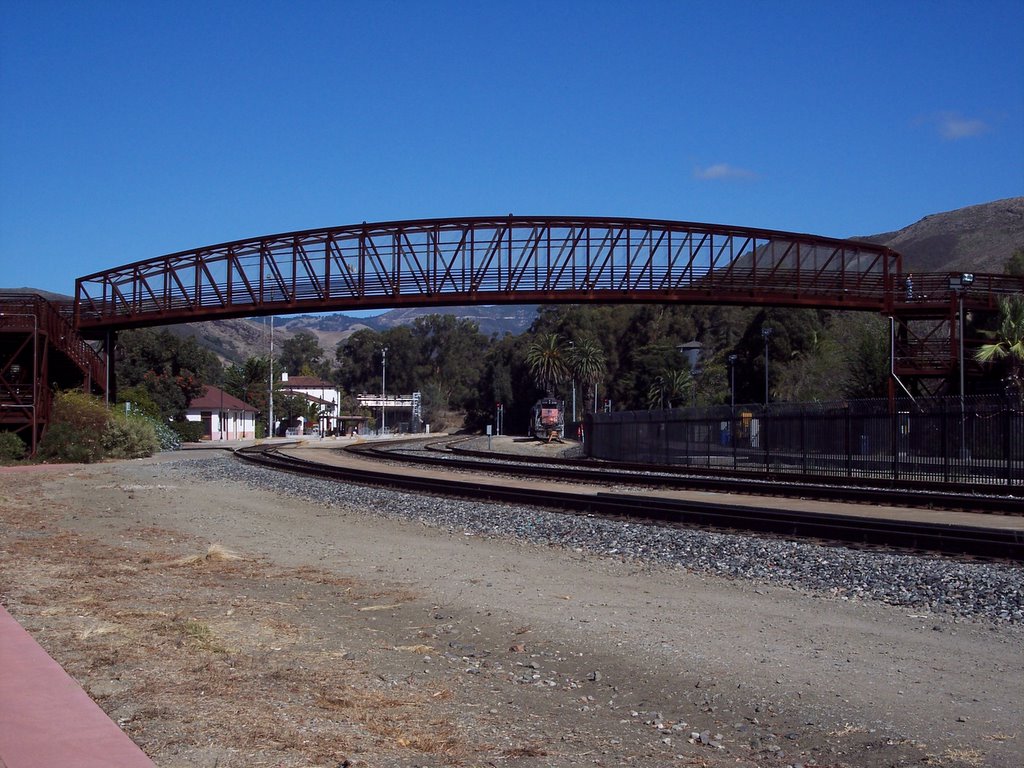
Chris took me on a train ride this weekend from San Luis Obispo to Santa Barbara. We went on the Surfliner on the way to Santa Barbara (which is a commuter train) and on the Coast Starlight on the way back. That train goes all the way to Seattle. It was great! You can see so much more on the train than you can on the freeway. The train takes you right along the coastline, so you have a great view of the ocean. It was a nice, sunny weekend, so the view was awesome! We saw a bunch of deer grazing in the fields, and a coyote catching himself some lunch. The train is a lot smoother than I thought it would be. It was the first time I had been on a train. Yeah, I know, I haven't been on a lot of things....haven't ridden in a taxi or been on the subway...haven't ridden on a trolley car or gone jetskiing...haven't been on a cruise or been in a hot-air balloon. Maybe someday.
We went and saw Saw 2 at the movie theatre on Saturday night. The theatre was pretty full, and the movie was quite good. I won't reveal anything about the movie except to say that it definitely leaves room for another sequel ;)
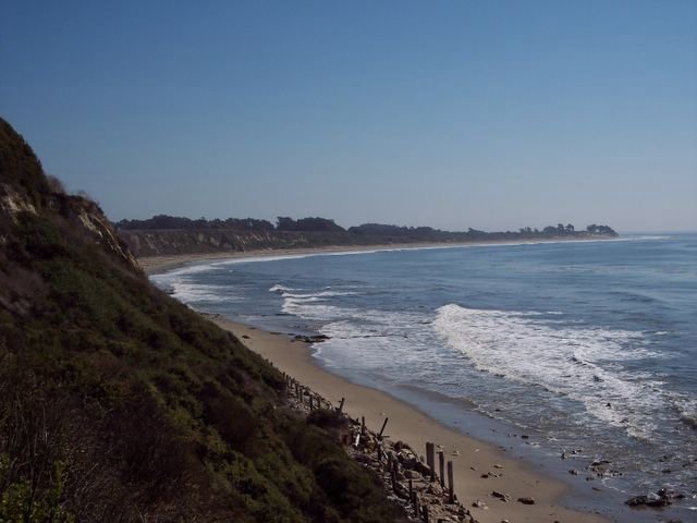
We took a walk along a trail in Goleta, CA in Sperling's Preserve on Sunday, before we had to go back to the train station. There is a butterfly preserve there, and in November or December, the monarch butteflies migrate there to take refuge in the eucalyptus trees. There were a few butterflies fluttering about, but it was too early to see them. We took a walk down the trail and ended up near the coast...actually, right above it. The trail was brushy, and luckily there wasn't any poison oak...believe me, I was watching out for it! The trail was full of bushes and you had to make your way through them, but the view of the coast, once you got past the bushes, was so worth it! Absolutely beautiful! I think we walked about a mile in all.
I had a great weekend. Great train ride....great weather....great movie....great food! It was, as Tony the Tiger says, "Grrrrrrrrrrrrrrrreat!"
Monday, October 31, 2005
Sunday, October 30, 2005


Tuesday, October 25, 2005
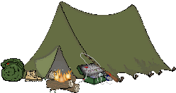
Camping Humor
Sherlock Holmes and Dr. Watson went on a camping trip. After a good meal, they lay down for the night and went to sleep. Some hours later, Holmes awoke and nudged his faithful friend.
Holmes said: "Watson, look up and tell me what you see".
Watson said: "I see a fantastic panorama of countless stars".
Holmes: "And what does that tell you?"
Watson pondered for a moment: "Astronomically, it tells me that there are millions of galaxies and potentially billions of planets. Astrologically, I observe that Saturn is in Leo. Horologically, I deduce that the time is approximately a quarter past three. Theologically, I can see that God is all powerful and that we are small and insignificant. Meteorologically, I suspect that we will have a beautiful day tomorrow."
"Why? - What does it tell you, Holmes?"
Holmes was silent for a moment then spoke: "Someone has stolen our tent."
~~~~~~~~~~~~~~~~~~~~~~~~~~~
These are actual comments left on U. S. Forest Service registration sheets and comment cards by backpackers completing wilderness camping trips:
"A small deer came into my camp and stole my bag of pickles. Is there a way I can get reimbursed? Please call."
"Escalators would help on steep uphill sections."
"Instead of a permit system or regulations, the Forest Service needs to reduce worldwide population growth to limit the number of visitors to wilderness."
"Trails need to be wider so people can walk while holding hands."
"Ban walking sticks in wilderness. Hikers that use walking sticks are more likely to chase animals."
"All the mile markers are missing this year."
"Found a smoldering cigarette left by a horse."
"Trails need to be reconstructed. Please avoid building trails that go uphill."
"Too many bugs and leeches and spiders and spider webs. Please spray the wilderness to rid the area of these pests."
"Please pave the trails so they can be plowed of snow in the winter."
"Chair lifts need to be in some places so that we can get to wonderful views without having to hike to them."
"The coyotes made too much noise last night and kept me awake. Please eradicate these annoying animals."
"Reflectors need to be placed on trees every 50 feet so people can hike at night with flashlights."
"Need more signs to keep area pristine."
"A McDonald's would be nice at the trail head."
"The places where trails do not exist are not well marked."
"Too many rocks in the mountains."
Just For Fun
CAMPING TIPS:
When using a public campground, a tuba placed on your picnic table will keep the campsites on either side vacant.
Get even with a bear who raided your food bag by kicking his favorite stump apart and eating all the ants.
A hot rock placed in your sleeping bag will keep your feet warm. A hot enchilada works almost as well, but the cheese sticks between your toes.
The best backpacks are named for national parks or mountain ranges. Steer clear of those named for landfills.
While the Swiss Army Knife has been popular for years, the Swiss Navy Knife has remained largely unheralded. It's single blade functions as a tiny canoe paddle.
Modern rain suits made of fabrics that "breathe" enable campers to stay dry in a downpour. Rain suits that sneeze, cough, and belch, however, have been proven to add absolutely nothing to the wilderness experience.
Lint from your navel makes a handy fire starter. Warning: Remove lint from navel before applying the match.
You'll never be lost if you remember that moss always grows on the north side of your compass.
You can duplicate the warmth of a down-filled bedroll by climbing into a plastic garbage bag with several geese.
The canoe paddle, a simple device used to propel a boat, should never be confused with a gnu paddle, a similar device used by Tibetan veterinarians.
When camping, always wear a long-sleeved shirt. It gives you something to wipe your nose on.
Take this simple test to see if you qualify for solo camping. Shine a flashlight into one ear. If the beam shines out the other ear, do not go into the woods alone.
A two-man pup tent does not include two men or a pup.
A potato baked in the coals for one hour makes an excellent side dish. A potato baked in the coals for three hours makes an excellent hockey puck.
In emergency situations, you can survive in the wilderness by shooting small game with a slingshot made from the elastic waistband of your underwear.
The guitar of the noisy teenager at the next campsite makes excellent kindling.
The sight of a bald eagle has thrilled campers for generations. The sight of a bald man, however, does absolutely nothing for the eagle.
It's entirely possible to spend your whole vacation on a winding mountain road behind a large motor home.
Bear bells provide an element of safety for hikers in grizzly country. The tricky part is getting them on the bears.
In an emergency, a drawstring from a parka hood can be used to strangle a snoring tent mate.
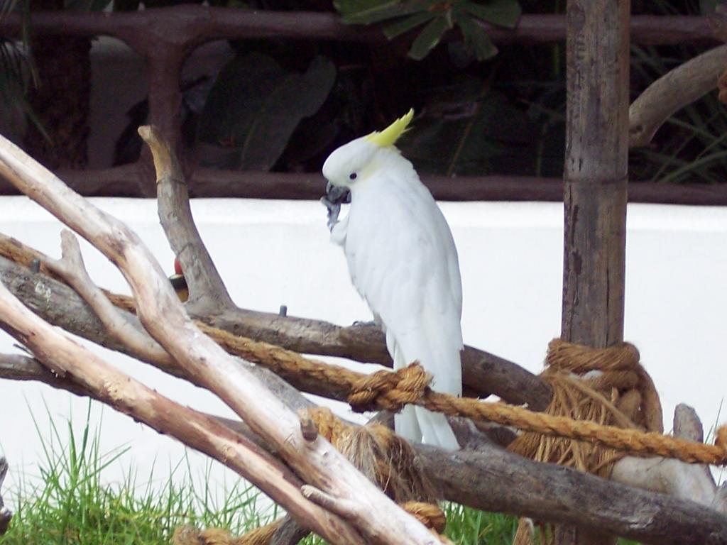
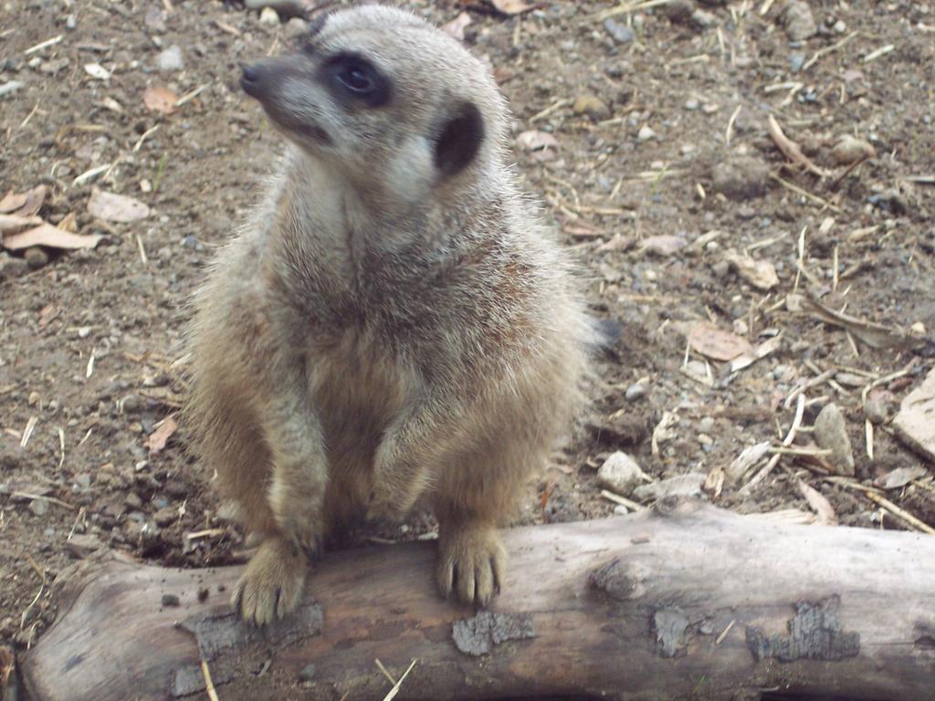
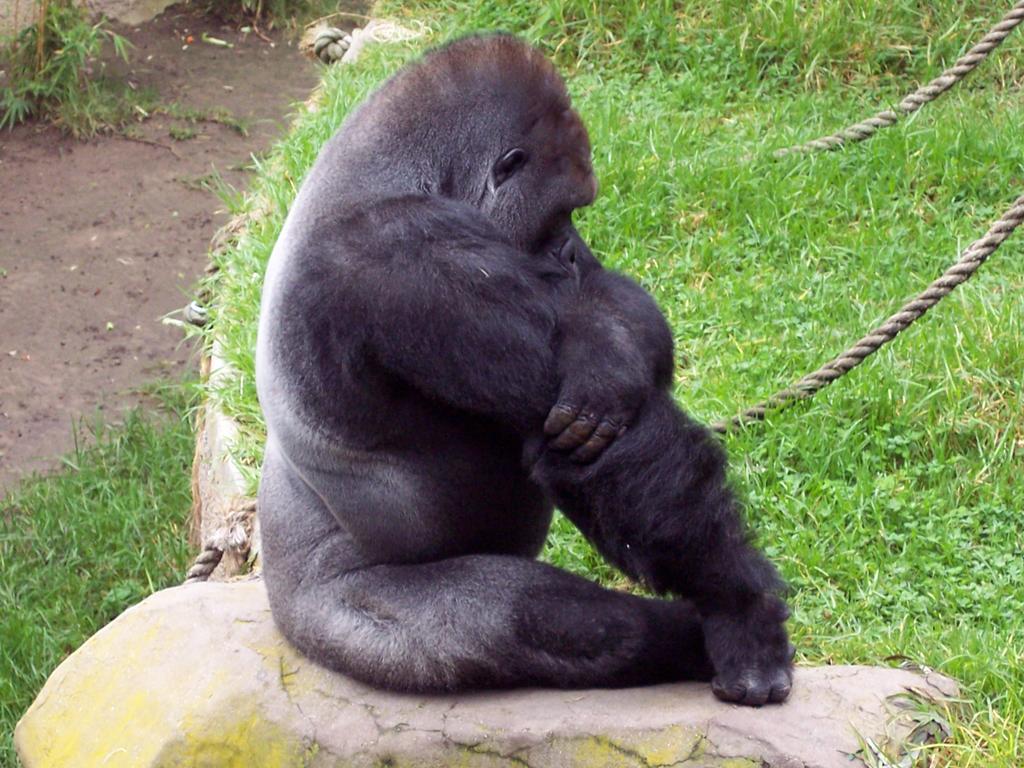
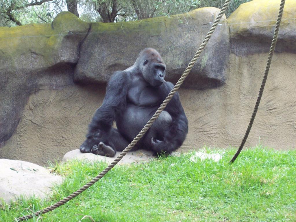
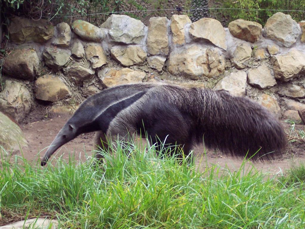
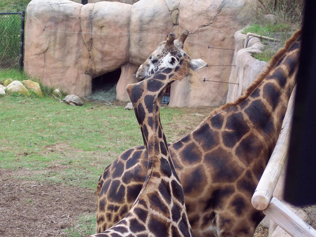
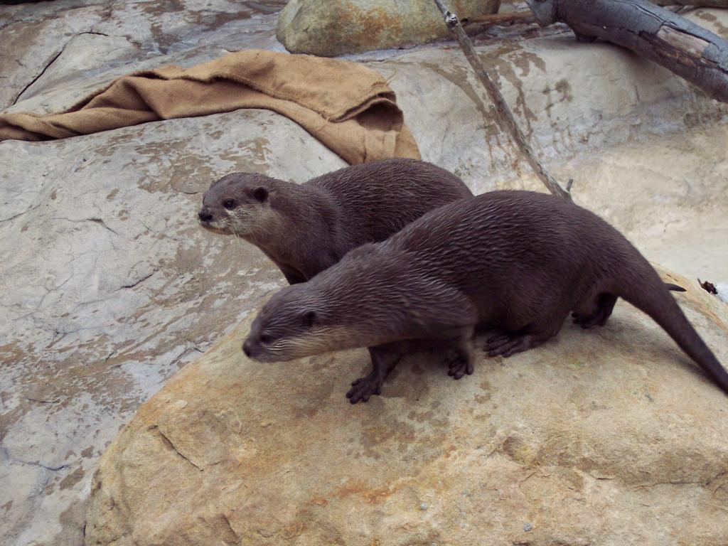
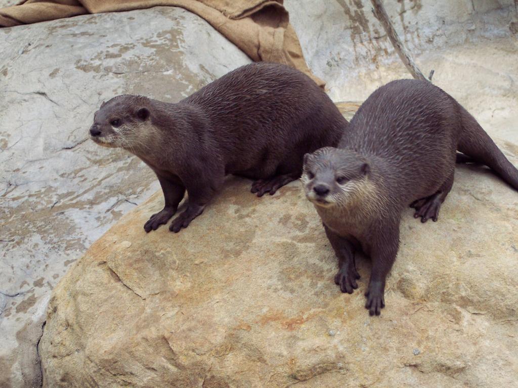
Santa Barbara Zoo
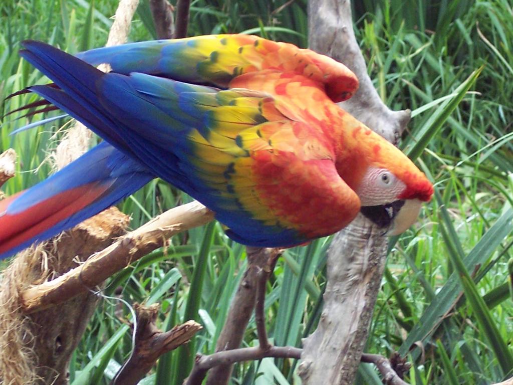
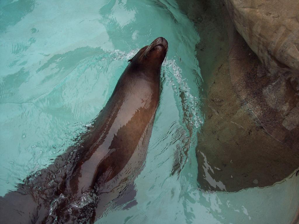
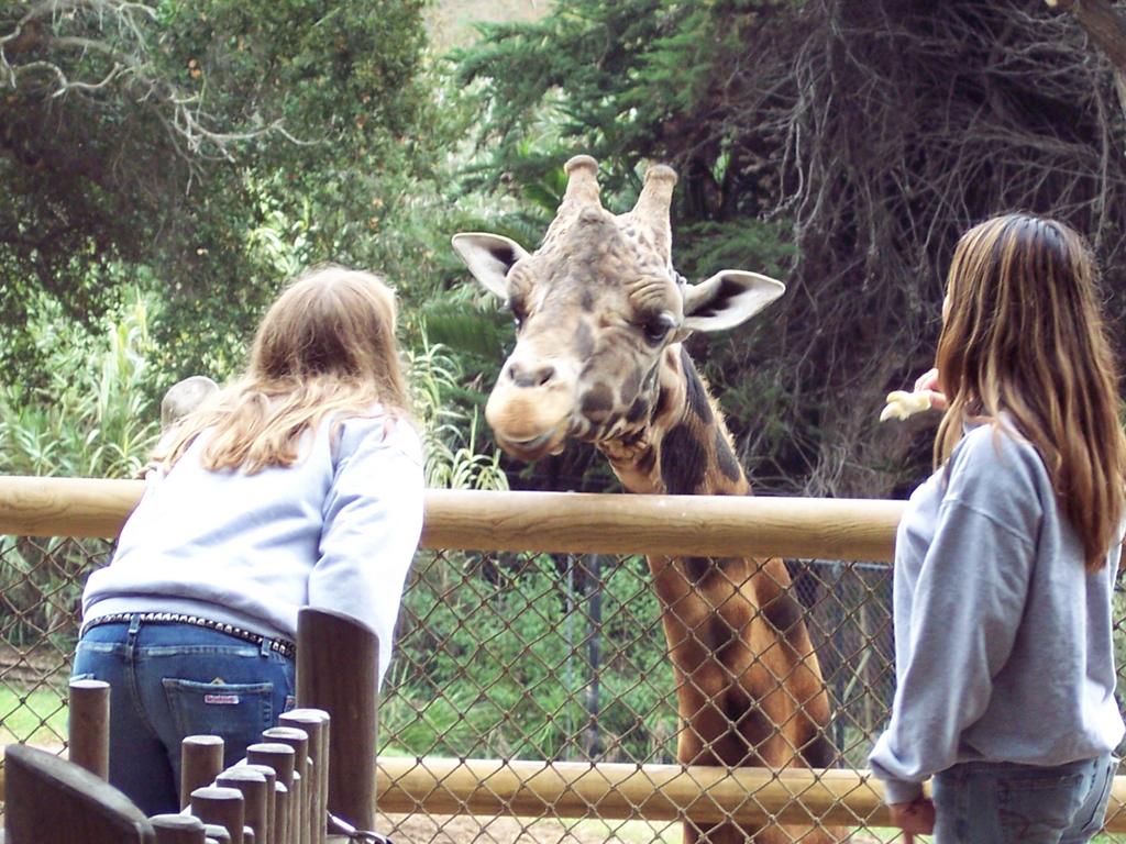
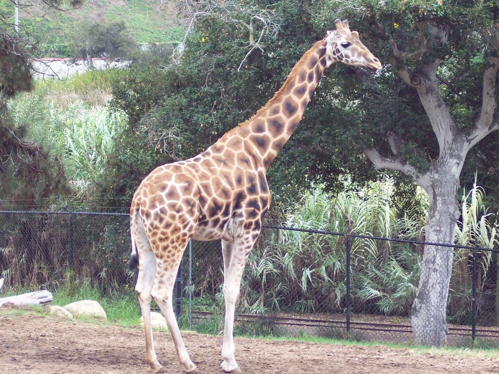
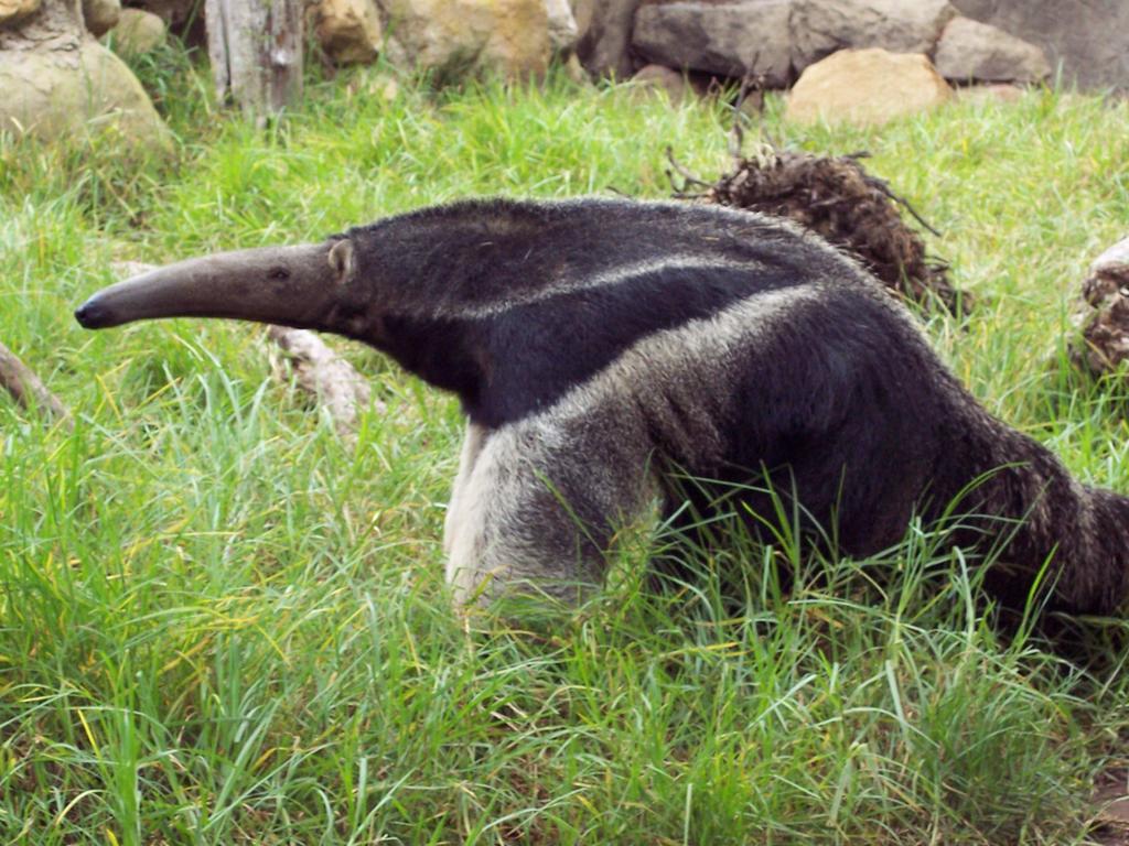
Chris and I went to the Santa Barbara Zoo on Saturday. The weather was a little chilly and overcast, but the trip was still great. One of the star attractions of the zoo is Gemina, the crooked-necked giraffe. Her neck is, indeed, crooked. It looks like it would be painful, but apparently it isn't. She eats fine and has even had a healthy baby. The zoo is not a huge zoo like the San Diego Zoo, but it is decent sized. We saw everything from tarantulas to lions. The reptile room was full of lizards, snakes, and even some insects and spiders. It was full of creepy-crawlies. They had a room full of turtles and fish, too, and a happily-swimming sea lion. They also have Asian elephants, lemurs, capybaras, foxes, monkeys, gorillas, lions, and a lot of birds. They have several aviaries, in fact. You can feed the giraffes and the lorakeets, and there is a petting zoo for the kids. The gorillas were being ornery. Apparently, they don't like each other much. In their enclosure, there are only the two males. Maybe they don't like sharing their territory. Well one of them did something pretty nasty. He sat down, and went poop and then ate it. I heard a kid exclaim, "ewwww. Why did he have to eat his poop?" That was sooooooo funny. Even though it was indeed pretty nasty, it was still funny all the same. The leopards were also putting on a show...they were in an amorous mood, if you know what I mean. After they were done, the female chased the male away, fangs bared and growling. Poor guy. He just wanted some lovin'.
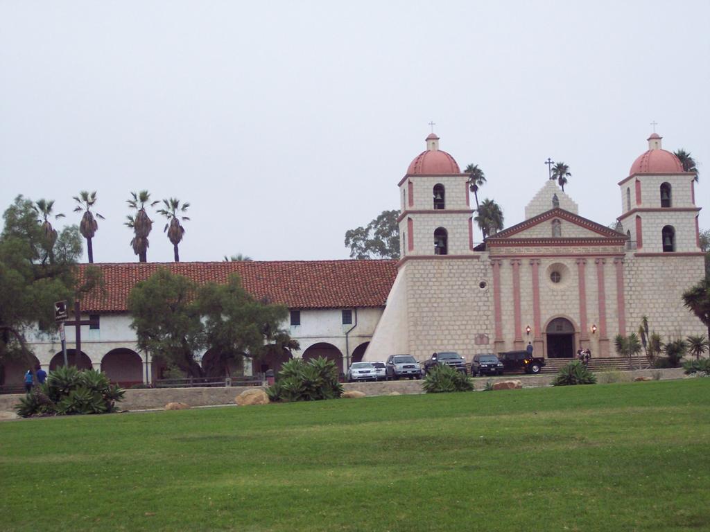
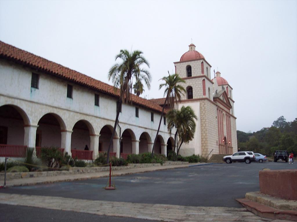
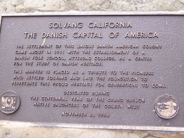
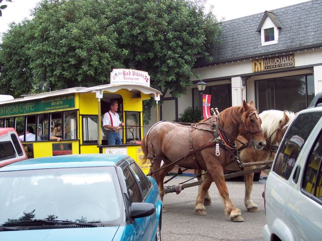
After the zoo, we drove to Santa Barbara Mission and looked around a little, and then Chris showed me around Santa Barbara a little. On Sunday, we went to Solvang, which is a little Danish-style town, full of bakeries, gift shops, galleries, and restaurants. It is very touristy. I picked up a few postcards and some candy there. We stopped in Lompoc for coffee and hot cocoa at a little bookstore/coffee shop, and there was a wedding reception going on in there and a guy playing blues music. So we went in and had a drink and talked. It was a really nice weekend. I had so much fun!
After the zoo, we drove to Santa Barbara Mission and looked around a little, and then Chris showed me around Santa Barbara a little. On Sunday, we went to Solvang, which is a little Danish-style town, full of bakeries, gift shops, galleries, and restaurants. It is very touristy. I picked up a few postcards and some candy there. We stopped in Lompoc for coffee and hot cocoa at a little bookstore/coffee shop, and there was a wedding reception going on in there and a guy playing blues music. So we went in and had a drink and talked. It was a really nice weekend. I had so much fun!
Monday, October 24, 2005

Sunday, October 23, 2005


Monday, October 17, 2005
Death Valley National Park
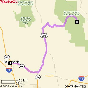
Chris and I went to Death Valley National Park on Saturday and Sunday. For anyone not familiar with Death Valley, it is the driest place in North America, averaging only 1.96 inches of rain per year. It is also one of the hottest places in the world, with the second highest ever recorded temperature in the world of 134 degrees farenheit. The ground temperature can be about 40% higher than the surrounding air temperature. Sometimes, the rocks get too hot to even touch. The highest recorded ground temperature in Death Valley was 201 degrees farenheit in Furnace Creek.
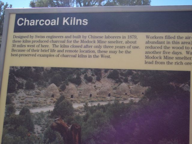
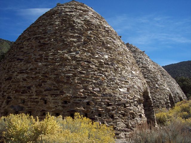
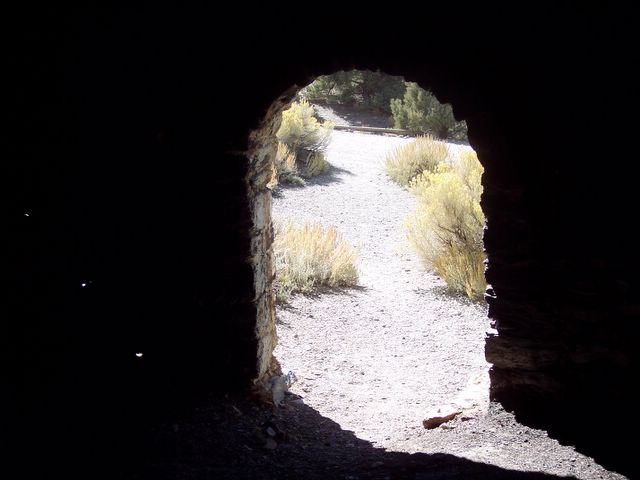
We took Wild Rose Canyon drive, an alternate route, and went up to the Charcoal Kilns first. The Charcoal Kilns were built by Chinese laborers in 1879, and were used to produce charcoal for the Modock Mine smelter. They closed after about 3 years of use. They are in very good shape and you can walk inside of them. We attempted to go up to Mahogany Flat, which is about 3 miles from the kilns, but the road is rocky and steep and 4x4's are recommended. My little car was not very equipped to make the drive. No trailers are allowed up there because of the road conditions. The road is also subject to washouts from flash floods.
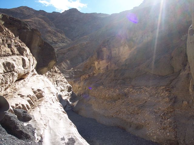
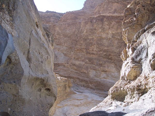
The next stop on the way into the park was Mosaic Canyon. This is one of the most popular hiking trails in Death Valley National Park. The canyon is located near Stovepipe Wells. The canyon was named after a rock formation known as Mosaic Breccia, breccia being the Italian word for "fragments." The rock formation is made up of angular fragments of many different kinds of parent rock. It is a rather easy hike, although there are some spots of smooth rock that you have to scramble up. The walls of the canyon are marble, polished from the water that comes through the canyon during floods. You surely don't want to be in the canyon when there have been rains though, because, as is obvious by the polished rock, the canyon is subject to flash floods. It is a very pretty walk.
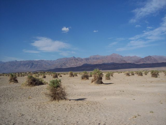
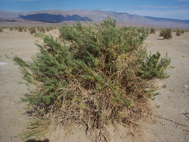
We stopped by Devil's Cornfield on the way to Furnace Creek. Devil's Cornfield, located near the Sand Dunes near Stovepipe Wells, is named so because the arrowweed that grows near the dunes resemble corn shocks. The roots of the weeds became exposed as the ground has deteriorated around them. Ground water keeps the plants alive in this seemingly uninhabitable land. The arrowweed grows in almost even spaced rows, thus the name Devil's Cornfield. There are also sand dunes near Stovepipe Wells, but the wind was too much on Saturday, so we didn't go out there that day. It was too dusty.
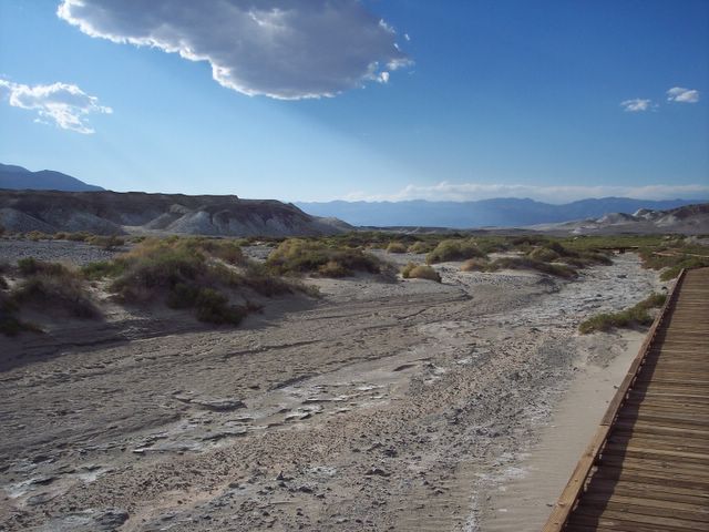
We also stopped by Salt Creek on the way to Furnace Creek. This is a nice, flat, easy little trail, maybe 1/2 mile long. You actually walk along a sort of boardwalk, as it is advisable to stay off of the ground as it can be muddy, and it also helps to preserve the habitat of the Salt Creek Pupfish, an endangered species of fish that only live in this one particular area. Salt Creek was once a lake, but it has since dried up and receded into only a few small streams. Looking at the few shallow streams that run through there, it is hard to imagine that anything can survive in such a limited environment. We didn't see any Pupfish though. I have since read that the best times to see the Pupfish is from March to May.
We reached Furnace Creek Campground and put up the tent. It was very windy that day, so making sure the tent stakes stuck in the ground was essential, otherwise the tent would have blown away. After we set up camp, we headed out to Artist Drive, which is between Furnace Creek and Badwater. Artist Drive is a beautiful drive among the canyons in Death Valley. It is named such as the rocks are colorful from the many different mineral deposits found in them. One point of interest on the drive is Artist Palette. This is a beautiful stop, and it is best viewed in the early evening when the sun is going down. It is during this time that the colors are most striking. You can see shades of pinks, yellows, reds, purples, and greens. The iron salts produces the reds, yellows and pinks. Decomposing mica makes up the green shades, and manganese makes the purple colors. You can venture down into the canyon as there is a makeshift "staircase" that goes down there. We took this staircase down and walked into a few of the canyons there and did some exploring and climbing. Just be careful as climbing up the walls can be dangerous as the ground is unstable in spots. It is a highly recommended stop in Death Valley, especially for camera freaks like me.
It was getting too dark to do much of anything else on Saturday, so we decided to head on back to Furnace Creek. After we got something to eat, it was time to go back to the campground and get ready for the night. As night fell, we heard the sounds of coyotes howling in the background. It sounded like they were not more than 100 feet from us, although I am positive they were a lot further away than that. It sounded like there was a whole pack of them. It was really neat to hear them. The wind continued to gust and then die down thoughout the night, and by morning, it was pretty calm.
After we packed up the tent and got breakfast, we headed on out to Badwater Basin. This is the lowest point in the Western Hemisphere at -282 feet below sea level. With a name like "Badwater" you would think that the water is poisonous, but that is not true. The water is not poisonous, but it is extremely salty and is unsuitable for drinking. The basin is vast and white from the salt deposits that line the ground. It looks like you are walking on snow when you are out there. They even have a spot where you can scrape off the salt from your shoes. There is no trail in particular out there. You can walk for miles and miles if you want to. We didn't go that far. Just far enough to get the bottoms of our shoes covered with salt and to snap a few pictures.
After we saw Badwater, we took a drive up to the trailhead to Natural Bridge Canyon. This trail is not as easy as the other ones. It is more of a moderate climb up into the canyon. The gravely, rocky pathway makes it more difficult to walk, so good shoes are a must. Up maybe 1/2 mile or so into the canyon, you will find the natural bridge. Also just past the bridge, is a smoothed out area of the canyon wall where a waterfall would come down in the event of a flood. Judging from the poor shape of the road, there have been many floods that have come through there.
After the Natural Bridge Canyon, we went down to Devil's Golf Course. This is an area where the salt pan is above flooding level. Without the smoothing effect of the flood waters, the salt grows upward into spiny-looking pinnacles. Wind and rain work constantly to erode the pinnacles into intricate, jagged and sharp shapes. It is best to take caution when walking among these salt pinnacles, as they are sharp and one misstep can lead to severe cuts or even broken bones. This is a fascinating area, both for geologists and tourists alike.
After we were done exploring the golf course, we drove down a little further to Golden Canyon. This is a mile-long hike into the canyon. We didn't go far though. My stomach was acting up and I didn't think it would be a good idea for me to go too far into the canyon and to be too far away from a bathroom - lol. Someday, I would like to go back and finish the hike.
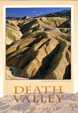
After this point, we took a drive to Zabriskie Point. This is a short climb to the top of a hill where you can get a good viewpoint of the badlands and of Manly Beacon. Manly Beacon is named after William Manly, a member of the Bennet-Arcane emigrant party, which became stranded in Death Valley in late December, 1849. This is one of Death Valley's signature landmarks. Manly and John Rogers, another member of the party, set out on foot and crossed some 500 miles to find a route out of the valley. When they came back a month later, they brought with them a mule, food and supplies (they had gotten 2 horses and a mule in San Fernando Valley, but the 2 horses died en route). According to Manly's memoirs, as they crossed the valley and were about to leave it, one member of the emigrant party looked back and said, "Goodbye Death Valley," and the name stuck. I think out of all the stops we made during the trip, this was my favorite spot. You can really see the topography of the landscape here. It is beautiful and strangely alien-looking.
The finaly stop we took on the way back was the sand dunes. It is a short trek from the road to the beginning of the dunes, but once you get out there, it is tough going as the sand offers little footing and makes it difficult to walk in. Plus it was pretty hot out there. Earlier in the year, a man died due to heat stroke or something hiking in the dunes. If you do hike in the dunes, bring plenty of water and a hat for shade, especially if you are going in the summer. Many hikes, however, in Death Valley, are not recommended in the summer due to the extreme heat.
Overall, the trip was great. There are so many sights to see that we didn't get to see them all. We plan on taking another trip sometime in the year to see Scotty's Castle, The Racetrack, Titus Canyon and some other places that we didn't see this time. Hopefully, we will be able to get back before it gets too hot again.
Links:
Death Valley Hikes
Death Valley Virtual Visitor Center
Death Valley National Park Website
Death Valley History
Death Valley Links Page
California Guide - Death Valley
Travel, tourism and recreation in Death Valley National Park
Miles Traveled:
We took Wild Rose Canyon drive, an alternate route, and went up to the Charcoal Kilns first. The Charcoal Kilns were built by Chinese laborers in 1879, and were used to produce charcoal for the Modock Mine smelter. They closed after about 3 years of use. They are in very good shape and you can walk inside of them. We attempted to go up to Mahogany Flat, which is about 3 miles from the kilns, but the road is rocky and steep and 4x4's are recommended. My little car was not very equipped to make the drive. No trailers are allowed up there because of the road conditions. The road is also subject to washouts from flash floods.
The next stop on the way into the park was Mosaic Canyon. This is one of the most popular hiking trails in Death Valley National Park. The canyon is located near Stovepipe Wells. The canyon was named after a rock formation known as Mosaic Breccia, breccia being the Italian word for "fragments." The rock formation is made up of angular fragments of many different kinds of parent rock. It is a rather easy hike, although there are some spots of smooth rock that you have to scramble up. The walls of the canyon are marble, polished from the water that comes through the canyon during floods. You surely don't want to be in the canyon when there have been rains though, because, as is obvious by the polished rock, the canyon is subject to flash floods. It is a very pretty walk.
We stopped by Devil's Cornfield on the way to Furnace Creek. Devil's Cornfield, located near the Sand Dunes near Stovepipe Wells, is named so because the arrowweed that grows near the dunes resemble corn shocks. The roots of the weeds became exposed as the ground has deteriorated around them. Ground water keeps the plants alive in this seemingly uninhabitable land. The arrowweed grows in almost even spaced rows, thus the name Devil's Cornfield. There are also sand dunes near Stovepipe Wells, but the wind was too much on Saturday, so we didn't go out there that day. It was too dusty.
We also stopped by Salt Creek on the way to Furnace Creek. This is a nice, flat, easy little trail, maybe 1/2 mile long. You actually walk along a sort of boardwalk, as it is advisable to stay off of the ground as it can be muddy, and it also helps to preserve the habitat of the Salt Creek Pupfish, an endangered species of fish that only live in this one particular area. Salt Creek was once a lake, but it has since dried up and receded into only a few small streams. Looking at the few shallow streams that run through there, it is hard to imagine that anything can survive in such a limited environment. We didn't see any Pupfish though. I have since read that the best times to see the Pupfish is from March to May.
We reached Furnace Creek Campground and put up the tent. It was very windy that day, so making sure the tent stakes stuck in the ground was essential, otherwise the tent would have blown away. After we set up camp, we headed out to Artist Drive, which is between Furnace Creek and Badwater. Artist Drive is a beautiful drive among the canyons in Death Valley. It is named such as the rocks are colorful from the many different mineral deposits found in them. One point of interest on the drive is Artist Palette. This is a beautiful stop, and it is best viewed in the early evening when the sun is going down. It is during this time that the colors are most striking. You can see shades of pinks, yellows, reds, purples, and greens. The iron salts produces the reds, yellows and pinks. Decomposing mica makes up the green shades, and manganese makes the purple colors. You can venture down into the canyon as there is a makeshift "staircase" that goes down there. We took this staircase down and walked into a few of the canyons there and did some exploring and climbing. Just be careful as climbing up the walls can be dangerous as the ground is unstable in spots. It is a highly recommended stop in Death Valley, especially for camera freaks like me.
It was getting too dark to do much of anything else on Saturday, so we decided to head on back to Furnace Creek. After we got something to eat, it was time to go back to the campground and get ready for the night. As night fell, we heard the sounds of coyotes howling in the background. It sounded like they were not more than 100 feet from us, although I am positive they were a lot further away than that. It sounded like there was a whole pack of them. It was really neat to hear them. The wind continued to gust and then die down thoughout the night, and by morning, it was pretty calm.
After we packed up the tent and got breakfast, we headed on out to Badwater Basin. This is the lowest point in the Western Hemisphere at -282 feet below sea level. With a name like "Badwater" you would think that the water is poisonous, but that is not true. The water is not poisonous, but it is extremely salty and is unsuitable for drinking. The basin is vast and white from the salt deposits that line the ground. It looks like you are walking on snow when you are out there. They even have a spot where you can scrape off the salt from your shoes. There is no trail in particular out there. You can walk for miles and miles if you want to. We didn't go that far. Just far enough to get the bottoms of our shoes covered with salt and to snap a few pictures.
After we saw Badwater, we took a drive up to the trailhead to Natural Bridge Canyon. This trail is not as easy as the other ones. It is more of a moderate climb up into the canyon. The gravely, rocky pathway makes it more difficult to walk, so good shoes are a must. Up maybe 1/2 mile or so into the canyon, you will find the natural bridge. Also just past the bridge, is a smoothed out area of the canyon wall where a waterfall would come down in the event of a flood. Judging from the poor shape of the road, there have been many floods that have come through there.
After the Natural Bridge Canyon, we went down to Devil's Golf Course. This is an area where the salt pan is above flooding level. Without the smoothing effect of the flood waters, the salt grows upward into spiny-looking pinnacles. Wind and rain work constantly to erode the pinnacles into intricate, jagged and sharp shapes. It is best to take caution when walking among these salt pinnacles, as they are sharp and one misstep can lead to severe cuts or even broken bones. This is a fascinating area, both for geologists and tourists alike.
After we were done exploring the golf course, we drove down a little further to Golden Canyon. This is a mile-long hike into the canyon. We didn't go far though. My stomach was acting up and I didn't think it would be a good idea for me to go too far into the canyon and to be too far away from a bathroom - lol. Someday, I would like to go back and finish the hike.
After this point, we took a drive to Zabriskie Point. This is a short climb to the top of a hill where you can get a good viewpoint of the badlands and of Manly Beacon. Manly Beacon is named after William Manly, a member of the Bennet-Arcane emigrant party, which became stranded in Death Valley in late December, 1849. This is one of Death Valley's signature landmarks. Manly and John Rogers, another member of the party, set out on foot and crossed some 500 miles to find a route out of the valley. When they came back a month later, they brought with them a mule, food and supplies (they had gotten 2 horses and a mule in San Fernando Valley, but the 2 horses died en route). According to Manly's memoirs, as they crossed the valley and were about to leave it, one member of the emigrant party looked back and said, "Goodbye Death Valley," and the name stuck. I think out of all the stops we made during the trip, this was my favorite spot. You can really see the topography of the landscape here. It is beautiful and strangely alien-looking.
The finaly stop we took on the way back was the sand dunes. It is a short trek from the road to the beginning of the dunes, but once you get out there, it is tough going as the sand offers little footing and makes it difficult to walk in. Plus it was pretty hot out there. Earlier in the year, a man died due to heat stroke or something hiking in the dunes. If you do hike in the dunes, bring plenty of water and a hat for shade, especially if you are going in the summer. Many hikes, however, in Death Valley, are not recommended in the summer due to the extreme heat.
Overall, the trip was great. There are so many sights to see that we didn't get to see them all. We plan on taking another trip sometime in the year to see Scotty's Castle, The Racetrack, Titus Canyon and some other places that we didn't see this time. Hopefully, we will be able to get back before it gets too hot again.
249 miles to Furnace Creek from Bakersfield
17 miles from Furnace Creek to Badwater
over 530 miles round-trip


Subscribe to:
Posts (Atom)


 Grab my blinkie if you wanna


 (Click on the links below to go there.)


 Click the moose to sign my Guest Book


 My "pet"


 Visit CALM