
Saturday, December 02, 2006
Monday, August 21, 2006
Pinnacles National Monument
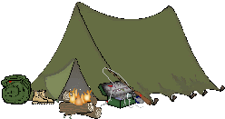
I went to Pinnacles National Monument over the weekend to camp and to hike. Pinnacles National Monument is located east of the Salinas Valley, near King City and Soledad, California. I had lived in King City, California as a kid, and lived there for some 10 years, but never went to the Pinnacles, despite being so close to it.
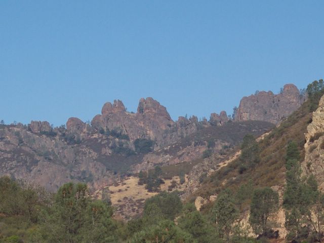
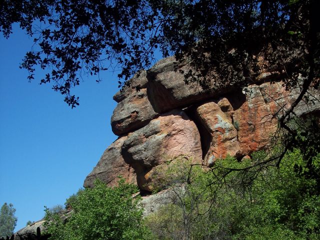
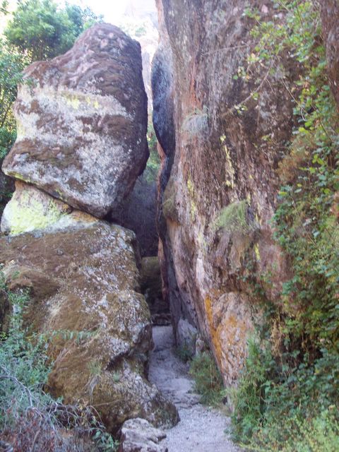
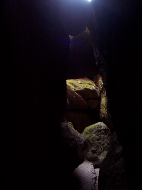
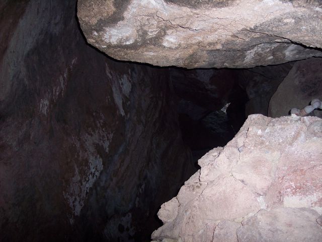
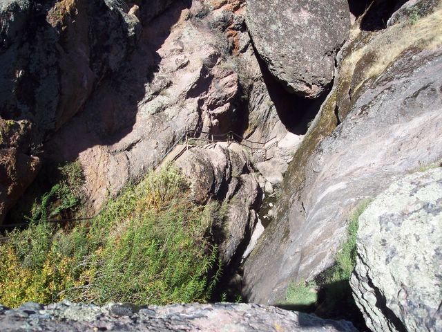
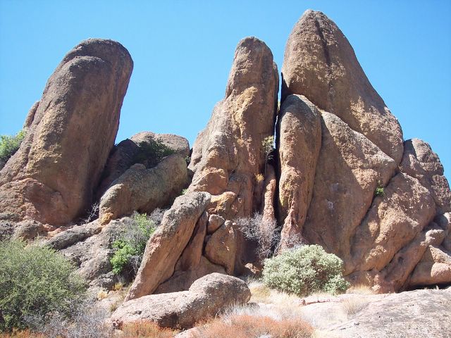
The Pinnacles are actually remnants of an extinct, ancient volcano. It is believed that the Pinnacles rocks are remnants of the Neenach Volcano that occurred some 23 million years ago near present-day Lancaster, CA, which is nearly 200 miles southwest of where the Pinnacles are present-day. The area is a favorite of rock climbers and hikers, as there are many trails to hike and sheer rock walls to climb. The Pinnacles also is home to the Balconies Cave and Bear Gulch Cave. Unlike caves like the Mammoth Caves and Carlsbad Caverns, the Balconies and Bear Gulch Caves are talus caves. Talus caves are caves formed when huge boulders topple down into deep, narrow gorges and wedge into the fractures before they reach the ground. These boulders became the ceilings of these caves. The caves are an attraction for not only human visitors, but also bats who roost in the caves to hibernate and raise their young. Because of this, the caves are sometimes closed off to allow some privacy for the bats and their young. They are also closed off sometimes due to flooding. Flashlights are required in the caves.
The Balconies cave is located on the west side of the monument, but you can hike to it from the east side. It is just a little longer of a hike from that side. I didn't go on that hike due to lack of time and the fact that it was over 90 degrees in the day time. The other trail was hot enough! Maybe next time I will get to do that hike.
There are 2 entrances into the park. The east entrance can be accessed via Highway 101, then Highway 25, near the town of King City, California. The gate at the east entrance is open 24 hours a day. There is a $5 entrance fee which is collected at the Bear Gulch Visitor Center. There is also a campground on the east side. The west entrance can be accessed via Highway 101 then Highway 146 near Soledad, CA. The gate at this entrance opens at 7:30 am and closes at night. The east and west entrances are not connected by a road, but you can hike from one side to the next.
I went to the east entrance of the monument and camped at The Pinnacles Campground. The campground is a nice place. It has a swimming pool, a store, showers and flush toilets. You can have duraflame campfires or charcoal, but there are no wood fires permitted in the campground. You can make reservations for the campground HERE. Reservations are recommended in the spring months.
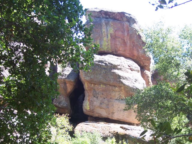
The Bear Gulch Cave is located on the east side of The Pinnacles and can be reached via the Bear Gulch Trail. It is about a .7 mile hike to the cave then another .3 mile hike to the Bear Gulch Reservoir. The hike is mostly uphill to the cave and reservoir and is rated as a "moderate" hike, but hey, if I can do it, anyone can (even if I do have sore calf muscles this morning). The cave offered a nice break from the heat. Standing in front of the cave, you can feel the cool air coming out. It felt like a natural air conditioner. The cave was very dark inside, but there were points of light coming in, as the cave is not a solid cave like Carlsbad Caverns. The toppled boulders offered nice little sky lights so there was some light (which was a good thing since someone forgot the flashlight - hehe). There are a lot of stairs to climb and some can be slippery due to the water and moss, and there were a lot of places where you had to duck because of the low rock overhangs , and there were also a few tight squeezes. Eventually, you have to climb out of the cave and back into the heat, and then there is a little more of a hike, about 10 minutes or so, to the Bear Gulch Reservoir. I was a little disheartened when I saw the narrow staircase going to the top of the reservoir, and at first didn't want to attempt it (because I am afraid of heights), but I thought that I would regret it if I didn't go to the top, since I had already come all that way. I made it to the top and I was very glad I did. The view of the lake is beautiful. I posted pictures below, of course :) After all the hiking to get there, you eventually have to go back the way you came, unless you want to continue on the hike, but it gets more difficult as it goes on. So, I just turned around and went back the way I came. Which meant going down the stairs (that was scary), and back through the dark cave and then down the hill to the parking lot (which was wearing on the old knees). I was sure tired after the hike, but I felt like I accomplished something.
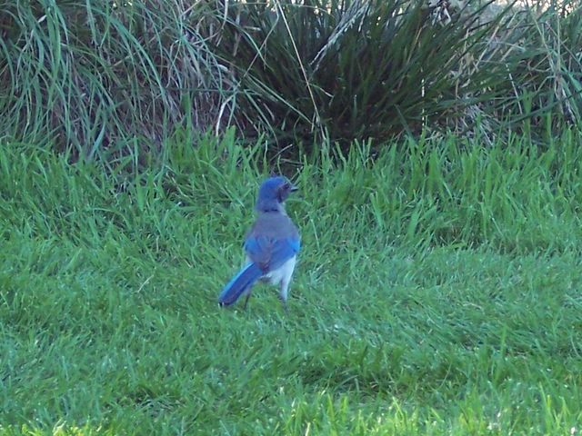
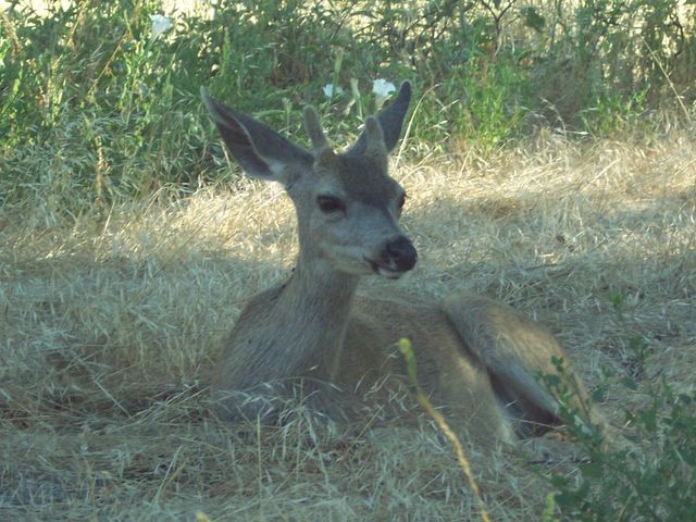
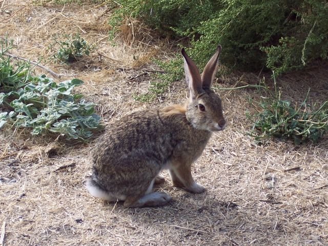
There is a variety of wildlife that calls the Pinnacles its home, including the rare California Condor. I didn't see any condors, but I did see several animals, including: raccoons, mule deer, cottontail rabbits, ground squirrels, and coyotes; as well as many different birds such as: scrub jays, Steller's jays, magpies, California Valley Quail, red-tailed hawks, and hairy woodpeckers. At the campground, I saw several mule deer does and their fawns and groups of raccoons setting off on their nightly forage.
I would definitely like to go back to The Pinnacles sometime in the spring, because I hear that the wildflowers are spectacular in the spring. Plus, hiking would be a lot nicer when the weather is cooler, and I definitely want to see the Balconies Cave. But I will leave the rock climbing to the rock climbers. I am definitely NOT a rock climber. Too scary! ;)
Links:
Pinnacles National Monument- National Park Service
Pinnacles Campground
Pinnacles Cyberhikes
Pinnacles National Monument - GORP
Pinnacles National Monument Map
My Yahoo Photo Album - Pinnacles
The Pinnacles are actually remnants of an extinct, ancient volcano. It is believed that the Pinnacles rocks are remnants of the Neenach Volcano that occurred some 23 million years ago near present-day Lancaster, CA, which is nearly 200 miles southwest of where the Pinnacles are present-day. The area is a favorite of rock climbers and hikers, as there are many trails to hike and sheer rock walls to climb. The Pinnacles also is home to the Balconies Cave and Bear Gulch Cave. Unlike caves like the Mammoth Caves and Carlsbad Caverns, the Balconies and Bear Gulch Caves are talus caves. Talus caves are caves formed when huge boulders topple down into deep, narrow gorges and wedge into the fractures before they reach the ground. These boulders became the ceilings of these caves. The caves are an attraction for not only human visitors, but also bats who roost in the caves to hibernate and raise their young. Because of this, the caves are sometimes closed off to allow some privacy for the bats and their young. They are also closed off sometimes due to flooding. Flashlights are required in the caves.
The Balconies cave is located on the west side of the monument, but you can hike to it from the east side. It is just a little longer of a hike from that side. I didn't go on that hike due to lack of time and the fact that it was over 90 degrees in the day time. The other trail was hot enough! Maybe next time I will get to do that hike.
There are 2 entrances into the park. The east entrance can be accessed via Highway 101, then Highway 25, near the town of King City, California. The gate at the east entrance is open 24 hours a day. There is a $5 entrance fee which is collected at the Bear Gulch Visitor Center. There is also a campground on the east side. The west entrance can be accessed via Highway 101 then Highway 146 near Soledad, CA. The gate at this entrance opens at 7:30 am and closes at night. The east and west entrances are not connected by a road, but you can hike from one side to the next.
I went to the east entrance of the monument and camped at The Pinnacles Campground. The campground is a nice place. It has a swimming pool, a store, showers and flush toilets. You can have duraflame campfires or charcoal, but there are no wood fires permitted in the campground. You can make reservations for the campground HERE. Reservations are recommended in the spring months.
The Bear Gulch Cave is located on the east side of The Pinnacles and can be reached via the Bear Gulch Trail. It is about a .7 mile hike to the cave then another .3 mile hike to the Bear Gulch Reservoir. The hike is mostly uphill to the cave and reservoir and is rated as a "moderate" hike, but hey, if I can do it, anyone can (even if I do have sore calf muscles this morning). The cave offered a nice break from the heat. Standing in front of the cave, you can feel the cool air coming out. It felt like a natural air conditioner. The cave was very dark inside, but there were points of light coming in, as the cave is not a solid cave like Carlsbad Caverns. The toppled boulders offered nice little sky lights so there was some light (which was a good thing since someone forgot the flashlight - hehe). There are a lot of stairs to climb and some can be slippery due to the water and moss, and there were a lot of places where you had to duck because of the low rock overhangs , and there were also a few tight squeezes. Eventually, you have to climb out of the cave and back into the heat, and then there is a little more of a hike, about 10 minutes or so, to the Bear Gulch Reservoir. I was a little disheartened when I saw the narrow staircase going to the top of the reservoir, and at first didn't want to attempt it (because I am afraid of heights), but I thought that I would regret it if I didn't go to the top, since I had already come all that way. I made it to the top and I was very glad I did. The view of the lake is beautiful. I posted pictures below, of course :) After all the hiking to get there, you eventually have to go back the way you came, unless you want to continue on the hike, but it gets more difficult as it goes on. So, I just turned around and went back the way I came. Which meant going down the stairs (that was scary), and back through the dark cave and then down the hill to the parking lot (which was wearing on the old knees). I was sure tired after the hike, but I felt like I accomplished something.
There is a variety of wildlife that calls the Pinnacles its home, including the rare California Condor. I didn't see any condors, but I did see several animals, including: raccoons, mule deer, cottontail rabbits, ground squirrels, and coyotes; as well as many different birds such as: scrub jays, Steller's jays, magpies, California Valley Quail, red-tailed hawks, and hairy woodpeckers. At the campground, I saw several mule deer does and their fawns and groups of raccoons setting off on their nightly forage.
I would definitely like to go back to The Pinnacles sometime in the spring, because I hear that the wildflowers are spectacular in the spring. Plus, hiking would be a lot nicer when the weather is cooler, and I definitely want to see the Balconies Cave. But I will leave the rock climbing to the rock climbers. I am definitely NOT a rock climber. Too scary! ;)
Links:
Sunday, August 20, 2006


Tuesday, July 25, 2006
I can now....
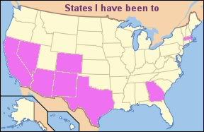
add 3 states to my list of states I have been to.... New Mexico, Texas and Colorado :)
Monday, July 24, 2006
New Mexico Vacation
Well, I am back from my 2 week vacation. We spent time in and/or drove thru 5 different states....California, Arizona, New Mexico, Colorado and Texas....so there is a lot to talk about. So grab a snack and sit back, because you will be here for a while.
DAY 1:
Destination - Flagstaff, Arizona

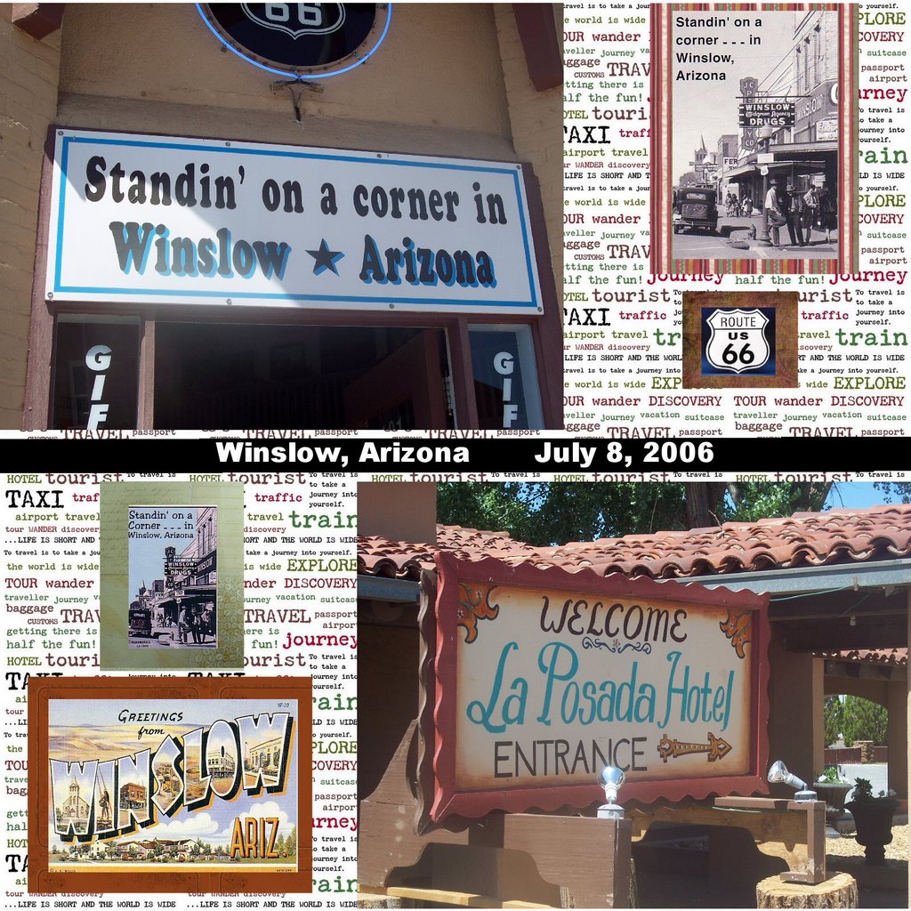
We started out on Saturday, July 8, 2006 near Santa Barbara, CA, with our destination being Flagstaff, Arizona. We stopped off in Winslow, Arizona which was made famous by the song, "Take It Easy" by The Eagles..... I was standin' on a corner in Winslow, Arizona. We stopped by a gift shop where I picked up some postcards and a few other souvenirs. We also stopped by the La Posada, a historic hotel near the railroad. It had a lot of exhibits and paintings to look at.
(actually, we hit Winslow on day 2....I had forgotten...but cut me some slack...We we on the road for a lot of days!)

We stayed in Flagstaff, Arizona that night. I really liked Flagstaff. It was very pretty, with lots of pine trees that filled the air with that mountain pine smell. It was a nice change from the smoggy air of Bakersfield.
Day 2:
Destination - Belen, New Mexico

The next day, we got up and started out to Belen, New Mexico to meet up with Greg and Christa, and then to later meet up with Jeanette, who were going with us to the cabin. It was cool to me, since I had never been to New Mexico, so everything was brand new.

We ended up eating at a place Jeanette took us to called Teofilos in Los Lunas, New Mexico. The food was great. But there is one question you need to know when you go to eat Mexican food in New Mexico.... Red or green? By red or green, they are talking about chile. Apparently the red is the milder of the 2. So if you are brave and want it hot, ask for green.
Day 3-7:
Destination - The cabin in Valley Jo, New Mexico
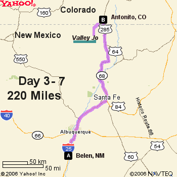
We left for the cabin in Valley Jo, New Mexico to meet up with Don and Melissa on Monday, July 10th, and we would be leaving there on Saturday, July 15th in the morning. That meant we would have 4 full days in the mountains....heaven.
We stopped in Espanola to get block ice for the refrigerator, but found this a difficult task, as Wal Mart didn't have any and neither did other convenience stores. Finally, after much driving around town and a few phone calls, we found some at The Water Store (yes, that is the actual name.) Who knew ice was so hard to find?!?
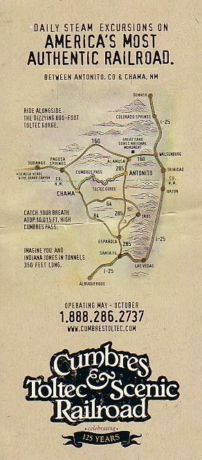
We stopped in Antonito, Colorado for a bathroom break at the Cumbres and Toltec Scenic Railroad Station. I had never set foot in Colorado before, so it was pretty cool to me. Plus, at the cabin, you can actually see the train go by twice a day up on the mountain.
Situated in Carson National Forest and accessible only by way of a rough, dirt road, the cabin is a rustic, almost primitive getaway from the traffic and crowds of people in the cities. The air is clean, and the night skies are dark and full of stars. There is no electricity or running water. You have to cook over a wood stove and there are no sinks or toilets. But who cares? It was just so wonderful to get away from the city that I almost forgot about all of that.
According to what I heard, Valley Jo became known as "Valley Jo" due to a mispronunciation. Seems someone called it a "vallejo" (which means "valley" in Spanish), but another person mispronounced it as "valley jo." I guess the name stuck.
The outhouse is known as "Chic Sales," named after Charles "Chic" Sales, an American actor and vaudevillian who wrote a book called, "The Specialist," which was about outhouse construction and building. For years, his name was used as an euphemism for "toilet." Thus the name. Despite being an outhouse, it actually smelled a lot better than some public restrooms.
We spent the days at the cabin sitting on the front porch reading or watching the birds, taking walks to the creek or short hikes, taking dips in the creek to wash up, and stargazing at night. We were also joined by three dogs.... Coco and Cassidy and Lobo. At first, Lobo didn't like the other dogs very much, but by the end, she began to tolerate their presence. Sometimes, cows would wander into the meadow, as the land is free range for cows.
I really enjoyed just watching the birds that stopped to feed at the bird feeders. Pine Siskins, Hummingbirds and Cassin's Finch were the most observed at the feeders, but American Robins foraged in the meadows in the evenings, and Western Flycatchers had a nest on the cabin porch and were constantly catching insects to feed their young, all while keeping a close eye on us human intruders.
At night, the skies were dark and deep and full of stars. I was even able to see the Milky Way for the first time in a long time (you can't see it here in Bakersfield due to all the light pollution and smog). It was so incredible!
Although there were no actual showers at the cabin, a portable camp shower had been set up behind the cabin, and there was always the creek which you could use to take a dip in and wash off, as I did. Boy that water was cold! But oh did it feel good to have clean hair.
But, by Saturday, it was time for us to leave and head back to "civilization." So we packed up the cars and dogs and headed out of the valley.
Day 8:
Destination - Roswell, New Mexico
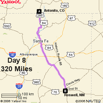
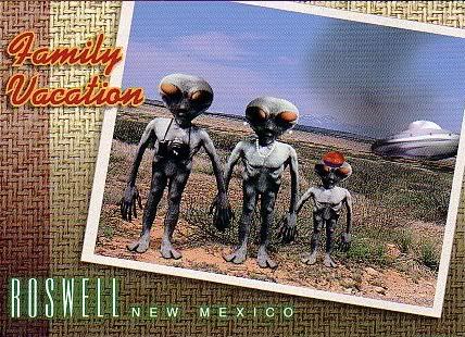
We headed out to Roswell, New Mexico on Saturday. It was mainly a driving day and not much sight-seeing as we were going to hit the UFO Museum the next morning. The town of Roswell itself is small, but the whole alien and UFO influence is apparent, as the street lights downtown had little "eyes" painted on them to resemble alien eyes. It was really funny.
Day 9:
Destination - Carlsbad, New Mexico
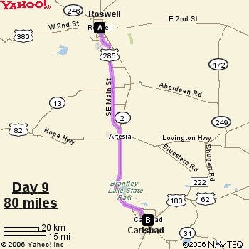
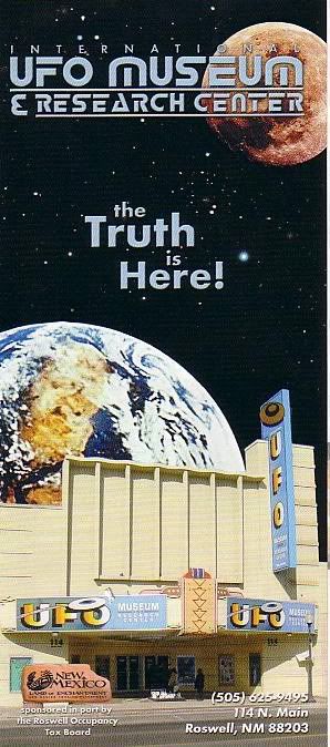
In the morning, we hit the International UFO Museum & Research Center. This was a neat place. For the $2 admission fee, you can read for hours about the whole Roswell cover-up, and about UFOs and reported abductions and such. There is a lot of information to read, so you kind of have to pick and choose what you want to look at if you are on a tight schedule.
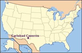
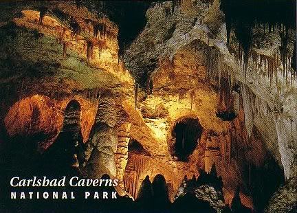
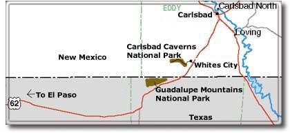
After a few hours of aliens and UFOs, we headed out to Carlsbad to see the caverns. This was my favorite part of the whole trip. Ever since I was a little kid, I had wanted to see Carlsbad Caverns. Of course, I never thought I would get to see it, but I did! It was so awesome!
Carlsbad Caverns is located in southeastern New Mexico in the foothills of the Guadalupe Mountains. Circular rock cooking pits and paintings on the entrance to the cavern are proof that the prehistoric Indians knew of the caverns.
Early cattlemen, who were the area's first settlers in the 1880's, also knew of the caverns and may have even explored part of them. They called the cave, the Bat Cave, and mining began, in the turn of the century, to mine the bat guano, which was used for fertilizer. One of the miners, Jim White, explored the caverns at every opportunity and later, he became an unofficial guide to the caverns and was eventually appointed Chief Ranger of the National Park Service.
Carlsbad Caverns was declared a National Monument in October 1923, after a report by Robert Holley stressed the beauty of the caverns. Subsequently, many extensive explorations of the caverns followed and on May 14, 1930, Carlsbad Caverns was declared a National Park.
The park contains over 100 known caves, including the nation's deepest limestone cave at 1,567 feet, Lechuguilla Cave. Lechuguilla Cave is also the world's 5th longest cave, with over 100 miles of mapped passages. This cave is not open to the public, however. Access to this cave is limited to scientific researchers, survey and explorer teams and National Park Service management-related trips.
The temperature inside of the caverns is a constant 56 degrees and humid, even though the surface temperature can range to nearly zero in the winter to above 100 degrees in the summer. Bats make the cave their home and fly out every summer night at dusk to feed on insects. Most of the bats migrate south to winter in the warmer regions. A chief resident of the cave is the Mexican Freetail Bat. These bats occupy the cave by the tens of thousands and migrate to the warmer climate of Mexico in the winter. At dusk, at the ampitheatre at the Natural Entrance to the cave, visitors can sit and listen to a talk on bats by a ranger and then watch the bats as they make their spiraling departure from the cave for their nightly feeding.
There are two self-guided tours that visitors can take at the park. One is the Natural Entrance route and the other is the Big Room Tour, which is accessible by elevator. I took the elevator route as the Natural Entrance is steep and adds an extra hour onto your tour, as it is an additional mile long. The Big Room tour is a mile long loop tour through the famous "Big Room."
The Big Room is all at once both awe-inspiring and beautiful. It is a marvelous wonder of geology, full of stalactites (formations that hang from the cave ceiling), stalagmites (formations that start on the cave floor),flowstone, travertine and cave popcorn. It is also, as the name states, "big." The floor area of the Big Room is approximately 357,480 sq. ft. About 6 football fields could fit inside the Big Room.
from Wikipedia....
The story of the creation of Carlsbad Cavern begins 250 million years ago with the creation of a 400 mile (600 km) long reef in an inland sea that covered this region. This horseshoe shaped reef formed from the remains of sponges, algae and seashells and from calcite that precipitated directly from the water. Cracks developed in the reef as it grew seaward. Eventually the sea evaporated and the reef was buried under deposits of salts and gypsum.
The forces of water decorated the cave in an almost endless array of spectacular limestone formations like this column and array of stalactites.
Then, a few million years ago, uplift and erosion of the area began to uncover the buried rock reef. Rainwater, made slightly acidic from the air and soil, seeped down into the cracks in the reef, slowly dissolving the limestone and beginning the process that would form large underground chambers. At the same time, hydrogen sulfide gas was migrating upward from vast oil and gas deposits beneath the ancient reef. This gas dissolved in the percolating ground water to form sulfuric acid. The added power of this corrosive substance explains the size of the passageways. The exposed reef became part of the Guadalupe Mountains and the underground chambers became the wonder of Carlsbad Cavern.
It is amazing how rock, water and a lot of time can create something so vast and amazing.
It truly was the experience of a lifetime. I was able to take a lot of pictures (with the help of a tripod, since the cave is dark), and some are posted below.
The cost of the tour is $6 per adult for the self-guided tours. You can also get an audio guide for an additional $3. The guided tours require reservations and have varying prices. For more info on the tours, click HERE.
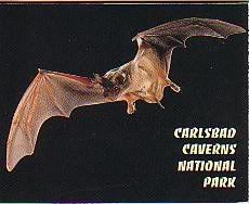
In the summer evenings, at sunset, you can walk to the ampitheatre located at the Natural Entrance, to watch the evening bat program. It is amazing to see thousands upon thousands of bats leaving the cave for their nightly feeding. There must have been a fifteen minute, steady stream of bats leaving the cave. I don't know how many bats that amounts to, but it must be a lot!
At day's end, I was completely exhausted, but felt great all at the same time.
Day 10:
Destination: Las Cruces, New Mexico
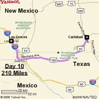
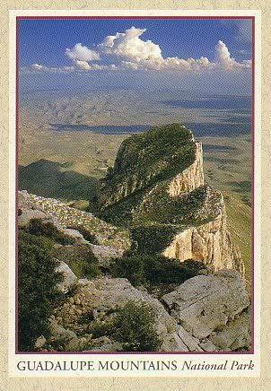
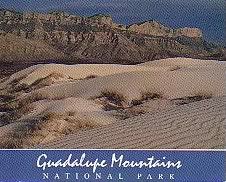
After a nice, long night's sleep, we got up the next morning and headed out to Las Cruces. Along the way, we crossed into Texas for a little way. We stopped off at Guadalupe Mountains National Park to take in a little of the scenery.
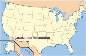
Located in west Texas in the Guadalupe Mountains, Guadalupe Mountains National Park contains Guadalupe Peak, the highest peak in Texas (8749 feet) , as well as El Capitan, which was long used as a landmark by travelers traveling on the old route. The Guadalupe Mountains also contain Carlsbad Caverns, which are located about 80 miles to the north.
We didn't do much exploring in the park, since we were on a schedule, but we did stop off at the visitor center which had a nice little nature trail around the building. Located in the park is also McKittrick Canyon. In the fall, the bigtooth maple trees turn red and gold, which is a stark contrast to the surrounding Chihuahuan Desert. While it was summer and the trees were still green, I did see pictures of the canyon in the fall, and it is very pretty.
After the stop in the park, we drove onto El Paso, Texas. We could look across and see Juarez, Mexico from the road. We didn't actually go into Mexico. We just looked over at it.
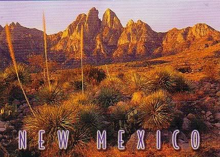
We got to Las Cruces, New Mexico in the afternoon and drove up to Dripping Springs Natural Area, located near the Organ Mountains. They are called the "Organ Mountains" because of their resemblence to a pipe organ. Also called "needles," the mountains are volcanic in origin, the remnants of volcanic vents which have been exposed to weathering.
Dripping Springs had a nice little visitor center and garden which was designed to attract birds.
Originally, a resort once stood on this land, which was built by Colonel Eugene Van Patten in the 1870's. Today, the resort is gone, but the ruins of it lie scattered along the canyon.
Day 11:
Destination - Belen, New Mexico
We started off the day by touring around La Mesilla, a historic town just outside of Las Cruces.
from Wikipedia:
The village of Mesilla was incorporated in 1848, after the Treaty of Guadalupe Hidalgo moved the U.S.-Mexico border south of the village of Doña Ana, placing it in the United States. A small group of citizens, unhappy at being part of the United States, decided to move south of the border. They settled in Mesilla at this time. By 1850, Mesilla was an established colony. By this time, its people were under constant threat of attack from the Apache. By 1851, the attacks caused the United States to take action to protect its people just to the north of the border, in the Mesilla Valley. They did this by creating Fort Fillmore. As a result of the fort, the United States declared the Mesilla Valley region part of the United States. Mexico also claimed this strip of land, causing it to become known as "No Mans Land." This boundary dispute, which was officially caused by a map error, was resolved in 1853, with the Gadsden Purchase. Mesilla became a part of the United States, as well as the southern part of New Mexico and Arizona.
It is a neat place for souvenir shopping and picture taking. We ate lunch at La Posta, which had some really great food. It was a great start to the day.
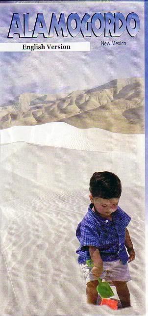
Next, it was off to White Sands National Monument.
A funny thing happened on the way to White Sands. We had to go through a checkpoint which was run by the INS. Yeah, we were questioned by the Border Patrol. They asked us if we were all citizens and such and then let us go through. The White Sands Visitor Center was literally across the road from the checkpoint.
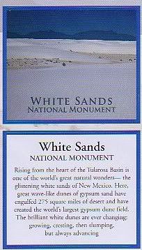
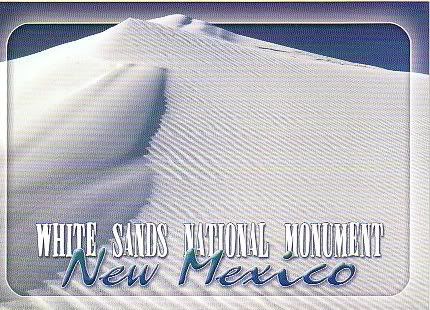
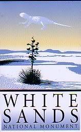
White Sands National Monument is located about 15 miles southwest of Alamagordo, New Mexico. The area is a gypsum sand dune field covering some 275 square miles, the largest gypsum dune field in the world.
from Wikipedia:
Gypsum is rarely found in the form of sand because it is water soluble. Normally, rain would dissolve the gypsum and carry it to the sea. Since the Tularosa Basin has no outlet to the sea, rain that dissolves gypsum from the surrounding San Andres and Sacramento Mountains is trapped within the basin and either sinks into the ground or forms shallow pools that subsequently dry out and leave gypsum in a crystalline form called selenite on the surface. During the last ice age a lake called Lake Otero covered much of the basin. When it dried out it left a large flat area of selenite crystals which is now the Alkali Flat. Lake Lucero, at the south-west corner of the park, is a dry lake bed at one of the lowest points of the basin that occasionally fills with water.
The whole area looks like it is covered with snow. Except for the heat of the summer, which was all too obvious once I got out of the car, I would have thought that I was driving among immense snow-covered fields. There were even kids sliding down the dunes on snow saucers. We even spotted one woman sunbathing on the dunes. I didn't see any wildlife, but being that it was over 100 degrees outside, that wasn't too surprising. There isn't much wildlife in the center of the dunes anyhow. Most animals prefer to live on the outskirts of the dunes, where there is vegetation they can use for food and shelter. Some species, including the Bleached Earless Lizard and the Cowles Prairie Lizard have evolved a white coloring to blend in with the white sands.
It was much too hot to do any hiking, so we drove along the loop drive which takes you through the dunes. Air conditioning is such a great invention.
We opted to go back to Belen via a scenic route known as The Billy The Kid National Scenic Byway. This road went through the mountains. It was a very pretty drive that takes you past the towns of Ruidoso, San Patricio, Lincoln, Fort Stanton and Capitan. Capitan is known as the birthplace of Smokey The Bear, because in 1950, a 17,000 acre forest fire raged through the Capitan Mountains. It was during this fire that a bady singed bear cub was rescued by firefighters and became "Smokey The Bear," now known as the symbol for forest fire prevention.
We arrived in Belen that evening around 7:40 pm at Janette's house , and were greeted by a fabulous thunderstorm. (we were also greeted by some fabulous food, courtesy of Janette). I must have stood outside for nearly a half an hour watching the lightning (ok, so that wasn't the smartest thing to do). I even got a little bit of it on film.
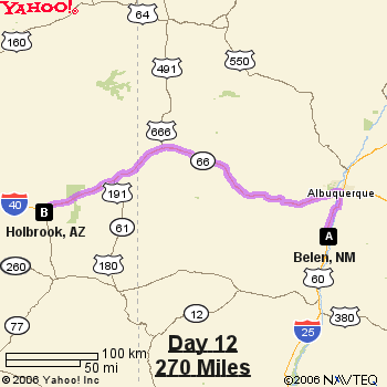
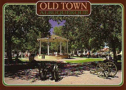
We had to say goodbye to Greg and Christa here, since they had to get a plane in Albuquerque to go back home. After saying goodbye, we headed off to Old Town Albuquerque to do some sightseeing and, of course, souvenir shopping.
Old Town Albuquerque is the historic part of the town. The first Spanish families settled on the banks of the Rio Grande in 1706. The village formed around a central plaza surrounded by a church, in the traditional Spanish pattern. Some of the old buildings are still standing, some of which have been converted into shops.
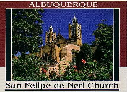
Also in the plaza is the San Felipe de Neri Chuch, a historic church built in 1793 to replace the original mission church built in 1706.
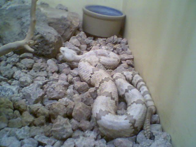
We went into many shops. Also on the tour was The American International Rattlesnake Museum. We went to the place around 10:30 am, but it was closed as the staff had to go out on an animal rescue. By the time we had eaten lunch, it was open, so we went in. There is a gift shop and the museum. The admission fee is $3.50 for adults. There were a lot of rattlesnakes in the museum...live ones. Of course, they were in cages. Also, there were some lizards, scorpions, tarantulas, salamanders and other non-venemous snakes as well. It was really cool.

After all the shopping and snake-seeing, we took off and headed to Holbrook, Arizona. We stayed there overnight, and were again treated to another thunderstorm. We sat in the parking lot and watched the lightning for a little while before heading to bed.
Day 13:
Destination - Needles, CA
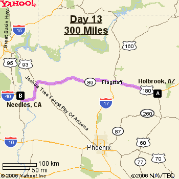
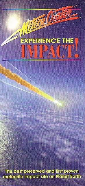
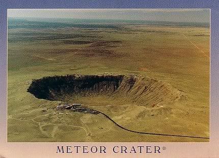
We headed out toward Flagstaff on Thursday, July 20, 2006. The first stop was to the Meteor Crater, sometimes known as the Barringer Crater. This crater was formed about 50,000 years ago by a meteorite some 54 yards across. Originally it was thought that the meteorite struck the earth at a speed of 45,000 mph, but this has been a subject of some debate. Some scientists believe it was notably slower than that, at 28,600 mph.
The crater, the first proven and best-preserved meteor crater in the world, is called the Barringer crater, because Daniel Barringer, a local miner and businessman purchased the crater and conducted research on its origins between 1903 and 1905. The conclusions of this research were that the crater was indeed created by a violent impact. Scientists remained skeptical of the crater's origins until 1960, when Eugene Shoemaker's research confirmed what Barringer had earlier stated.
from Wikipedia:
The key discovery was the presence in the crater of the minerals coesite and stishovite, rare dense forms of silica found only where quartz-bearing rocks have been severely shocked by a large meteorite impact. They cannot be created by volcanic action; the only known mechanism of creating them is through an impact event.
The crater is still owned by the Barringer family, so it is not protected as a National Monument, instead remaining privately owned and operated. There is a museum, gift shop and guided rim tours. There are also indoor and outdoor observation decks and a free film. The cost to get in the museum is $15 per adult.
You can reach the Meteor Crater off of the I-40, between Winslow and Flagstaff, Arizona.
After seeing the crater, we took off and headed toward Flagstaff. Our next stop was Walnut Canyon National Monument.
Walnut Canyon National Monument is located about 10 miles southeast of Flagstaff, Arizona. It was proclaimed a National Monument on November 30, 1915. There is a .9 mile loop trail that descends 185 feet into the canyon, passing by several cliff dwellings which served as homes for the Sinagua People. I didn't walk the whole trail as it was very steep and my feet were sore. But I was still able to see a lot of the area, and it is beautiful. The term "sinagua" means "without water" in Spanish. The name served as a tribute for these people's ability to turn a relatively dry region into a homeland.
The Sinagua people lived in the canyon for about 100 years, and then, for reasons unknown, they moved. It is believed that the Sinagua people were eventually assimilated into Hopi culture.
Today, the National Park service protects the remnants of these people's homes
We hit a pretty bad thunderstorm on the road and actually had to pull over at a truck stop for a while to wait out the worst of it. The rain was pouring down so hard that it severely reduced the visibility, and there was lightning everywhere. In fact, as we were sitting in the car, lightning struck a power pole and the power at the truck stop went out. I caught some of it on video on my digital camera....
Click HERE to watch if the video doesn't load up on this page.
I am just so fascinated by lightning.
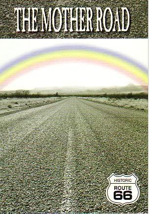
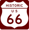
Later on, we drove down the old Route 66, through Oatman, Arizona. The road was twisty and turny, but very scenic. We got to Oatman too late to go into the shops as they were all closed, but the town was still really neat to look at.
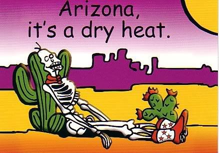
We arrived in Needles, California in the evening, and it was very hot. VERY hot. I think it was still over 100 degrees when we got there. It was a big, hot welcome back to California!
Day 14:
Destination - Bakersfield, CA - HOME!
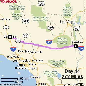
There wasn't a whole lot to this day. It was mostly a driving day, but we did take a side road and went down the Old Route 66 through Amboy, California, a small, blink-and-you'll-miss-it town. The only working place in town is the post office. All of the other places have closed up shop.
I got home around 8 pm or so, exhausted from the trip but still excited about all I had seen. I was eager to upload the pictures I took to my computer, so, even as tired as I was, I stayed up and uploaded my pictures, eager to see them all, and to, in a way, relive my vacation again.
I made up some scrapbook pages on Paintshop. You can see them by clicking HERE.
Links:
Winslow, Arizona
La Posada
Flagstaff City Site
Charles 'Chic' Sale
Cumbres and Toltec Scenic Railroad
Cumbres & Toltec Official Site
Carson National Forest
International UFO Museum & Research Center
Roswell Official City Site
Roswell UFO Incident
Carlsbad Caverns National Park
Carlsbad Caverns
Carlsbad Caverns - Wikipedia
Lechuguilla Cave virtual tour
Lechuguilla Cave Pictures
Mexican Freetail Bat
Carlsbad Official City Site
Guadalupe Mountains National Park
Guadalupe Mountains
The Chihuahuan Desert
Dripping Springs
The Organ Mountains
Historic Old Mesilla
Mesilla, New Mexico
La Posta de Mesilla
White Sands National Monument
White Sands - Desert, USA
Gypsum
Old Town Albuquerque
American International Rattlesnake Museum
Petrified Wood
Meteor Crater - Wikipedia
Meteor Crater - Official Site
Walnut Canyon National Monument - Wikipedia
Walnut Canyon National Monument
Walnut Canyon - Desert USA
Sinagua People
Historic Route 66
Route 66 Guide
Oatman, Arizona - Ghost Town
Oatman, Arizona
Amboy, California
About Billy The Kid
Total miles traveled (for me): 2747 miles round-trip
DAY 1:
Destination - Flagstaff, Arizona
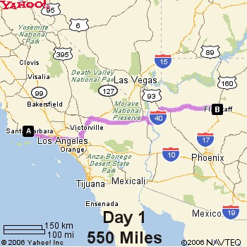
We started out on Saturday, July 8, 2006 near Santa Barbara, CA, with our destination being Flagstaff, Arizona. We stopped off in Winslow, Arizona which was made famous by the song, "Take It Easy" by The Eagles..... I was standin' on a corner in Winslow, Arizona. We stopped by a gift shop where I picked up some postcards and a few other souvenirs. We also stopped by the La Posada, a historic hotel near the railroad. It had a lot of exhibits and paintings to look at.
(actually, we hit Winslow on day 2....I had forgotten...but cut me some slack...We we on the road for a lot of days!)
We stayed in Flagstaff, Arizona that night. I really liked Flagstaff. It was very pretty, with lots of pine trees that filled the air with that mountain pine smell. It was a nice change from the smoggy air of Bakersfield.
Day 2:
Destination - Belen, New Mexico

The next day, we got up and started out to Belen, New Mexico to meet up with Greg and Christa, and then to later meet up with Jeanette, who were going with us to the cabin. It was cool to me, since I had never been to New Mexico, so everything was brand new.

We ended up eating at a place Jeanette took us to called Teofilos in Los Lunas, New Mexico. The food was great. But there is one question you need to know when you go to eat Mexican food in New Mexico.... Red or green? By red or green, they are talking about chile. Apparently the red is the milder of the 2. So if you are brave and want it hot, ask for green.
Day 3-7:
Destination - The cabin in Valley Jo, New Mexico
We left for the cabin in Valley Jo, New Mexico to meet up with Don and Melissa on Monday, July 10th, and we would be leaving there on Saturday, July 15th in the morning. That meant we would have 4 full days in the mountains....heaven.
We stopped in Espanola to get block ice for the refrigerator, but found this a difficult task, as Wal Mart didn't have any and neither did other convenience stores. Finally, after much driving around town and a few phone calls, we found some at The Water Store (yes, that is the actual name.) Who knew ice was so hard to find?!?
We stopped in Antonito, Colorado for a bathroom break at the Cumbres and Toltec Scenic Railroad Station. I had never set foot in Colorado before, so it was pretty cool to me. Plus, at the cabin, you can actually see the train go by twice a day up on the mountain.
Situated in Carson National Forest and accessible only by way of a rough, dirt road, the cabin is a rustic, almost primitive getaway from the traffic and crowds of people in the cities. The air is clean, and the night skies are dark and full of stars. There is no electricity or running water. You have to cook over a wood stove and there are no sinks or toilets. But who cares? It was just so wonderful to get away from the city that I almost forgot about all of that.
According to what I heard, Valley Jo became known as "Valley Jo" due to a mispronunciation. Seems someone called it a "vallejo" (which means "valley" in Spanish), but another person mispronounced it as "valley jo." I guess the name stuck.
The outhouse is known as "Chic Sales," named after Charles "Chic" Sales, an American actor and vaudevillian who wrote a book called, "The Specialist," which was about outhouse construction and building. For years, his name was used as an euphemism for "toilet." Thus the name. Despite being an outhouse, it actually smelled a lot better than some public restrooms.
We spent the days at the cabin sitting on the front porch reading or watching the birds, taking walks to the creek or short hikes, taking dips in the creek to wash up, and stargazing at night. We were also joined by three dogs.... Coco and Cassidy and Lobo. At first, Lobo didn't like the other dogs very much, but by the end, she began to tolerate their presence. Sometimes, cows would wander into the meadow, as the land is free range for cows.
I really enjoyed just watching the birds that stopped to feed at the bird feeders. Pine Siskins, Hummingbirds and Cassin's Finch were the most observed at the feeders, but American Robins foraged in the meadows in the evenings, and Western Flycatchers had a nest on the cabin porch and were constantly catching insects to feed their young, all while keeping a close eye on us human intruders.
At night, the skies were dark and deep and full of stars. I was even able to see the Milky Way for the first time in a long time (you can't see it here in Bakersfield due to all the light pollution and smog). It was so incredible!
Although there were no actual showers at the cabin, a portable camp shower had been set up behind the cabin, and there was always the creek which you could use to take a dip in and wash off, as I did. Boy that water was cold! But oh did it feel good to have clean hair.
But, by Saturday, it was time for us to leave and head back to "civilization." So we packed up the cars and dogs and headed out of the valley.
Day 8:
Destination - Roswell, New Mexico
We headed out to Roswell, New Mexico on Saturday. It was mainly a driving day and not much sight-seeing as we were going to hit the UFO Museum the next morning. The town of Roswell itself is small, but the whole alien and UFO influence is apparent, as the street lights downtown had little "eyes" painted on them to resemble alien eyes. It was really funny.
Day 9:
Destination - Carlsbad, New Mexico
In the morning, we hit the International UFO Museum & Research Center. This was a neat place. For the $2 admission fee, you can read for hours about the whole Roswell cover-up, and about UFOs and reported abductions and such. There is a lot of information to read, so you kind of have to pick and choose what you want to look at if you are on a tight schedule.
After a few hours of aliens and UFOs, we headed out to Carlsbad to see the caverns. This was my favorite part of the whole trip. Ever since I was a little kid, I had wanted to see Carlsbad Caverns. Of course, I never thought I would get to see it, but I did! It was so awesome!
Carlsbad Caverns is located in southeastern New Mexico in the foothills of the Guadalupe Mountains. Circular rock cooking pits and paintings on the entrance to the cavern are proof that the prehistoric Indians knew of the caverns.
Early cattlemen, who were the area's first settlers in the 1880's, also knew of the caverns and may have even explored part of them. They called the cave, the Bat Cave, and mining began, in the turn of the century, to mine the bat guano, which was used for fertilizer. One of the miners, Jim White, explored the caverns at every opportunity and later, he became an unofficial guide to the caverns and was eventually appointed Chief Ranger of the National Park Service.
Carlsbad Caverns was declared a National Monument in October 1923, after a report by Robert Holley stressed the beauty of the caverns. Subsequently, many extensive explorations of the caverns followed and on May 14, 1930, Carlsbad Caverns was declared a National Park.
The park contains over 100 known caves, including the nation's deepest limestone cave at 1,567 feet, Lechuguilla Cave. Lechuguilla Cave is also the world's 5th longest cave, with over 100 miles of mapped passages. This cave is not open to the public, however. Access to this cave is limited to scientific researchers, survey and explorer teams and National Park Service management-related trips.
The temperature inside of the caverns is a constant 56 degrees and humid, even though the surface temperature can range to nearly zero in the winter to above 100 degrees in the summer. Bats make the cave their home and fly out every summer night at dusk to feed on insects. Most of the bats migrate south to winter in the warmer regions. A chief resident of the cave is the Mexican Freetail Bat. These bats occupy the cave by the tens of thousands and migrate to the warmer climate of Mexico in the winter. At dusk, at the ampitheatre at the Natural Entrance to the cave, visitors can sit and listen to a talk on bats by a ranger and then watch the bats as they make their spiraling departure from the cave for their nightly feeding.
There are two self-guided tours that visitors can take at the park. One is the Natural Entrance route and the other is the Big Room Tour, which is accessible by elevator. I took the elevator route as the Natural Entrance is steep and adds an extra hour onto your tour, as it is an additional mile long. The Big Room tour is a mile long loop tour through the famous "Big Room."
The Big Room is all at once both awe-inspiring and beautiful. It is a marvelous wonder of geology, full of stalactites (formations that hang from the cave ceiling), stalagmites (formations that start on the cave floor),flowstone, travertine and cave popcorn. It is also, as the name states, "big." The floor area of the Big Room is approximately 357,480 sq. ft. About 6 football fields could fit inside the Big Room.
from Wikipedia....
The story of the creation of Carlsbad Cavern begins 250 million years ago with the creation of a 400 mile (600 km) long reef in an inland sea that covered this region. This horseshoe shaped reef formed from the remains of sponges, algae and seashells and from calcite that precipitated directly from the water. Cracks developed in the reef as it grew seaward. Eventually the sea evaporated and the reef was buried under deposits of salts and gypsum.
The forces of water decorated the cave in an almost endless array of spectacular limestone formations like this column and array of stalactites.
Then, a few million years ago, uplift and erosion of the area began to uncover the buried rock reef. Rainwater, made slightly acidic from the air and soil, seeped down into the cracks in the reef, slowly dissolving the limestone and beginning the process that would form large underground chambers. At the same time, hydrogen sulfide gas was migrating upward from vast oil and gas deposits beneath the ancient reef. This gas dissolved in the percolating ground water to form sulfuric acid. The added power of this corrosive substance explains the size of the passageways. The exposed reef became part of the Guadalupe Mountains and the underground chambers became the wonder of Carlsbad Cavern.
It is amazing how rock, water and a lot of time can create something so vast and amazing.
It truly was the experience of a lifetime. I was able to take a lot of pictures (with the help of a tripod, since the cave is dark), and some are posted below.
The cost of the tour is $6 per adult for the self-guided tours. You can also get an audio guide for an additional $3. The guided tours require reservations and have varying prices. For more info on the tours, click HERE.
In the summer evenings, at sunset, you can walk to the ampitheatre located at the Natural Entrance, to watch the evening bat program. It is amazing to see thousands upon thousands of bats leaving the cave for their nightly feeding. There must have been a fifteen minute, steady stream of bats leaving the cave. I don't know how many bats that amounts to, but it must be a lot!
At day's end, I was completely exhausted, but felt great all at the same time.
Day 10:
Destination: Las Cruces, New Mexico
After a nice, long night's sleep, we got up the next morning and headed out to Las Cruces. Along the way, we crossed into Texas for a little way. We stopped off at Guadalupe Mountains National Park to take in a little of the scenery.
Located in west Texas in the Guadalupe Mountains, Guadalupe Mountains National Park contains Guadalupe Peak, the highest peak in Texas (8749 feet) , as well as El Capitan, which was long used as a landmark by travelers traveling on the old route. The Guadalupe Mountains also contain Carlsbad Caverns, which are located about 80 miles to the north.
We didn't do much exploring in the park, since we were on a schedule, but we did stop off at the visitor center which had a nice little nature trail around the building. Located in the park is also McKittrick Canyon. In the fall, the bigtooth maple trees turn red and gold, which is a stark contrast to the surrounding Chihuahuan Desert. While it was summer and the trees were still green, I did see pictures of the canyon in the fall, and it is very pretty.
After the stop in the park, we drove onto El Paso, Texas. We could look across and see Juarez, Mexico from the road. We didn't actually go into Mexico. We just looked over at it.
We got to Las Cruces, New Mexico in the afternoon and drove up to Dripping Springs Natural Area, located near the Organ Mountains. They are called the "Organ Mountains" because of their resemblence to a pipe organ. Also called "needles," the mountains are volcanic in origin, the remnants of volcanic vents which have been exposed to weathering.
Dripping Springs had a nice little visitor center and garden which was designed to attract birds.
Originally, a resort once stood on this land, which was built by Colonel Eugene Van Patten in the 1870's. Today, the resort is gone, but the ruins of it lie scattered along the canyon.
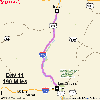
Day 11:
Destination - Belen, New Mexico
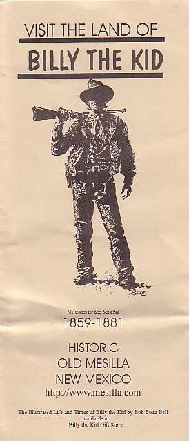
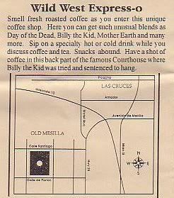
We started off the day by touring around La Mesilla, a historic town just outside of Las Cruces.
from Wikipedia:
The village of Mesilla was incorporated in 1848, after the Treaty of Guadalupe Hidalgo moved the U.S.-Mexico border south of the village of Doña Ana, placing it in the United States. A small group of citizens, unhappy at being part of the United States, decided to move south of the border. They settled in Mesilla at this time. By 1850, Mesilla was an established colony. By this time, its people were under constant threat of attack from the Apache. By 1851, the attacks caused the United States to take action to protect its people just to the north of the border, in the Mesilla Valley. They did this by creating Fort Fillmore. As a result of the fort, the United States declared the Mesilla Valley region part of the United States. Mexico also claimed this strip of land, causing it to become known as "No Mans Land." This boundary dispute, which was officially caused by a map error, was resolved in 1853, with the Gadsden Purchase. Mesilla became a part of the United States, as well as the southern part of New Mexico and Arizona.
It is a neat place for souvenir shopping and picture taking. We ate lunch at La Posta, which had some really great food. It was a great start to the day.
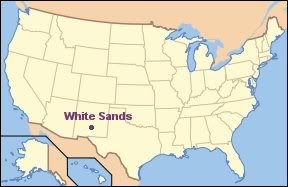
Next, it was off to White Sands National Monument.
A funny thing happened on the way to White Sands. We had to go through a checkpoint which was run by the INS. Yeah, we were questioned by the Border Patrol. They asked us if we were all citizens and such and then let us go through. The White Sands Visitor Center was literally across the road from the checkpoint.
White Sands National Monument is located about 15 miles southwest of Alamagordo, New Mexico. The area is a gypsum sand dune field covering some 275 square miles, the largest gypsum dune field in the world.
from Wikipedia:
Gypsum is rarely found in the form of sand because it is water soluble. Normally, rain would dissolve the gypsum and carry it to the sea. Since the Tularosa Basin has no outlet to the sea, rain that dissolves gypsum from the surrounding San Andres and Sacramento Mountains is trapped within the basin and either sinks into the ground or forms shallow pools that subsequently dry out and leave gypsum in a crystalline form called selenite on the surface. During the last ice age a lake called Lake Otero covered much of the basin. When it dried out it left a large flat area of selenite crystals which is now the Alkali Flat. Lake Lucero, at the south-west corner of the park, is a dry lake bed at one of the lowest points of the basin that occasionally fills with water.
The whole area looks like it is covered with snow. Except for the heat of the summer, which was all too obvious once I got out of the car, I would have thought that I was driving among immense snow-covered fields. There were even kids sliding down the dunes on snow saucers. We even spotted one woman sunbathing on the dunes. I didn't see any wildlife, but being that it was over 100 degrees outside, that wasn't too surprising. There isn't much wildlife in the center of the dunes anyhow. Most animals prefer to live on the outskirts of the dunes, where there is vegetation they can use for food and shelter. Some species, including the Bleached Earless Lizard and the Cowles Prairie Lizard have evolved a white coloring to blend in with the white sands.
It was much too hot to do any hiking, so we drove along the loop drive which takes you through the dunes. Air conditioning is such a great invention.
We opted to go back to Belen via a scenic route known as The Billy The Kid National Scenic Byway. This road went through the mountains. It was a very pretty drive that takes you past the towns of Ruidoso, San Patricio, Lincoln, Fort Stanton and Capitan. Capitan is known as the birthplace of Smokey The Bear, because in 1950, a 17,000 acre forest fire raged through the Capitan Mountains. It was during this fire that a bady singed bear cub was rescued by firefighters and became "Smokey The Bear," now known as the symbol for forest fire prevention.
We arrived in Belen that evening around 7:40 pm at Janette's house , and were greeted by a fabulous thunderstorm. (we were also greeted by some fabulous food, courtesy of Janette). I must have stood outside for nearly a half an hour watching the lightning (ok, so that wasn't the smartest thing to do). I even got a little bit of it on film.
We had to say goodbye to Greg and Christa here, since they had to get a plane in Albuquerque to go back home. After saying goodbye, we headed off to Old Town Albuquerque to do some sightseeing and, of course, souvenir shopping.
Old Town Albuquerque is the historic part of the town. The first Spanish families settled on the banks of the Rio Grande in 1706. The village formed around a central plaza surrounded by a church, in the traditional Spanish pattern. Some of the old buildings are still standing, some of which have been converted into shops.
Also in the plaza is the San Felipe de Neri Chuch, a historic church built in 1793 to replace the original mission church built in 1706.
We went into many shops. Also on the tour was The American International Rattlesnake Museum. We went to the place around 10:30 am, but it was closed as the staff had to go out on an animal rescue. By the time we had eaten lunch, it was open, so we went in. There is a gift shop and the museum. The admission fee is $3.50 for adults. There were a lot of rattlesnakes in the museum...live ones. Of course, they were in cages. Also, there were some lizards, scorpions, tarantulas, salamanders and other non-venemous snakes as well. It was really cool.
After all the shopping and snake-seeing, we took off and headed to Holbrook, Arizona. We stayed there overnight, and were again treated to another thunderstorm. We sat in the parking lot and watched the lightning for a little while before heading to bed.
Day 13:
Destination - Needles, CA
We headed out toward Flagstaff on Thursday, July 20, 2006. The first stop was to the Meteor Crater, sometimes known as the Barringer Crater. This crater was formed about 50,000 years ago by a meteorite some 54 yards across. Originally it was thought that the meteorite struck the earth at a speed of 45,000 mph, but this has been a subject of some debate. Some scientists believe it was notably slower than that, at 28,600 mph.
The crater, the first proven and best-preserved meteor crater in the world, is called the Barringer crater, because Daniel Barringer, a local miner and businessman purchased the crater and conducted research on its origins between 1903 and 1905. The conclusions of this research were that the crater was indeed created by a violent impact. Scientists remained skeptical of the crater's origins until 1960, when Eugene Shoemaker's research confirmed what Barringer had earlier stated.
from Wikipedia:
The key discovery was the presence in the crater of the minerals coesite and stishovite, rare dense forms of silica found only where quartz-bearing rocks have been severely shocked by a large meteorite impact. They cannot be created by volcanic action; the only known mechanism of creating them is through an impact event.
The crater is still owned by the Barringer family, so it is not protected as a National Monument, instead remaining privately owned and operated. There is a museum, gift shop and guided rim tours. There are also indoor and outdoor observation decks and a free film. The cost to get in the museum is $15 per adult.
You can reach the Meteor Crater off of the I-40, between Winslow and Flagstaff, Arizona.
After seeing the crater, we took off and headed toward Flagstaff. Our next stop was Walnut Canyon National Monument.
Walnut Canyon National Monument is located about 10 miles southeast of Flagstaff, Arizona. It was proclaimed a National Monument on November 30, 1915. There is a .9 mile loop trail that descends 185 feet into the canyon, passing by several cliff dwellings which served as homes for the Sinagua People. I didn't walk the whole trail as it was very steep and my feet were sore. But I was still able to see a lot of the area, and it is beautiful. The term "sinagua" means "without water" in Spanish. The name served as a tribute for these people's ability to turn a relatively dry region into a homeland.
The Sinagua people lived in the canyon for about 100 years, and then, for reasons unknown, they moved. It is believed that the Sinagua people were eventually assimilated into Hopi culture.
Today, the National Park service protects the remnants of these people's homes
We hit a pretty bad thunderstorm on the road and actually had to pull over at a truck stop for a while to wait out the worst of it. The rain was pouring down so hard that it severely reduced the visibility, and there was lightning everywhere. In fact, as we were sitting in the car, lightning struck a power pole and the power at the truck stop went out. I caught some of it on video on my digital camera....
Click HERE to watch if the video doesn't load up on this page.
I am just so fascinated by lightning.
Later on, we drove down the old Route 66, through Oatman, Arizona. The road was twisty and turny, but very scenic. We got to Oatman too late to go into the shops as they were all closed, but the town was still really neat to look at.
We arrived in Needles, California in the evening, and it was very hot. VERY hot. I think it was still over 100 degrees when we got there. It was a big, hot welcome back to California!
Day 14:
Destination - Bakersfield, CA - HOME!
There wasn't a whole lot to this day. It was mostly a driving day, but we did take a side road and went down the Old Route 66 through Amboy, California, a small, blink-and-you'll-miss-it town. The only working place in town is the post office. All of the other places have closed up shop.
I got home around 8 pm or so, exhausted from the trip but still excited about all I had seen. I was eager to upload the pictures I took to my computer, so, even as tired as I was, I stayed up and uploaded my pictures, eager to see them all, and to, in a way, relive my vacation again.
I made up some scrapbook pages on Paintshop. You can see them by clicking HERE.
Links:
Winslow, Arizona
La Posada
Flagstaff City Site
Charles 'Chic' Sale
Cumbres and Toltec Scenic Railroad
Cumbres & Toltec Official Site
Carson National Forest
International UFO Museum & Research Center
Roswell Official City Site
Roswell UFO Incident
Carlsbad Caverns National Park
Carlsbad Caverns
Carlsbad Caverns - Wikipedia
Lechuguilla Cave virtual tour
Lechuguilla Cave Pictures
Mexican Freetail Bat
Carlsbad Official City Site
Guadalupe Mountains National Park
Guadalupe Mountains
The Chihuahuan Desert
Dripping Springs
The Organ Mountains
Historic Old Mesilla
Mesilla, New Mexico
La Posta de Mesilla
White Sands National Monument
White Sands - Desert, USA
Gypsum
Old Town Albuquerque
American International Rattlesnake Museum
Petrified Wood
Meteor Crater - Wikipedia
Meteor Crater - Official Site
Walnut Canyon National Monument - Wikipedia
Walnut Canyon National Monument
Walnut Canyon - Desert USA
Sinagua People
Historic Route 66
Route 66 Guide
Oatman, Arizona - Ghost Town
Oatman, Arizona
Amboy, California
About Billy The Kid
Total miles traveled (for me): 2747 miles round-trip
Subscribe to:
Posts (Atom)


 Grab my blinkie if you wanna


 (Click on the links below to go there.)


 Click the moose to sign my Guest Book


 My "pet"


 Visit CALM


