Tuesday, January 27, 2009
Weekend Day Trip Planning
Friday, January 23, 2009
I was published again :)
You can see it by clicking
HERE
Tuesday, January 20, 2009
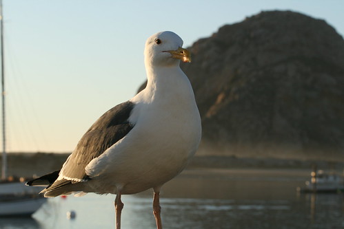
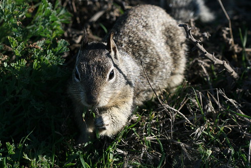
Harbor Seal

There is plenty of wildlife in the bay, such as this harbor seal who was hanging around a fishing boat, waiting for scraps.
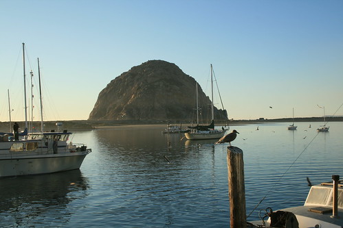
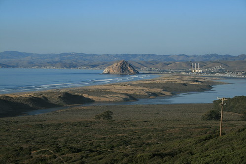
Morro Rock
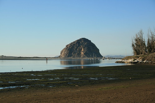
Morro Rock is a landmark in Morro Bay. Morro Rock is a volcanic plug that stands 176 meters high. Although it was quarried in the past, it is now protected, as it is home to the endangered peregrine falcon.
Spooner's Cove
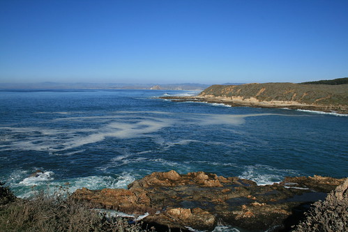
Spooner's Cove, in Montana de Oro State Park, in Los Osos, CA, as seen from The Bluffs Trail. Morro Rock can be seen far off in the background.
Link: http://www.californiacoastaltrail.info/cms/archives/hike_fav.php?aid=166
Bluffs Trail
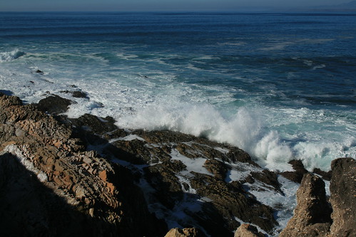
The Bluffs Trail is a 2.1 mile trail that takes you along the bluffs and down to the tidepools on the beach (if you wish to go there). Waves constantly crash onto shore, with a thunderous booming sound.
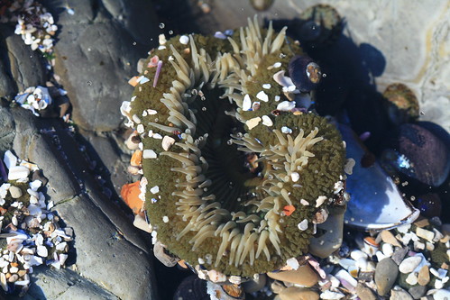
Sea Anenome
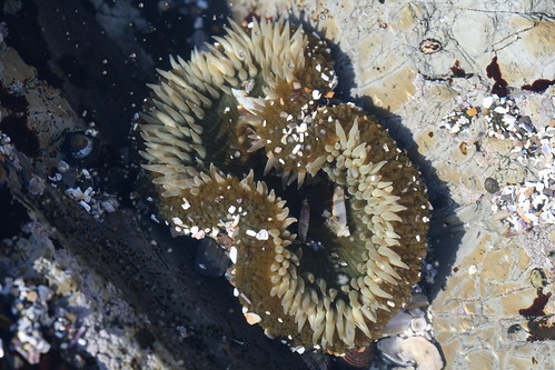
Sea anenomes, such as this one, are commonly found in tidepools. Other residents of tidepools include starfish, sea urchins, hermit crabs, fish, and the occasional octopus.
Tidepool
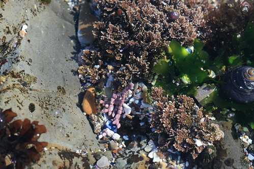
The Bluffs Trail will take you to Corallina Cove, which has many tidepools for you to explore. There is a tiny fish in this picture. Can you see him? (hint: he is right next to the orange rock in the tidepool). He blends in so well to his surroundings that he is hard to spot.
Click this link http://farm4.static.flickr.com/3507/3213010744_8336b20264_b.jpg for a larger view of the picture.
Monarchs of Pismo Beach
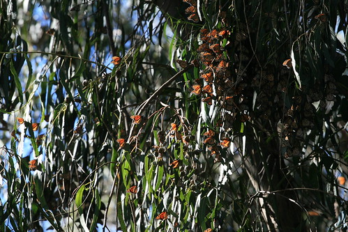
There is a eucalyptus grove in Pismo Beach which is home to a colony of Monarch butterflies who make it their winter home from November thru February each year. This grove hosts an average of 25,000 butterflies each year. The butterflies lay their eggs on milkweed plants, on which the caterpillars feed on. I visited the grove on Monday, January 19th, and there were hundreds of butterflies flying around and thousands more roosting in the trees.
Link to check out: http://www.monarchbutterfly.org/grove.htm
Monarch butterfly
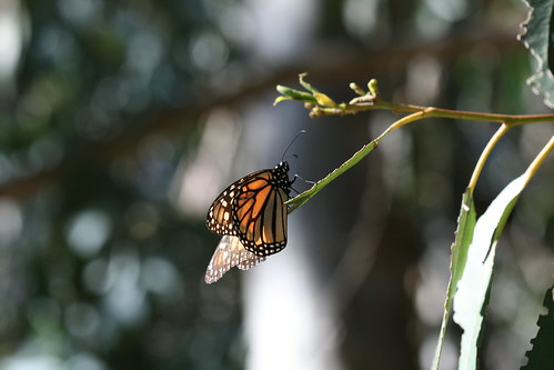
The Monarchs that visit Pismo Beach are a unique variety. They have a lifespan of up to 6 months, as opposed to the normal lifespan of 6 weeks of the common Monarch. This extended lifespan can be attributed to a unique fat storing system.
Monarchs in the trees
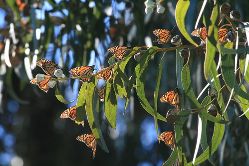
Monarch butterflies sun themselves amongst the leaves in Pismo Beach. The grove in Pismo Beach (located on the south boundary of the city on Highway 1) is host to one of the largest colonies of Monarch butterflies in the nation.
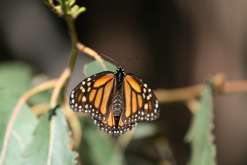
Monarchs in the trees
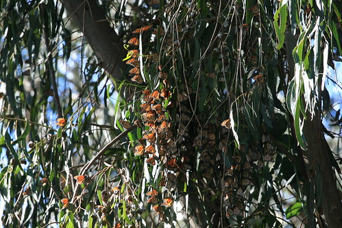
Thousands of Monarch butterflies nest in the eucalyptus trees in Pismo Beach from November thru February.
Saturday, January 17, 2009

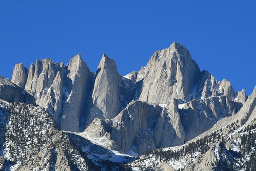
Mt Whitney
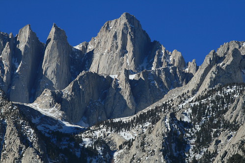
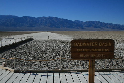
Mt Whitney was named after Josiah Whitney, the state geologist of California, and was first climbed by Charles Begole, A. H. Johnson, and John Lucas, in 1873. This picture shows the east face of the peak. The west face lies within the boundaries of Sequoia National Park. Just 76 miles east of Mt Whitney, the highest point in the contiguous 48 states, lies Badwater Basin in Death Valley National Park, which is the lowest point in North America.
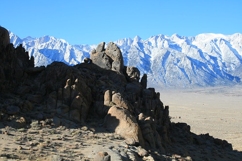
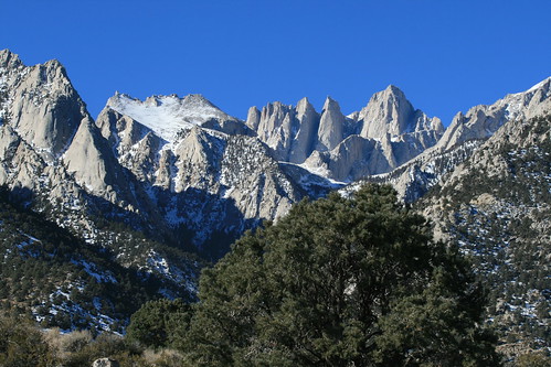
The Alabama Hills
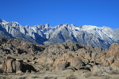
The red colors of the Alabama Hills contrast with the grey and white colors of the Sierras in the background. The Alabama Hills are located in the town of Lone Pine, California, and have been the location for many western movies and shows, such as The Lone Ranger, Gunga Din and Hopalong Cassidy films.
Mesquite Flat Sand Dunes (5)
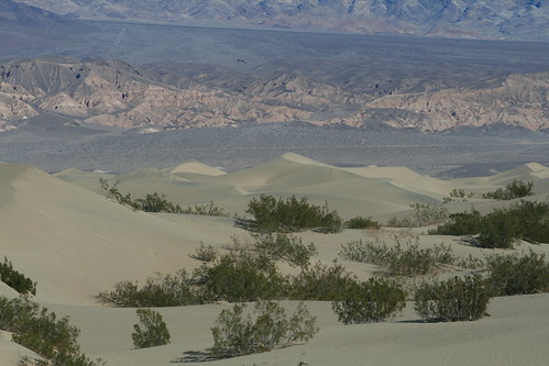
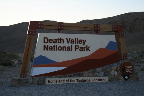
Death Valley National Park is the largest National Park in the US, outside of Alaska.
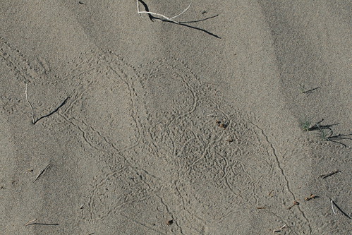
Mesquite Flat Sand Dunes (7)
The Mesquite Flat Sand Dunes, near Stovepipe Wells. These dunes look close, but distance is deceiving here.
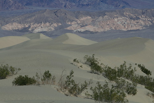
Mesquite Flat Sand Dunes (10)
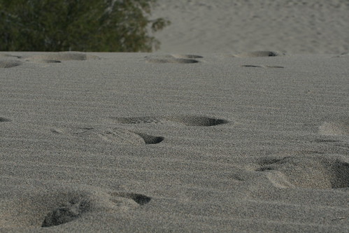
There are no trails on the sand dunes, but there are plenty of footprints to follow.
Devil's Golf Course (4)
The salt and gravel beds of Devil's Golf Course extend to a depth of 1000 feet. Later studies suggest that, in some places, they extend to a depth of as much as 9000 feet.
Devil's Golf Course (32)
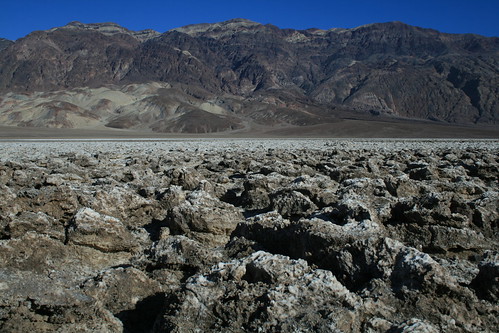
According to a 1934 National Park Service Death Valley guide book, "only the devil could play golf" on this surface, hence its name.
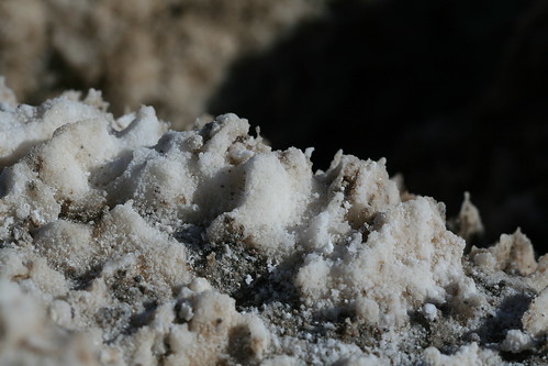
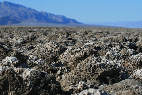
Devil's Golf Course (28)
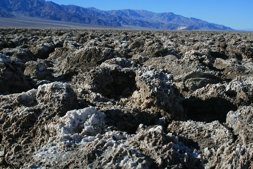
Spiky, crystalline salt spires rise up from the valley floor, creating Devil's Golf Course.
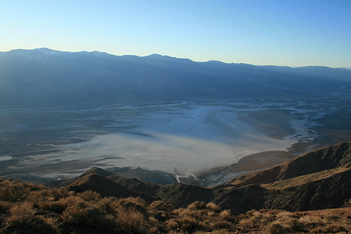
Badwater (3)
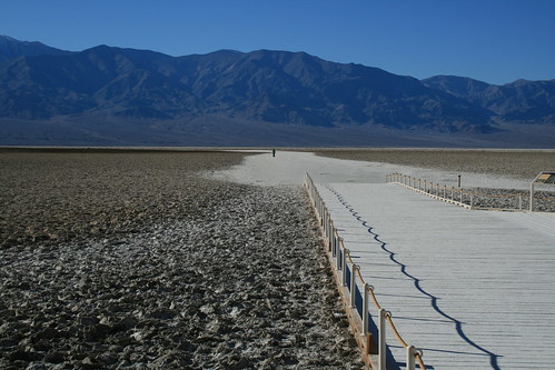
The salt flats at Badwater Basin. The salt flats here were created 2000 - 4000 years ago when a 30 foot lake evaporated, leaving a 1-5 foot layer of salt in its wake.
Artist's Palette (17)
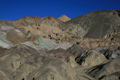
Oxidation of different metals, including iron salts, maganese and mica create the striking colors of Artist's Palette in Death Valley National Park.
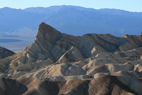
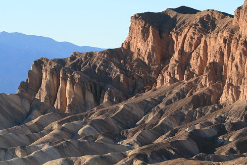
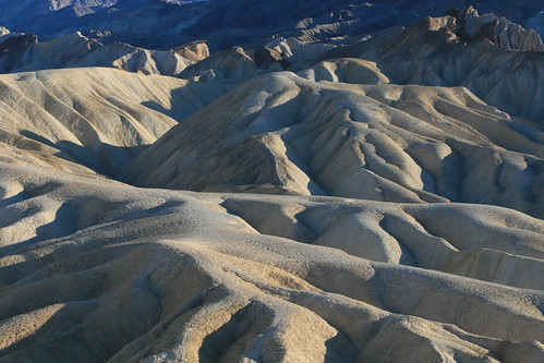
Zabriskie Point (16)
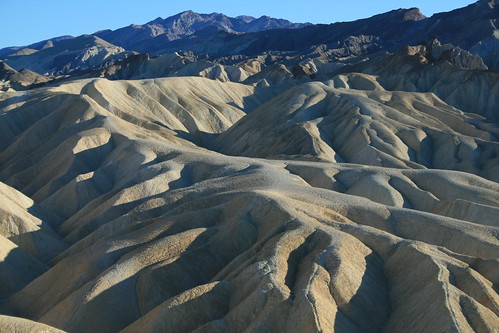
The badlands at Zabriskie Point. The badlands are made up of mud and siltstone. As the name implies, the badlands support almost no plant life.
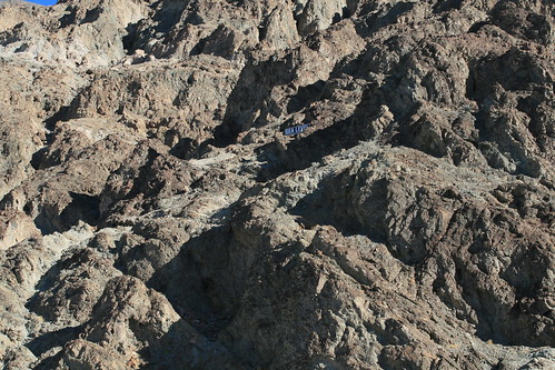
Dante's View (2)
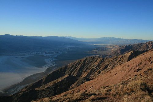
Atop Dante'S View - It was chilly up here. I even saw a few patches of snow on the way up.
Tuesday, January 13, 2009
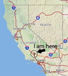
Road Trip Time!
Friday, January 09, 2009
I have been published :)
Cool, huh?
Tuesday, January 06, 2009
Thought of The Day - Jan 6, 2009
(can you tell I am just dying for a road trip? hehehe)


 Grab my blinkie if you wanna


 (Click on the links below to go there.)


 Click the moose to sign my Guest Book


 My "pet"


 Visit CALM


