Posted below are pictures taken at Shell Creek Road on March 25, 2008. I got there just before sunset, so I didn't have much time to take pictures. I went back here on Saturday, March 29, 2008 as well, but it was fairly cloudy and misty. I will post those pictures later on, too.
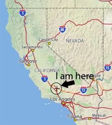
Shell Creek Road is located off of Highway 58 West, about 19 miles east of Santa Margarita, CA.
Monday, March 31, 2008

.jpg)
.jpg)
.jpg)
Sunday, March 30, 2008
Carrizo Plain National Monument - March 25, 2008
thatAfter the mess with my driver's license was cleared up (see my other blog for all the info on this if you want a good laugh or want to read a good "omg" story), I took a drive up to Carrizo Plain National Monument and then down Highway 58 West to Shell Creek Road, because I had heard this was a good spot for wildflowers (trust me, it was! - I will post pics from that area tomorrow). Carrizo Plain did not disappoint! It was alive with color. There were vast fields of yellow (Goldfields and Hillside Daisies), and purple (Wild Heliotrope, Wild Hyacinth, Filaree, Red Maids and Owl's Clover), as well as patches of blue (Baby Blue Eyes). The plain looked like someone had driven over in an airplane and threw paint down on the earth.
The birds have also returned to the plain. I saw Western Meadowlarks, Horned Larks, Red Tailed Hawks, Sparrows and Mourning Doves, to name a few. I also spotted a few Pronghorn at dusk when I was driving back.
I posted some pictures below. Enjoy!
Links to check out:
Carrizo Plain National Monument
Wikipedia: Carrizo Plain
Carrizo Plain - a 3D Tour
Sierra Club: Carrizo Plain

.jpg)
.jpg)


.jpg)
.jpg)


.jpg)
.jpg)
.jpg)
.jpg)

.jpg)
.jpg)

Saturday, March 22, 2008
Death Valley National Park - 3/15/08
I went to Death Valley National Park last Saturday. It started out as a nice day, but it got really cloudy and windy as the afternoon wore on. I got to visit a few spots that I didn't get to visit before: Scotty's Castle, Ubehebe Crater and The Racetrack. I just wish it had been sunnier. I mean, it was cold at Ubehebe Crater!!!
The wildflowers were out in bloom alongside the road from Stovepipe Wells to Furnace Creek, as well as alongside the road to Beatty, NV. I saw many different types: Desert Sunflower, Wild Heliotrope, Parachute Plant, Desert Star and Yellow Cups. It was pretty windy and cloudy so the pictures didn't come out as well as I had hoped. But there is always next time ;)
I posted pictures below.
Links to check out:
Death Valley National Park
Places of Interest in Death Valley
Death Valley Wildflower Reports


.jpg)
.jpg)

.jpg)
.jpg)
.jpg)
.jpg)
.jpg)
.jpg)
.jpg)

.jpg)

.jpg)
.jpg)
.jpg)
.jpg)
.jpg)
.jpg)
.jpg)

.jpg)
.jpg)

Wildflowers on Granite Road outside of Bakersfield
I took a drive not too long ago on Granite Road. There are lots of wildflowers out there....Fiddleneck, Popcorn Flower, Miner's Lettuce, Wild Hyacinth, Red Maids, and more! Th hills are orange with Fiddleneck. It was kind of cloudy that day so I didn't get a whole lot of pictures.
.jpg)
Subscribe to:
Posts (Atom)


 Grab my blinkie if you wanna


 (Click on the links below to go there.)


 Click the moose to sign my Guest Book


 My "pet"


 Visit CALM