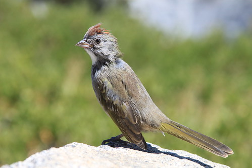
I had a little visitor when I was taking pics of Half Dome....this Green Tailed Towhee sat on the rock in front of me, just a foot or so away. He stayed still long enough for me to take a few pics before hopping off.
Tuesday, August 13, 2013
Glacier Point - 8/12/13
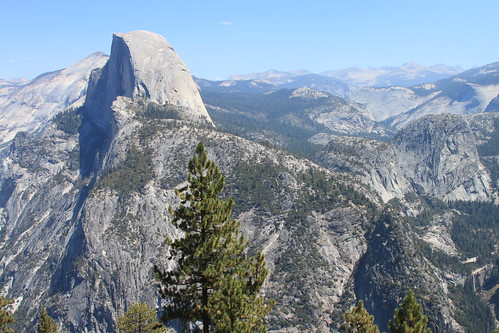
I took a drive up Glacier Point Road, intending to hike Sentinel Dome. But after finding no place to park at the trailhead, I drove up to Glacier Point to take in the view. No matter how many times I have seen it, it never fails to impress! Both Vernal and Nevada Falls have been reduced to trickles, as always happens during the summer. In Yosemite Valley, Yosemite Falls has completely dried up.
Tuolumne Meadows - Lembert Dome - 8/11/13
The Lembert Dome trail is about 4 miles round trip and climbs about 850 feet in elevation. The trail is nice and shaded for the most part, although the dome itself is totally exposed. Steep and rocky for the first mile or so, the trail levels out at the Dog Lake/Lembert Dome junction and stays fairly level for the most part of the last mile. The last 1-2 tenths of a mile starts climbing uphill again before you finally start the trek up to the top of the granite dome.
Tuolumne Meadows - Lembert Dome - 8/11/13
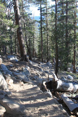
A steep and rocky section of the Lembert Dome/Dog Lake trail. Luckily, most of the climbing is done over the first mile.
Tuolumne Meadows - Lembert Dome - 8/11/13
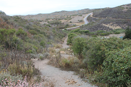
The trail continues to climb fairly steeply up the hill...
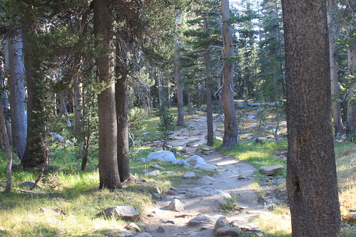
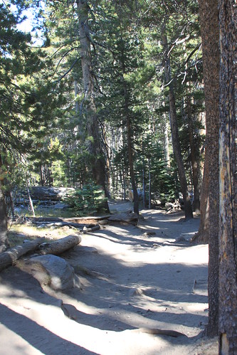
Tuolumne Meadows - Lembert Dome - 8/11/13
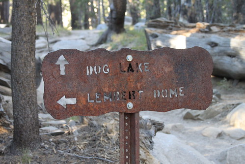
At this junction, the Lembert Dome trail levels off for a good while before climbing once again.
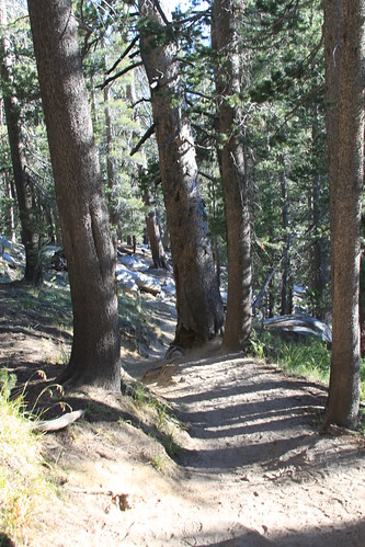
Tuolumne Meadows - Lembert Dome - 8/11/13
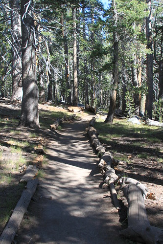
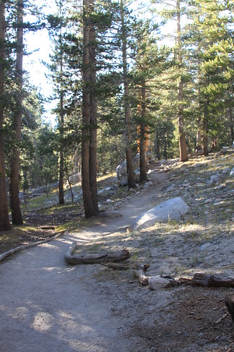
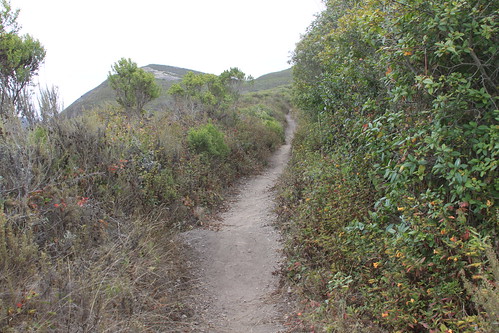
This section of the trail is mostly level and nicely shaded. It will give you a chance to catch your breath and give your legs a bit of a rest.
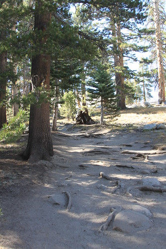
Tuolumne Meadows - Lembert Dome - 8/11/13
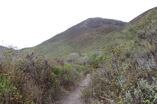
The trail climbs again here for a short while, and then you hit granite, and it's up the dome you go.
Tuolumne Meadows - Lembert Dome - 8/11/13
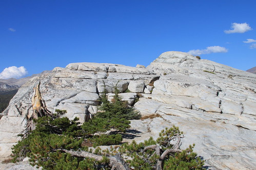
The view from the top of Lembert Dome is amazing. But, in retrospect, I should have hiked it in the morning when the sun was behind me and the lighting was better. Still, it was a sight to behold. I sat here for a good 20 minutes, drinking some water, taking a breather and enjoying the view. Then I started to get a little chilly, so I decided it was time to head back down.
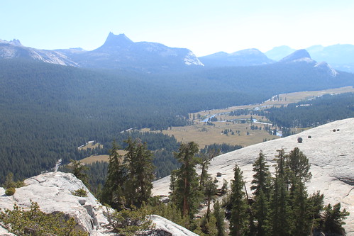
Tuolumne Meadows - Lembert Dome - 8/11/13
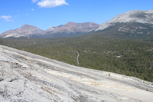
Near the top of Lembert Dome. You can see Tioga Road far below.
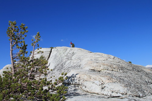
.JPG) The hike up to the top of the dome looks daunting. I was actually afraid to hike to the top. But all you have to do is take your time and pick your own route to the top. You don't have to climb straight up. I made my way around to the left and approached the top of the dome from the backside.
The hike up to the top of the dome looks daunting. I was actually afraid to hike to the top. But all you have to do is take your time and pick your own route to the top. You don't have to climb straight up. I made my way around to the left and approached the top of the dome from the backside.
.JPG)
Tuolumne Meadows - Lembert Dome - 8/11/13
A view from the top of Lembert Dome in Yosemite National Park.
Tuolumne Meadows - Lembert Dome - 8/11/13
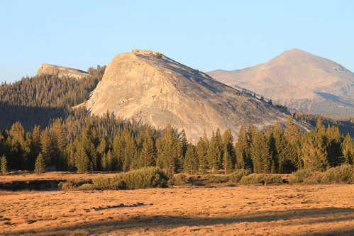
Lembert Dome in the evening sunlight. By the time I had finished my hike, it was nearly 7:00 pm. I always find that Lembert Dome looks its best in the soft, warm evening sunlight, just before sunset.
Tuolumne Meadows - Mule Deer - 8/11/13
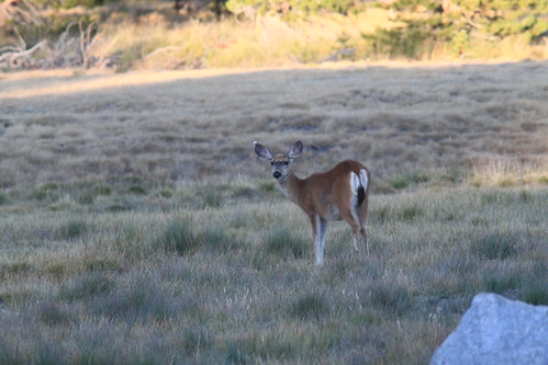
When I was driving away from the Lembert Dome parking lot after my hike, I spotted this Mule Deer doe grazing in a nearby meadow.
Monday, August 12, 2013
Yosemite! 8/12/13
I camped out in Tuolumne Meadows campground last night for the second time this summer. It was great weather for it too. I was glad I made a reservation online, as the campground filled up by the late afternoon. I arrived at about 1:45. After I finished setting up my tent and things and grabbing a quick drink. I drove to the Visitor Center to stamp my National Parks passport, and then drove to the Lembert Dome/Dog Lake parking lot to set off on the hike up Lembert Dome. The hike is between 3.7 and 4 miles round trip (I have seen various lengths, but according to the trail markers, it seems like it is more like 2 miles one way - at the trailhead it says it is 1.3 miles to Dog Lake - at the Dog Lake junction, it says it is .3 miles to Dog Lake and 1 mile to Lembert Dome) and climbs about 850 feet in elevation. The starting elevation is over 8500 feet. feet. The trail climbs steeply for the first mile or so. It is rocky in places and the high starting altitude can wreak havoc on the lungs if you aren't acclimated (which I wasn't since I just arrived to Tuolumne Meadows about an hour prior to starting the hike) - the altitude kicked my butt for the first mile. I mean, KICKED my butt! I had to stop a few times since I was getting kind of light headed and my heart was racing. But, at the Dog Lake/Lembert Dome junction, the trail levels out nicely so you can catch your breath and give your legs a rest. The trail is nicely shaded all along the way, but even more so at this point. From the junction, the sign says you have a mile to go, and most of this distance is fairly level. It isn't until the last 1-2 tenths of a mile that you start to climb again, and soon you hit granite. From here, there is not trail to speak of. It is up to you to pick your own way up the granite. For me, it was easier to zig zag my way up. It is way easier on the legs and I didn't feel like I was going to fall. One you reach what seems like the top, you realize there is still a little more ways to go. Some hikers took the direct, steep way up. But I am not very graceful (lol), so a roundabout way was more my speed. I really wasn't sure I was even going to go to the top, since I am such a fraidy-cat when it comes to heights. But, slowly, I walked to the left and made my way up til I had reached the top. What a view! It was awesome! At this point the elevation is 9450 feet.. I found a good place to sit so I could drink some water and take some pictures and just enjoy the view. I sat there for a good 20 minutes before heading down. It was quite windy, which, at times, nearly threw me off balance (which was scary), and I was glad I hadn't worn a hat - lol. Slowly, I made my way back down. But here is where it got weird. I couldn't seem to find the trail when I got back down. So, after wandering for a while, climbing over fallen logs and climbing up through the forest, I finally found my way back to the trail. I knew I had to keep walking left, and when I saw the granite through the trees, I knew the trail was right there - whew! But it added time and distance to my hike, not to mention, a lot of cussing - lol. So, it might be best to really look at the trail and remember what it looks like. Or make a marker, like a rock cairn or something to mark your spot, less you have to take a detour like me. I kind of booked it down the trail, as it was already nearly 6:00 and I wanted to go to the store to get ice and firewood before it closed. I thought it closed at 7:00. I made it back to my car at 6:48, and I made it to the store. Only to find out that it closes at 8:00 - lol. I didn't even have a campfire. I was too tired and wanted to crawl into my sleeping bag - lol. The night was cold - very cold. It was in the 30s in the morning, and I was glad I had brought my sweats. My sleeping bag is rated for 0 degree weather, but I was still cold! I didn't want to get out of my sleeping bag in the morning - lol.
If you are going to hike Lembert Dome, bring plenty of water (the trail is well shaded, but the dome itself is totally exposed, and you always need more water in the higher elevations to avoid dehydration), sunscreen and sturdy hiking shoes with good tread. You may want to leave your hat in the car, because, with the wind, you may lose it - lol. Or wear one of those hats that you can tie on. A trekking pole (or 2) is also helpful. And don't forget the camera! You will definitely want to take pics from the top! The trail is rated anywhere from easy (I have seen from various reviews) to moderate to moderately strenuous (according to Yosemite's paper guide they give you when you arrive). While I don't think it's easy (unless you are one of those people who can sprint up Mt Whitney), I don't think it's moderately strenuous either. I would rate it as moderate. If you take away the altitude, it would be an easy to moderate hike.
There is another trail that starts from near the Tuolumne Lodge parking lot, which is shorter, but much steeper. This trail is more of a direct climb up the dome instead of the roundabout way that I took.
Tired, tired tonite. I didn't sleep at all last nite. My eyes were shut, but I was awake all night. Had a horrible headache from the high altitude, which always happens to me on the first night camping above 8000 feet. Doesn't seem to happen below 8000 feet - weird. Of course, going on a high altitude hike hours earlier probably didn't help - lol. Had a great hike though. Didn't plan on hiking Lembert Dome til fall, but, what the heck. I was there. Why not? lol. Wanted to hike Sentinel Dome today, but there was absolutely no parking available. Bought myself a new national parks pass too - woo hoo! I'm already getting excited about planning the next hike :) Probably Bishop's Peak in SLO and back to Little Lakes Valley the week after to actually finish the trail - all the way to Gem Lakes. Maybe by next year, I'll be ready for Upper Yosemite Falls or Cloud's Rest. One step at a time. I am off to bed. My hands are killing me, but my legs are fine actually. Not very sore at all (of course, that could change come tomorrow - lol). I posted pics to flickr and will update my blog tomorrow.
Until then, happy trails!
Tuesday, August 06, 2013
Valencia Peak Trail - 7/27/13
The trail climbs through sagebrush as it rises up above the campground.
Valencia Peak Trail - 7/27/13
I hiked up Valencia Peak this time from the Oats Peak Trail. The trailhead begins just past the Nature Center, before you go into the campground. I won't take this trail to Valencia Peak again though. It was far too narrow and poison oaky for my taste. The Valencia Peak Trail (trailhead across from The Bluffs trailhead) is a way better way to go.
Valencia Peak Trail - 7/27/13
The trail is very narrow in places like this. So watch out for poison oak. It is EVERYWHERE! It is probably best to wear long pants if you plan to hike up to Valencia Peak from this trail.
Valencia Peak Trail - 7/27/13
At this point, I was able to see the peak, as it was previously hidden in the fog. Thankfully, the fog lifted and I had a beautiful sunny hike from this point on.
Valencia Peak Trail - 7/27/13
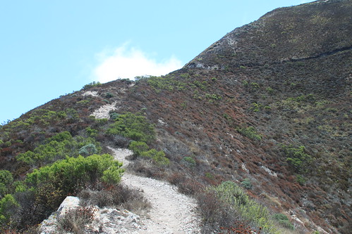
The trail climbs higher and higher, and gets steep in areas like this one. There aren't many level areas along the trail, whish is tough on the legs hiking up, but even harder on the knees and ankles on the way down.
Valencia Peak Trail - 7/27/13
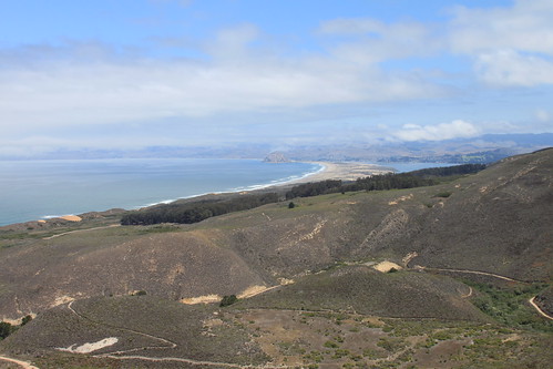
On a sunny day like this, the views are great. You can see Spooner's Cove to the right.
Valencia Peak Trail - 7/27/13
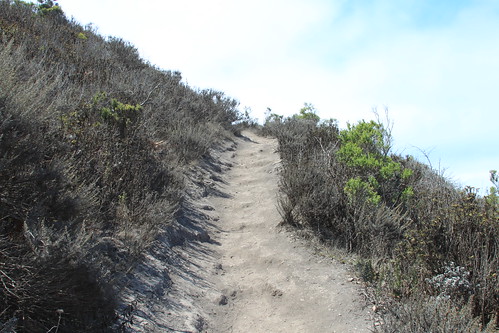
I procrastinated for a few minutes here before heading up. This is my least favorite part of the trail. Rocks and I aren't the best of friends, and it is very rocky from this point on.
Valencia Peak Trail - 7/27/13
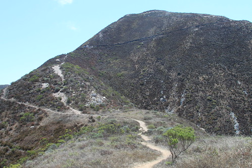
At this point in the trail, sh*t gets real - lol. This is the part I dread. It is very steep (as you can see) and rocky. I hiked it this time with a trekking pole, which made it WAY easier. I am far too clumsy to trust my own balance in this section of the trail - lol. Thankfully, this section of the trail is short. Just a few more switchbacks and you will be at the top.
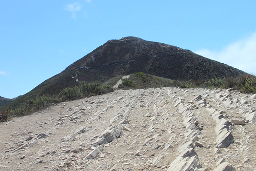
Valencia Peak Trail - 7/27/13
I made it!!! After a 2 mile hike climbing over 1250 feet in elevation, mostly uphill, steep and rocky in places and totally shadeless, I made it to the top. It's a good feeling (even though your thighs are telling you otherwise - lol).
Valencia Peak Trail - 7/27/13
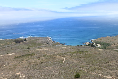
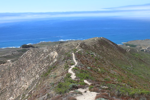
Once you hike to the summit, you have to go all the way back down. To me, the downhill is worse than the climb up. But with views like this, the hike is totally worth it :)
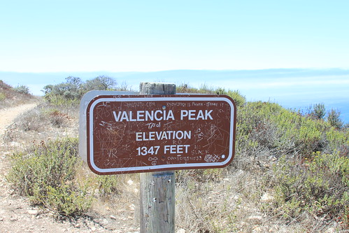
Valencia Peak Trail - 7/27/13
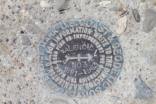
The summit marker is located on the little hill behind the Valencia Peak sign. There is a short little trail that leads up to the marker, so don't forget to take the few extra steps to see it.
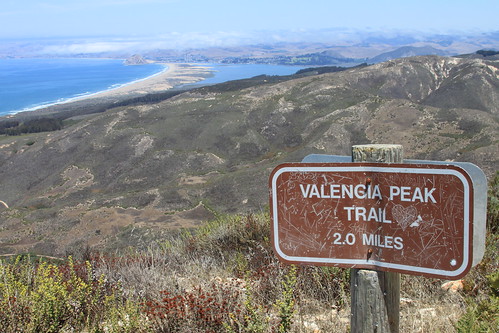
Valencia Peak Trail - 7/27/13
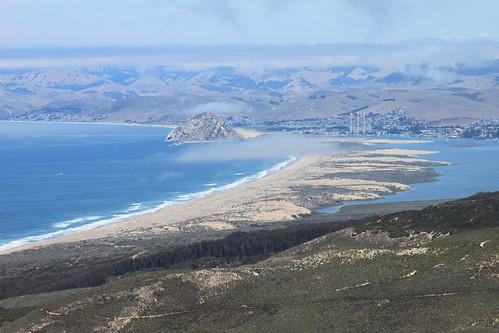
The view from the summit of Valencia Peak - soooo beautiful on this sunshiney day.
Monday, August 05, 2013
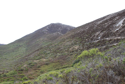
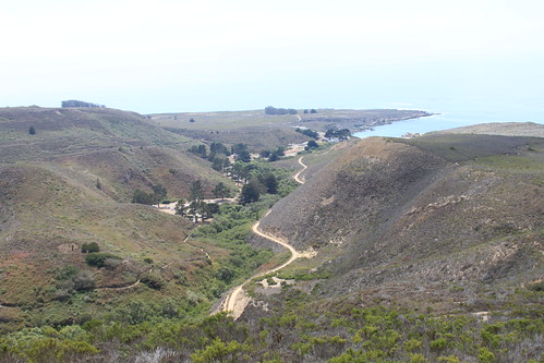
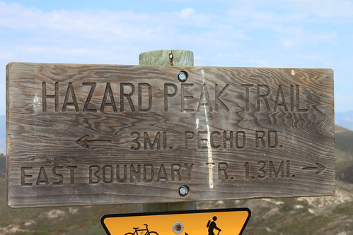
Hazard Peak Trail - 7/22/13
Hazard Peak is located in Montana de Oro State Park in Los Osos, CA. There is no fee to get into this park.
From the Hazard Peak parking lot, you can see Valencia Peak in the background. You don't really get a good view of Hazard Peak until after you make your way out of the eucalyptus grove.
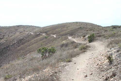
Hazard Peak Trail - 7/22/13
The Hazard Peak Trail is a 3-mile hike to the summit. Over the 3 miles, you climb about 1025 feet in elevation, so the trail is not overly steep, but rather, a gradual climb. Not too many level areas on the trail. On sunny days it can get rather warm, and there is very little shade. The narrow trail is open to hikers and bikes. No dogs are allowed on the trail. And if you ride a bike on the trail, bike bells are encouraged.
Hazard Peak Trail - 7/22/13
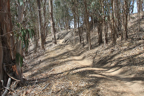
Shade is a rare commodity on Hazard Peak Trail. Aside from the shade of this eucalyptus grove, there is no shade at all on the trail. Bring your hat, sunscreen and plenty of water on this trail.
Hazard Peak Trail - 7/22/13
This gopher snake was using the trail to warm itself up. I got close to the snake, but it didn't even move. I took a few pics, then walked away, leaving the snake in peace :)
Hazard Peak Trail - 7/22/13
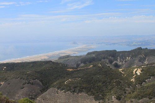
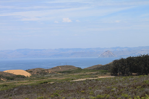
The view from the summit is pretty awesome. You can see Morro Bay far below. It was even better since it was a sunny day :)
Hazard Peak Trail - 7/22/13
For some reason, I had thought this was a 2 mile one-way hike to the summit, but, it turned out it was a 3-mile hike.
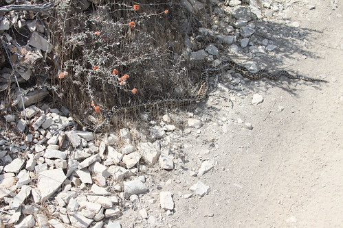
Hazard Peak Trail - Baby Rattlesnake - 7/22/13
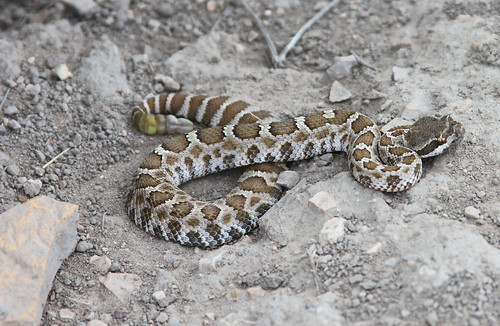
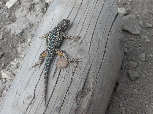
About a quarter of a mile from the trail head on the way back to my car, I found this little guy on the side of the trail. I almost didn't see him. And I wouldn't have, if a lizard sitting near him hadn't jumped and run and caught my attention. Cool!
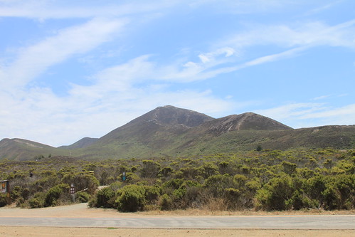
Devil's Postpile National Monument - Minarets - 7/2013
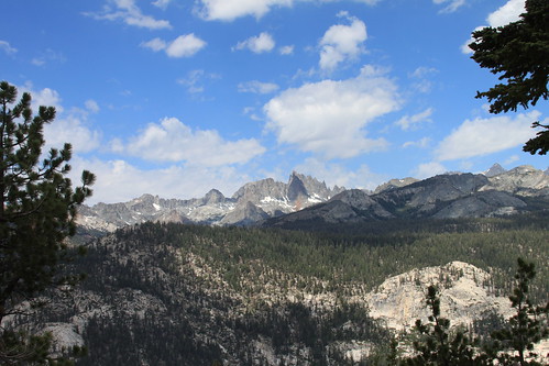
A view of the Minarets from the road into Devil's Postpile.
Subscribe to:
Posts (Atom)


 Grab my blinkie if you wanna


 (Click on the links below to go there.)


 Click the moose to sign my Guest Book


 My "pet"


 Visit CALM