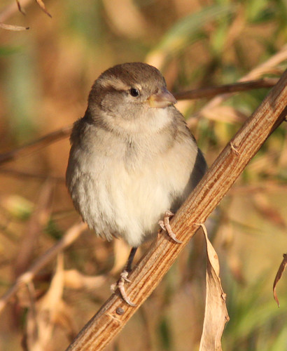
The very common, but very cute, female House Sparrow.
Wednesday, November 20, 2013
Lake Ming - Say's Phoebe
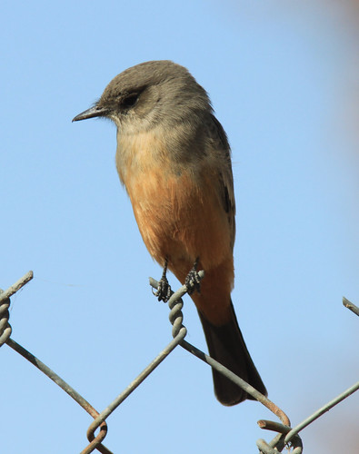
A cute little Say's Phoebe sits on the fence at Lake Ming in Bakersfield, CA. I am glad to see these guys returning.
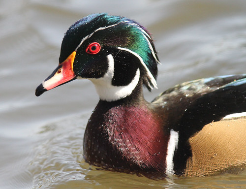
Kern National Wildlife Refuge - Gadwall
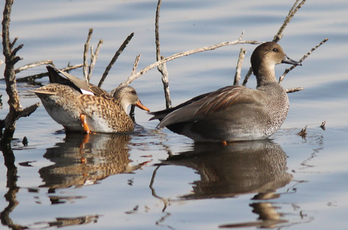
A Gadwall pair get ready for a swim at the Kern National Wildlife Refuge.
Kern National Wildlife Refuge - Northern Harrier
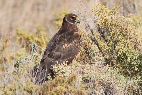
A female Northern Harrier sits in the low brush at the Kern National Wildlife Refuge. The male is grey in color.
Kern National Wildlife Refuge - Red Tailed Hawk
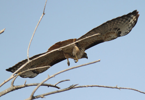
A Red Tailed Hawk takes flight at the Kern National Wildlife Refuge.
Kern National Wildlife Refuge - Greater Yellowlegs
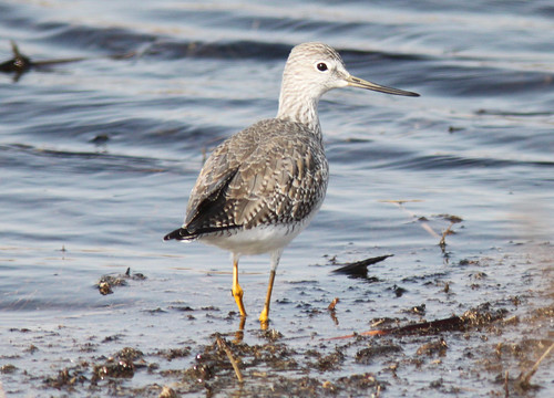
The Greater Yellowlegs can be distinguished from the Lesser Yellowlegs from its size (it's larger than the Lesser), and its longer and slightly upturned bill. The Lesser has a shorter and straight bill.
Kern National Wildlife Refuge - Loggerhead Shrike
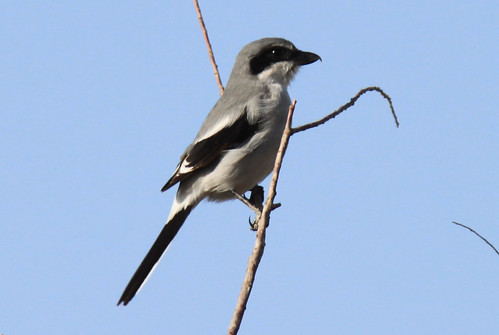
A Loggerhead Shrike poses for a picture at the Kern National Wildlife Refuge.
Hart Park - Red Shouldered Hawk
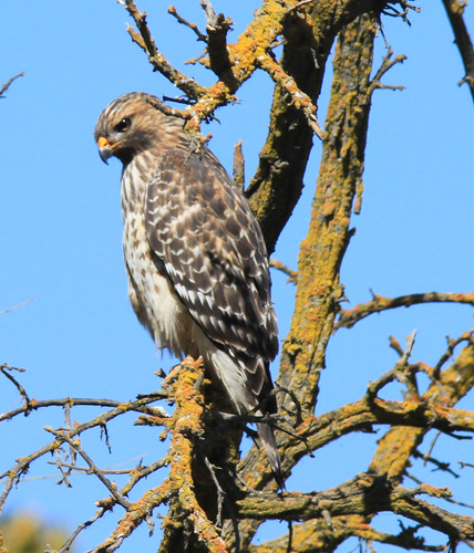
A Red Shouldered Hawk sits in a tree, searching the ground for something to eat. The Red Shouldered Hawk looks similar to the Red Tailed Hawk, but this hawk is much smaller in size and lacks the red chest band of the Red Tailed Hawk.
Hart Park - Great Egret
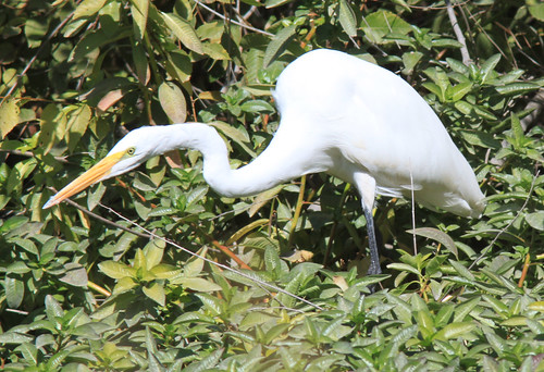
A Great Egret stalks its prey. Another common sight at Hart Park is the Snowy Egret which resembles the Great Egret, although the Snowy Egret has a black beak and is about half the size of the Great Egret.
Hart Park - Cedar Waxwing
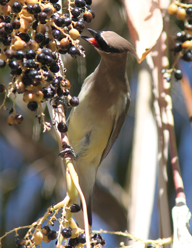
With winter coming, the Cedar Waxwings return to Hart Park to feast upon the berries in the trees.
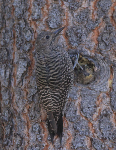
Hart Park - Nuttals Woodpecker
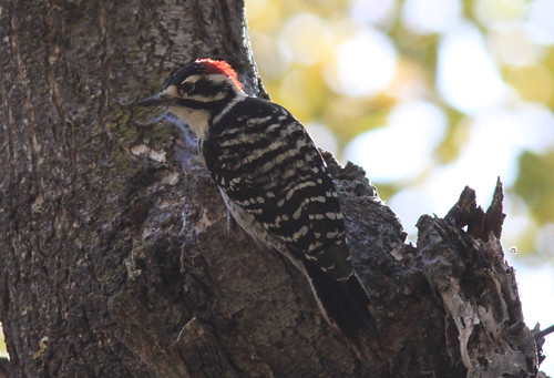
A male Nuttals Woodpecker pauses a moment before searching for something to eat.
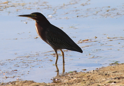
Hart Park - Black Phoebe
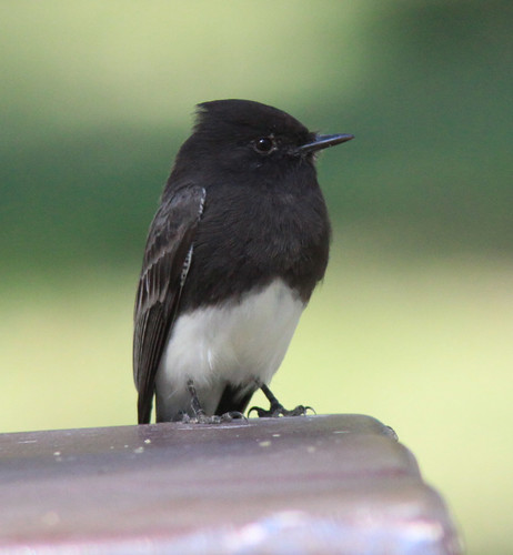
A cute little Black Phoebe sits on a picnic table at Hart Park in Bakersfield, CA.
Little Lakes Valley Trail - 8/26/13
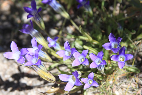
Not many flowers were still in bloom, but these Sierra Gentain were still showing some nice color.
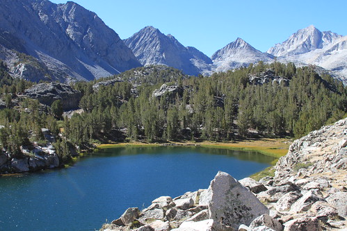
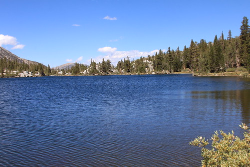
Little Lakes Valley Trail - 8/26/13
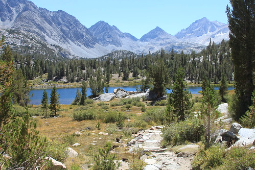
A view of the trail approaching Heart Lake. This is probably my favorite spot on the trail.
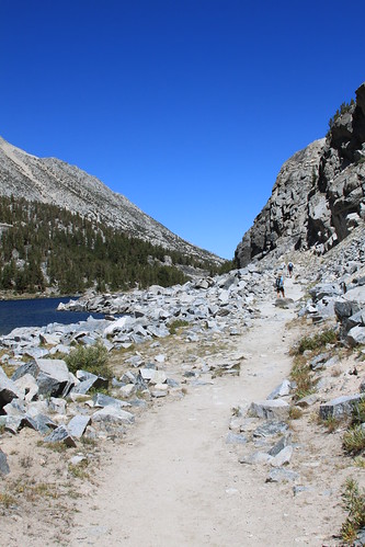
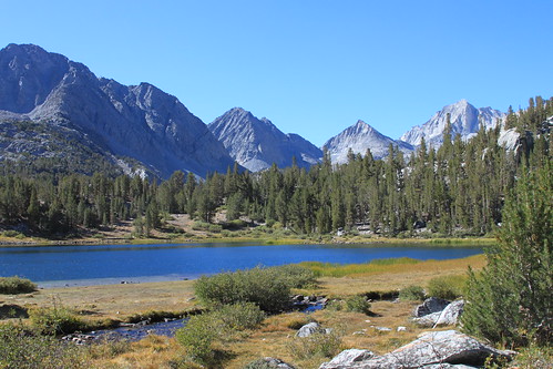
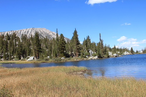
Little Lakes Valley Trail - 8/26/13
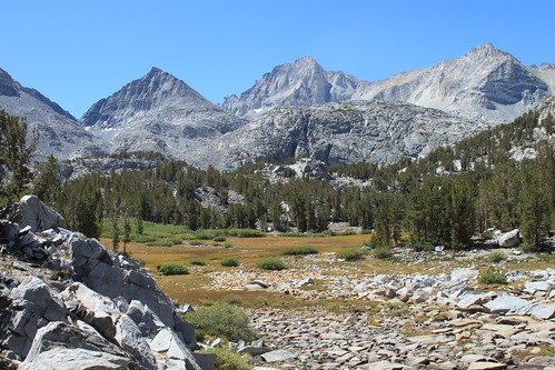
A view from the trail near Chicken Foot Lake, showing the rocky Eastern Sierra Mountain range in the background.
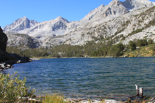
Little Lakes Valley Trail - 8/26/13
Chicken Foot Lake. This is the next lake you come to after you reach Long Lake. This was as far as I made it on this hike. I simply did not have time enough to go farther. I had never seen this lake before. Yet another beautiful spot on the trail.
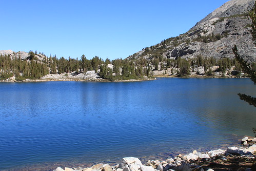
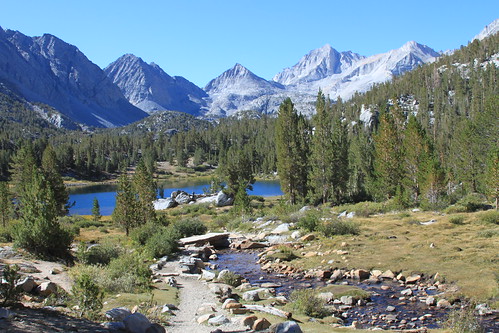
Little Lakes Valley Trail - 8/26/13
About 2 miles into the hike, you come to Long Lake. I always stop here and have a snack :) It sure was cold this morning.
Little Lakes Valley Trail - 8/26/13
With views like this, you can see why I return year after year to hike this trail. Simply beautiful.
Eastern Brooks Lakes - 8/25/13
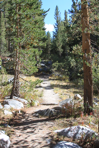
The trail starts out level enough, and then begins climbing up over a rocky ridge and then goes down into a valley where you will find the lakes.
Eastern Brooks Lakes - 8/25/13
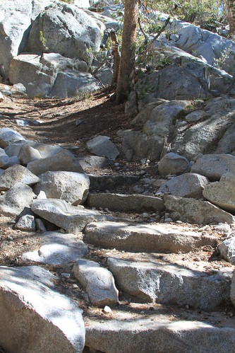
There are a few steep and rocky spots along the trail, but nothing too difficult. It's the 10,000+ feet in altitude that will get you huffing and puffing.
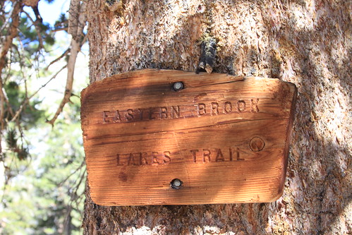
Eastern Brooks Lakes - 8/25/13
The Eastern Brooks Lakes are a secluded spot in the Eastern Sierras. The trailhead is located near the Little Lakes Valley trailhead, but it is off to the left. This trail gets very little foot traffic, as most people take the more popular Little Lakes Valley hike. The trail to the lakes is about a 2 mile round trip hike, and is rated as difficult in the trail guide I got at the store. I didn't find it nearly as daunting as I expected. I hiked this trail one day, and hiked the Little Lakes trail the next. While the Little Lakes trail is definitely more popular, I would still recommend this trail, because with views like this, why not do both?
Orange Crowned Warbler - Little Lakes Valley
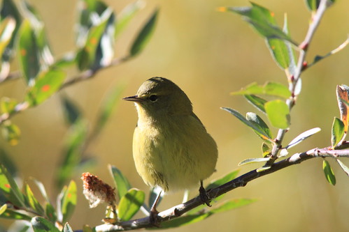
This Orange Crowned Warbler poses on a branch in the early morning sunshine.
Williamson's Sapsucker - Mammoth Lakes
The female Williamson's Sapsucker blends in perfectly with her surroundings.
Mountain Chickadee
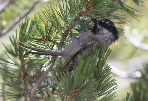
Mountain Chickadees are one of the most common birds you will find in the Eastern Sierras.
Squirrel - Little Lakes Valley Trail
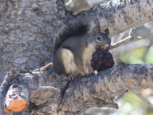
A squirrel pauses a moment with a pinecone, before scrambling up the tree with his prize.
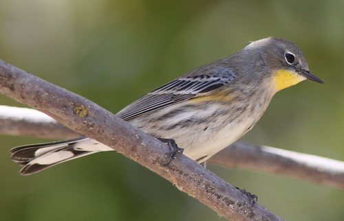
Yellow Rumped Warbler - Little Lakes Valley
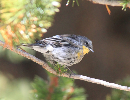
A Yellow Rumped Warbler sits on a branch along the Little Lakes Valley Trail.
Bishop Peak Trail - 8/18/13
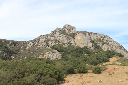
Bishop Peak is the tallest of the nine "sisters" (or Morros) in San Luis Obispo County, at an elevation of 1546 feet at the peak. The trail is 2.0 miles one way to the top of the peak, with an elevation gain of 950 feet (from the Highland Drive trailhead). The trail is rated as moderate to strenuous, depending on who you ask. I found the trail to be hard, but not too hard.
I started the trail from the Patricia Drive side, as there was no parking available at the trailhead starting at Highland Drive. The Patricia Drive trailhead begins at a slightly lower elevation, so you have to work a bit harder to climb from here. Beginning the trail from here adds another .2 miles and a little more elevation gain.
Bring water! This is essential, as even if the temps are in the low to mid 70's, there is very little shade. Sturdy hiking boots are also recommended as there are many steep and rocky sections on the trail. I would not advise people to climb the peak in flip flops: you will fall. Dogs are permitted on the trail, but no bicycles are allowed. Also, there is quite a bit of poison oak, especially in the lower parts of the trail. It is best to arrive early, especially if you want to start the hike from Highland Drive, as there is very little parking there. There is also a lot of traffic on the trail, as it is a very popular trail.
All in all, it was a great hike, with some truly awesome views. I will surely return to do this hike again. Although, this time, I may refrain from drinking red colored Gatorade. When I got back to my car and looked in the mirror, my lips and teeth were bright red. No wonder people were looking at me funny!!! LOL
Happy trails!
Directions to Trailhead (from the Sierra Club Website): From San Luis Obispo head west toward Los Osos on Foothill Blvd. Turn Right on Patricia Drive. Head straight until you reach the stop sign at Highland Drive. Continue straight for 1/4 mile. On the left you will see three black post blocking an open driveway, and a sign "TRAIL" marking the entrance. As a courtesy to neighbors, please park on the Bishop Peak side (west) of Patricia Drive away from homes.
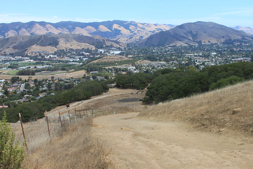
Bishop Peak Trail - 8/18/13
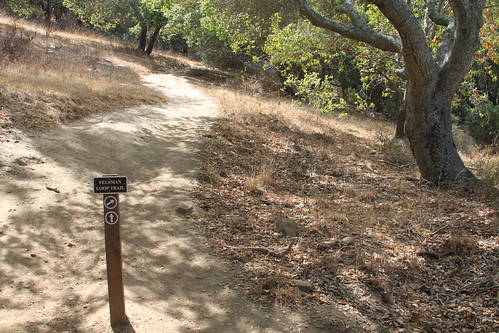
When you reach this point, the trail forks. You can actually go either way and it will still get you to the main trail to the peak. Going right just takes longer. But I went straight at this point.
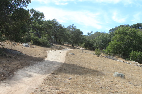
Bishop Peak Trail - 8/18/13
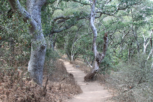
About a half mile into the trail or so, you come to a nice, shady, woodsy area. This is a nice place for a rest, or just to enjoy the one shady spot on the trail.
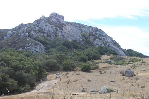
Bishop Peak Trail - 8/18/13
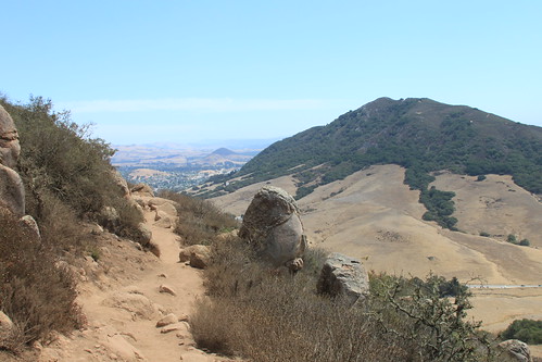
A view from the trail. You can see the highway far below, and Cerro San Luis, another peak, can be seen directly across from the west side of the trail.
Bishop Peak Trail - 8/18/13
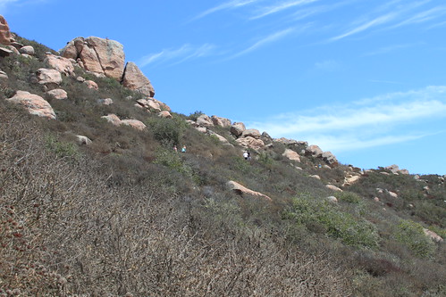
A view from the trail. You can see some hikers making their ascent up the trail. The trail gets pretty steep at this point, and there is absolutely no shade for the last mile or so.
Bishop Peak Trail - 8/18/13

A view of the trail. You can see a few hikers walking along. The trail was very busy this day, as it was a weekend and a nice, sunny day. This trail is very popular with the college students in town who view hiking the peak as a rite of passage.
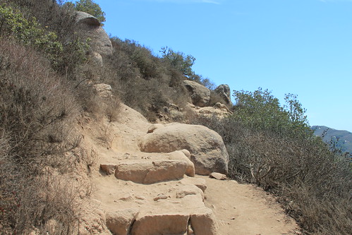
Bishop Peak Trail - 8/18/13
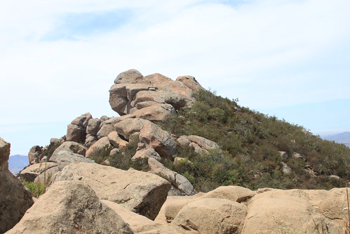
At the top of the trail, you have to do a bit of boulder hopping to get to the true summit. I was able to do it with my backpack and camera, but it wasn't that easy. My legs were bruised after my climb - lol.
Bishop Peak Trail - 8/18/13
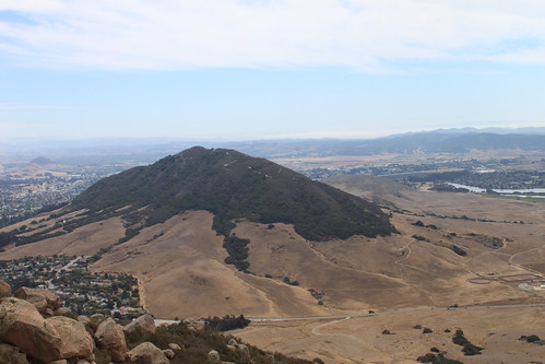
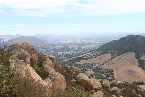
View of Cerro San Luis, aka Madonna Mountain, from the summit of Bishop Peak. There is a 4 mile round trip trail that you can hike to the summit of this peak. I haven't hiked this one yet.
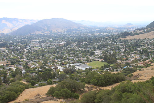
Bishop Peak Trail - 8/18/13
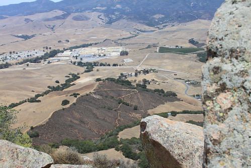
Another view from the top of Bishop Peak in San Luis Obispo. This view is looking eastward. You can see a trail far below.
Bishop's Peak Trail - 8/18/13
A view from the top of Bishop Peak in San Luis Obispo. It was quite the hike, but the views were worth it!
Subscribe to:
Posts (Atom)


 Grab my blinkie if you wanna


 (Click on the links below to go there.)


 Click the moose to sign my Guest Book


 My "pet"


 Visit CALM