Devil's Postpile is located near the town of Mammoth Lakes, CA. Situated in the Inyo National Forest on the western slopes of the Sierra Nevada mountain range at an elevation of 7560 feet, it is a beautiful place, surrounded by green meadows and tall trees, including lodgepole pine and red fir trees. To get there, you must take a shuttle bus as the road is very narrow and they do not allow parking at the lot, unless you are camping at Devil's Postpile Campground. Still, you must find a campsite or you will be fined. You can drive to Minaret Summit without paying the shuttle fee, but to go any further down, you need to take the shuttle. You can buy shuttle tickets at Mammoth Lakes at the booths for $7 per person (adult price). There is no additional admission fee to this National Monument.
The trail to the base of the postpile is mostly flat, so it is easy for even a person like me (hehe). The hike to the top is pretty steep in some areas, and, yes, I had to stop several times to rest. The elevation also comes into play, for the air is a bit thinner and you don't get as much oxygen when you breathe in as when you do in low elevations. Still, a seasoned person could probably hike very easily to the top. Even though it was steep and kind of tough, the trip was so worth it! The view from the top was amazing, and seeing the top of the postpile was very cool, especially after only having seen it in pictures before. The whole hike, roundtrip, was about a mile or so. We didn't have enough time to hike to Rainbow Falls, but I would like to go back someday to make that trip as well.
Mammoth Lakes is a really nice area with plenty of outdoor activities to do. There are numerous trailheads for the hikers, lots of campgrounds, horseback riding, gondola rides to the summit, and skiiing in the wintertime. It is located about 42 miles northwest of Bishop, CA.
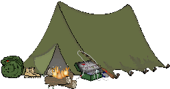
We stayed at the East Fork Campground near Tom's Place, CA, which is about 18 miles from Mammoth Lakes, at an elevation of around 9,000 ft. It is a nice campground, with plenty of trees and streams for fishermen. It offers flush toilets, with sinks in the bathrooms and mirrors (which is a rare commodity amongst campground bathrooms!) and there are even heating vents in the bathrooms, which is nice for those cold mornings and nights. There are large bear boxes to store your food in (it is bear country up there!), campfire rings and grills for cooking food. A little further up the road there is a nice little store with a kitchen, called Rock Creek Lakes Resort. We had breakfast there. I had pancakes, and let me tell you, those pancakes are HUGE! Very good too! I was pretty hungry, but was barely able to finish the 2nd pancake up. We split a piece of fresh nectarine pie, and boy was that pie yummy!!!!
A little further up the road is a narrow, 1-lane road that you can drive up to a parking lot to more hiking trails. There are several trails up there, including Mosquito Flat, Mono Pass, and Hilton Lakes/Davis Lake. We took the Little Lakes trail. This trail is supposed to be easy, but there are several uphills along the way, which can be strenuous, especially since you are over 10,000 feet in elevation. It did tire me out quite a bit, but the views were spectacular! A lot of fishermen were going up there, since trout fishing is supposed to be very good in the numerous alpine lakes and streams. There are quite a few mosquitos, so bring some repellant, and oh, some sunscreen too, since there is not a whole lot of shade along the trail. In the background, you can see several Sierra Nevada peaks, including Bear Creek Spire, which tops off at an elevation of 13,713 feet. There are numerous alpine lakes, streams and meadows along this trail, which makes it a very popular trail and one of the most scenic ones I have ever been on. A lot of people bring their dogs, and it seems like the dogs love it as well.
This trip was very fun. Next to Yosemite, the scenery in the Mammoth Lakes/Tom's Place area is the most beautiful I have seen. I would highly recommend it to everyone! Even if you aren't a hiker (and I am not much of a hiker myself - lol), at least take the Devil's Postpile trail. It is nice and flat, and the views are amazing. Make sure and bring a camera, too. You will be disappointed if you don't. As usual, I posted some pictures below.
Devil's Postpile National Monument
Mammoth Lakes, CA
Yosemite Map
East Fork Campground
Rock Creek Lakes Resort
Huell Howser/California's Gold


 Grab my blinkie if you wanna


 (Click on the links below to go there.)


 Click the moose to sign my Guest Book


 My "pet"


 Visit CALM


No comments:
Post a Comment