Sunday, April 30, 2006


the ski area up in Kyle Canyon

near the end of the road in Kyle Canyon

Valley of Fire State Park is located about 50 miles northeast of Las Vegas, Nevada, near Lake Mead. Besides being a recreation area for hiking and camping, it is also a favorite area for filmmakers. Several movies have been filmed here, such as Star Trek Generations.

Indigo Bush (Psorothamnus schotti Fabaceae )

Thrives in desert plains, slopes and sandy washes.

Desert Bighorn Sheep taking a break in the hills near Valley of Fire State Park

The Desert Bighorn is an endangered subspecies of Bighorn Sheep that live in the Southwestern regions of the US.

Beavertail Cactus

Evening at Valley of Fire State Park

Dedicated in 1935, Valley of Fire State Park is Nevada's oldest state park. It covers 34,880 acres. Throughout the park, you can see the brilliant colors of the sandstone rock.

Valley of Fire State Park

Prehistoric users of this area were the Ancient Pueblo peoples, also called Anasazi. You can see several examples of their rock art in the park.


Beehives - one of the first viewpoints in Valley of Fire State Park

Beehives

These sandstone formations were formed as a result of wind and water erosion.

Beehives

Balanced Rock - near the Visitor Center

Balanced Rock is named so as the top part of the rock looks like it is precariously balanced on top of the bottom portion.

Chuckwalla (Sauromalus ater)

When this lizard senses danger, it will crawl into a crevice and inflate itself to make it too big for the predator to pull out. They can grow 11-18 inches long. They are diurnal, which means they are active day and night. They are often spotted lying on the rocks, basking in the sun, and they will continue to bask in the sun until their optimum body temperature of 100-105 degrees f is reached. They are strictly herbivorous, feeding on fruits, leaves, flowers and buds. This one was a youngster as he had colored bands on his tail. He is hiding in the shadow. Maybe if you click on the photo you can actually see him, but he is there! lol

Chipmunk by the car

Petroglyphs on the trail to Mouses Tank

Petroglyphs probably had a deep cultural, religious and spiritual significance to the people who created them.


Petrified log - one of many in the park

Wikipedia's definition of petrified wood: "Petrified wood is a type of fossil: it exists of fossil wood where all the organic materials have been replaced with minerals (most often a silicate, such as quartz), while retaining the original structure of the wood. The petrifaction process has occurred underground, when wood became buried under sediment. Mineral-rich water flowing through the sediment deposited minerals in the plant's cells and as the plant's lignin and cellulose decayed away, a stone cast was formed in its place."

The pretrification process preserves all of the features of the original wood, right down to the microscopic level, including tree rings.


Natural Arch

Natural arches (sometimes also called bridges), can be formed by wind or water erosion.

Natural Arch

Eventually, as with all rock arches, this arch will break and disappear due to its continued exposure to erosion.

one of the "Seven Sisters" - a group of 7 pinnacles

Elephant Rock

Named so for its resemblance to an elephant.

Elephant Rock - there is a trail to it but you can actually see it from the road


Atlatl Rock

Atlatl means "a notched stick used to throw primitive spears."

Atlatl Rock petroglyphs

It is estimated that some of the petroglyphs on Atlatl Rock are 1,500 years old, though some may be even older, and some, more recent.

Atlatl Rock petroglyphs

Atlatl Rock petroglyphs

Some petroglyphs on Atlatl Rock include symbols for big-horned sheep, deer, horned lizards, people and the atlatl, a precursor to the bow and arrow. It is this symbol of the atlatl, which is one of the best prehistoric renderings of the atlatl found in North America, which the rock is named for.


The Cabins

These cabins were built from native sandstone in the 1930's as a shelter for passing travelers.

Petroglyphs on rock behind The Cabins in Valley of Fire State Park

Petroglyphs are images incised in rock by ancient people as a form of communication. They have been found on every continent in the world except for Antarctica.

White Domes at Valley of Fire State Park

Hoover Dam

President Franklin D Roosevelt dedicated the Hoover Dam on September 30, 1935. The first generator began operation in October 1935.

High Scaler Statue at The Hoover Dam

The Hoover Dam is located in Black Canyon near Las Vegas, Nevada. It is a National Historic Landmark, and is one of America's Seven Modern Civil Engineering Wonders. It is 726.4 feet tall, and contains 3.25 million cubic yards of concrete.

Hoover Dam

Hoover Dam is named for Herbert Hoover, the 31st president of the United States. It has also been called Boulder Dam, but the name Hoover Dam was made permanent by Congress in 1947.

Hoover Dam

The Hoover Dam is a concrete gravity-arch dam.

Wikipedia's definition of a gravity-arch dam is "In a gravity dam, stability is secured by making it of such a size and shape that it will resist overturning, sliding and crushing at the toe. The dam will not overturn provided that the moment around the turning point, caused by the water pressure is smaller than the moment caused by the weight of the dam. "

Hoover Dam

Interesting facts:

A total of 21,000 men worked on the dam. On the average, 3,500 men, daily, worked on the dam.

The maximum water pressure at the base of the dam is 45,000 pounds per square foot.

The dam weighs more than 6,600,000 tons.

The dam's reservoir, Lake Mead, is America's largest man-made reservoir. When full, it is 110 miles in length and can reach a depth of 500 feet.

Sunday, April 23, 2006

Day Trip

I decided to take a little drive to see the Tule Elk State Reserve today. It is about 20 miles from Bakersfield, so it isn't very far. The reserve is smallish. There are a few tables to picnic on and a viewing area with a telescope to see the elk up closer. There were a few herds out in the reserve, and from what I could see, they were bulls...all of the ones I saw had antlers. Through my binoculars, I could see the antlers were covered in velvet. I wasn't able to get any good pictures, though, since the elk were so far off.

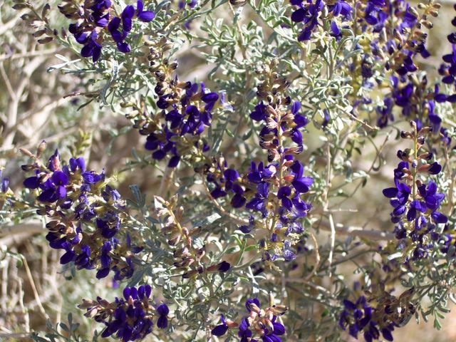
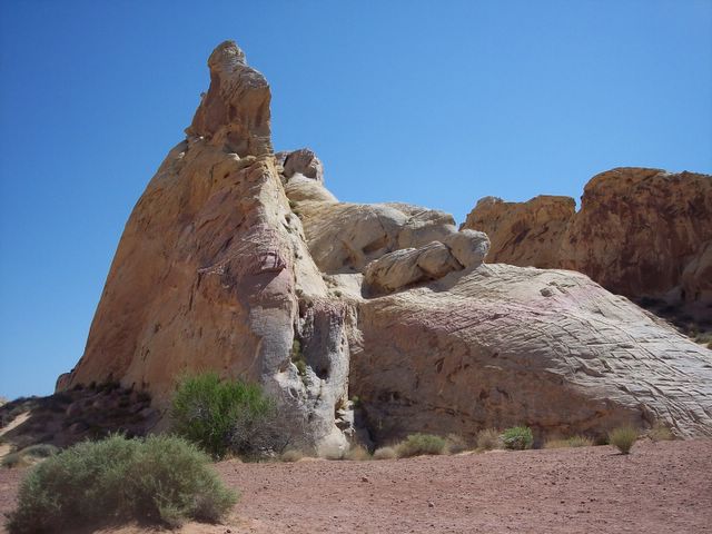
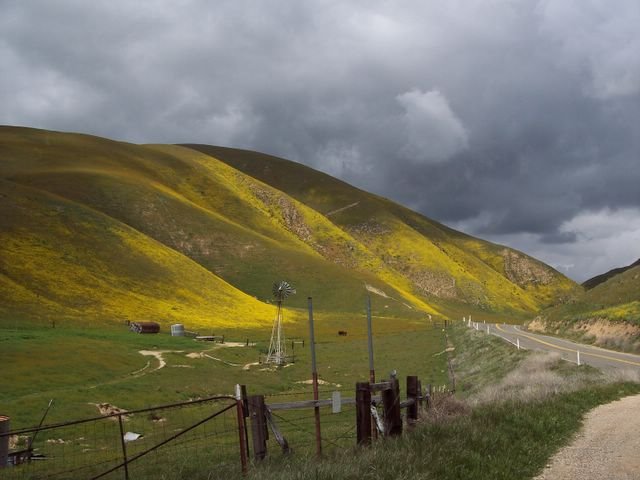
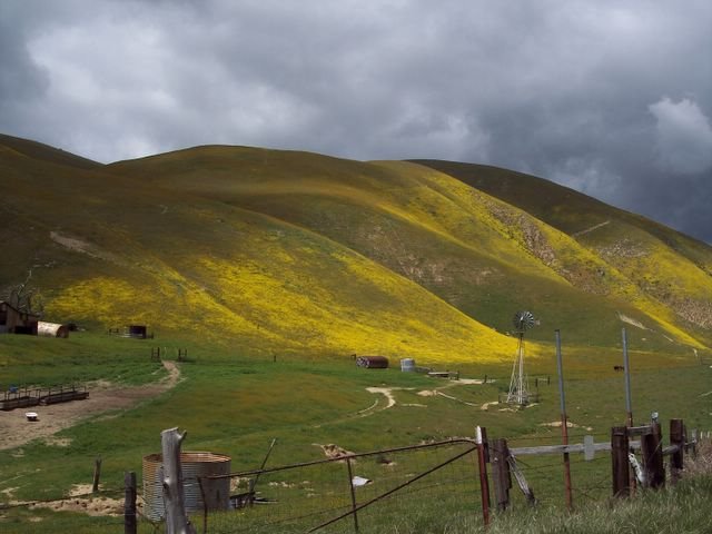
After seeing the elk, I decided to go back to Carrizo Plain again, since it wasn't very far. This time, I took Highway 58, which cuts through Buttonwillow and McKittrick. It is a very windy, twisty road, and slow going, but scenic nonetheless. The hills were green, and parts of them were covered in flowers. I had to pull over at one point to take a picture. The hills were absolutely beautiful!

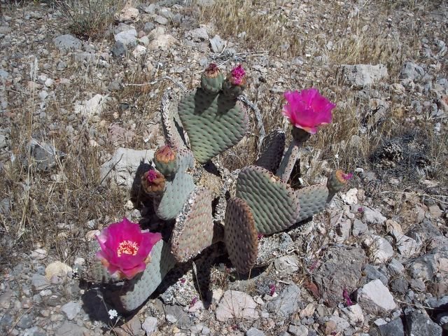
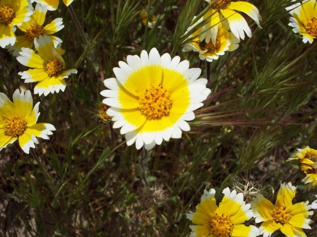
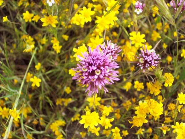
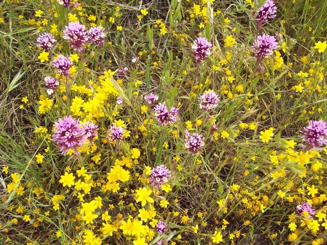
I stopped at Soda Lake, which is pretty dry for the most part right now. There is a boardwalk where you can walk near the shore with some benches where you can sit and watch for birds and such. There were several people out this time (last time I went I saw maybe 4 or 5 people total). It looked like a group of people on a wildflower tour. The fields were alive with color... yellows, purples, blues, whites. It was a cloudy day, but the flowers made the day look bright.

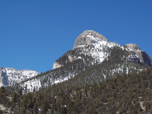
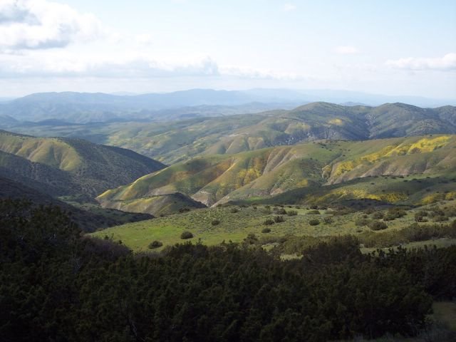
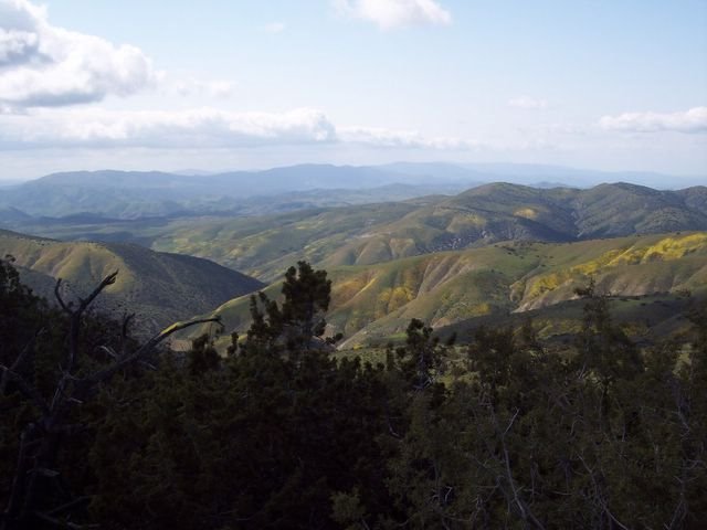
After stopping at Soda Lake, I went to the top of Caliente Ridge. Now this may not have been such a good idea since I was in a passenger car and the road is unpaved and rutty in several areas, and very steep on top of it. At one point, I nearly got stuck going up the hill....a very steep part of the hill. My car would not move because one of the wheels got stuck in a rut. I had to back up then floor it to get out. It was interesting to say the least.

But, despite the nearly-getting-stuck incident, the view from the top was worth it! It was absolutely gorgeous. I was glad I made the trip (by the way, all of the cars parked at the top were either pickup trucks or SUV's - lol).

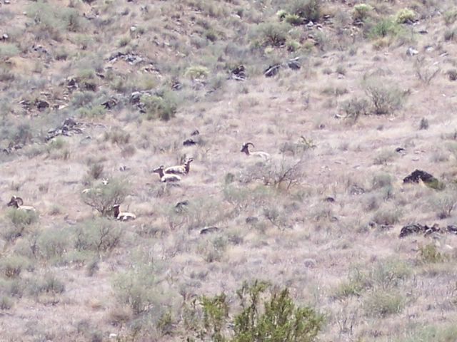
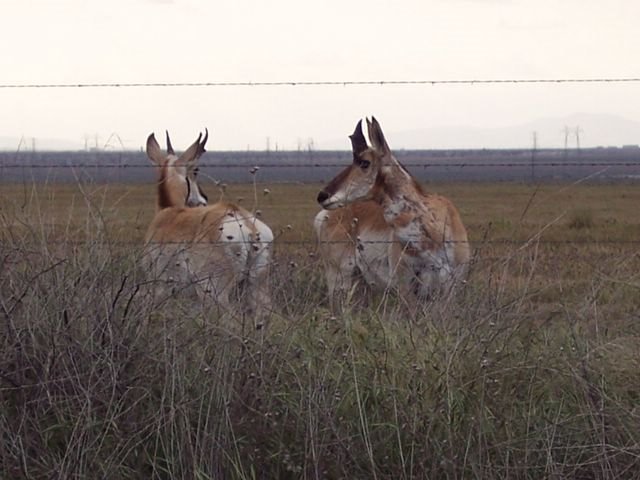
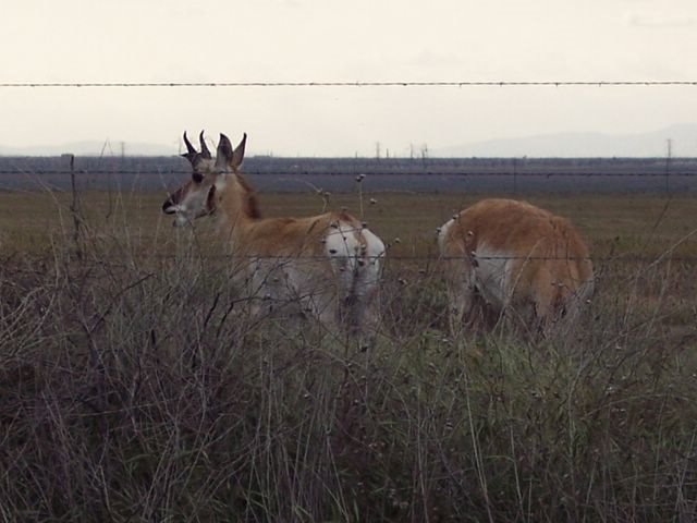
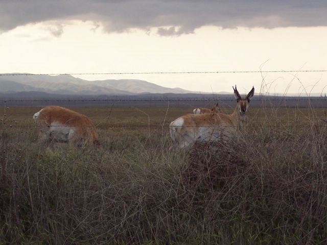
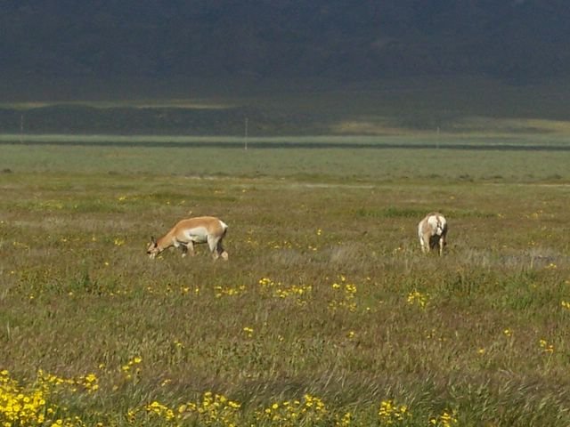
On my way back to the main road, I saw a pronghorn antelope running across the plain. They can run very fast. In fact, they are the fastest land animal in the North America, running at top speed of 55-60 mph. I was so excited to see it, because it was the first time I had ever seen one in the wild. On the main road, I spotted a small herd of maybe 10-15 pronghorn grazing maybe 30-50 feet off of the road. I snapped a few pictures, but they didn't really show much. I just ordered a telephoto lens for my digital camera so I can get closer shots next time. I also spotted another herd on my way back to the I-5, just east of McKittrick, CA. I was surprised to see them there since I didn't think they roamed that far out of Carrizo Plain. This time, I was able to get better pictures since they were closer to the road. But they sure were keeping their eyes on me!

I posted some pictures below, so enjoy! It is almost May, so camping season is coming soon! But with the gas prices on the rise, it sure is gonna make camping more expensive.

gas prices in California - yikes - this is gonna cut into my traveling!

Pronghorn antelope - I saw these guys as I was driving eastbound on Highway 58, just east of McKittrick, CA

Pronghorn antelope grazing near the highway

Pronghorn antelope

Westbound on Highway 58 - the hills were blooming with color, making the drive pretty, despite the cloudy day

Highway 58 going west

Tidy tips - these flowers are everywhere in Carrizo Plain

Owl clover (the purple flowers)

Owl clover (the purple flowers) amid goldfields (yellow flowers) in Carrizo Plain National Monument

Pronghorn antelope grazing in Carrizo Plain National Monument

On top of Caliente Ridge

Atop Caliente Ridge in Carrizo Plain National Monument