Monday, July 25, 2005

Beach Weekend

This last weekend, I stayed fairly close to home, but just far away enough to get away from the heat of Bakersfield. This weekend I took a trip to the coast and went to Shell Beach and Montana de Oro State Park. The weather was beautiful. It was nice and sunny in Santa Maria, but the beaches were foggy, as is typical of summer time. It seemed like the pelicans had taken over Shell Beach, as there were literally hundreds of them flying about and making their homes on the various rock "islands" around the shore. The air was full of the sounds of waves crashing onto shore and the cries of sea gulls. Chris and I took a walk towards the infamous Pirate's Cove (a nude beach - hehe), but we didn't actually go down there. It was a nice walk amongst the huge mansions that lined street. What a view those people must have. We spotted several lizards like this one ...


along the pathway. I even made a snare out of some wheat grass and caught one, which is something I haven't done since I was a teenager.

The next day, we headed to Montana de Oro State Park in Los Osos, CA. It is a beautiful place, even in the fog. There are a lot of hiking trails in the park, if you are feeling adventurous. We took an easy trail called the Bluffs Trail, which is a long, winding, relatively flat trail that snakes its way around the bluffs and coves. There is a lot of erosion going on around there, so you can't go too near the edge, less you fall off (and trust me, that would be BAD!). We saw quite a bit of wildlife and birds around there, including rabbits, ground squirrels, quail, comorants, various other birds, and even a seal swimming around in the coves. He didn't make his presence a secret, as he was very noisy, making seal "barks" now and then. A large group of comorants was resting on some rocks, and seemed to be pretty content there, until more people came, and then they suddenly took off squawking, in what looked like black fog.

We found some tidepools in one of the coves and explored those for a while. They look like miniature oceans, full of sea anenomes, hermit crabs, starfish, sea weed, mussels and barnacles, and other snail-looking creatures. I used to love to look at tidepools when I was a kid. I think, in a way, I never really grew up, because I still like to look at tidepools, climb amongst the rocks and skip stones on the sea.

We didn't leave the beach til after 5 pm. On the way out of the park, you could see Morro Rock peeking through the fog.


It looked surreal.

I am back in Bakersfield now, and it is ONLY supposed to be 103 today. I wish I could go to the beach everyday!

I posted some more pics below, and there are even more on My Yahoo Photo Album

Destinations:


  • Shell Beach, CA (151 miles from Bakersfield)

  • Montana de Oro State Park (17 miles from Shell Beach)


    Links:


  • Brown Pelican

  • Montana de Oro State Park

  • Sea Anenome

  • Shell Beach

  • Sea Anenome in a tidepool


    Starfish and little sea anenomes


    Poison Oak in Montana de Oro ... BAD!!!


    Rabbit on the Bluffs Trail in Montana de Oro


    Ground Squirrel on the Bluffs Trail in Montana de Oro


    Montana de Oro State Park


    Brown Pelicans at Shell Beach, CA


    Honeybee on some purple flowers


    foggy day in Shell Beach, CA

    Monday, July 11, 2005

    Yosemite Weekend

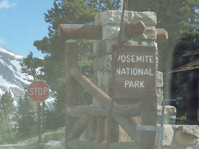
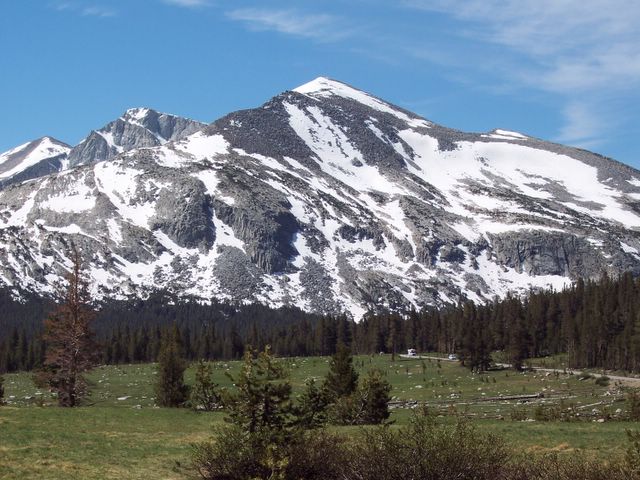
    Well, Chris and I went camping in Yosemite National Park this weekend (7/8/05 - 7/10/05). This time we ventured up Tioga Road, as it was open for business (finally!). Due to the large amounts of snow and one of the wettest winters in years, there was a rather large delay in getting the road open. As we drove up the road, we saw that a few of the campgrounds were still closed. (Note: If you are thinking about camping in Porcupine Flat or in White Wolf, think again...they are still closed!). This was rather disheartening, as all of the Yosemite Valley campgrounds were full.

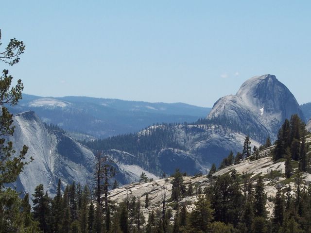
    We stopped at Olmstead Point (elevation 8400 feet) to check out the scenery, on our first stop to Tuolumne Meadows. From here, you can see Cloud's Rest and the backside of Half Dome, 2 of Yosemite's major hiking spots. The view was incredible! We spotted a Yellow-Bellied Marmot running to and fro amongst the boulders. I couldn't get a picture of him, as the critter was too fast - lol. From what I hear, Olmstead Point is prime marmot country.

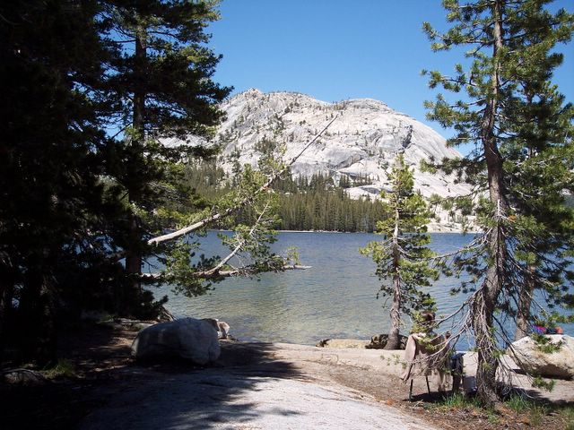
    The next stop was Tenaya Lake. This place was beautiful. Located 7 miles west of Tuolumne Meadows, it is a large, clear, blue lake, surrounded by granite domes. The lake is named after Chief Tenaya, who argued that the lake already had a name...Pie-we-ack, or Land of The Shining Rocks. It is a great place to stop and fish, take in the scenery, or have a picnic.

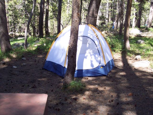
    We finally reached Tuolumne Meadows (elevation around 8600 feet) in the early afternoon. And lucky us, Tuolumne Meadows Campground was open and there were spaces available. We snatched up a site for 2 nights, and set up camp. Lucky for us, this was the first night that the campground was open! The weather was beautiful...clear, blue skies, and nice and warm in the daytime, though it got to be quite chilly at night.

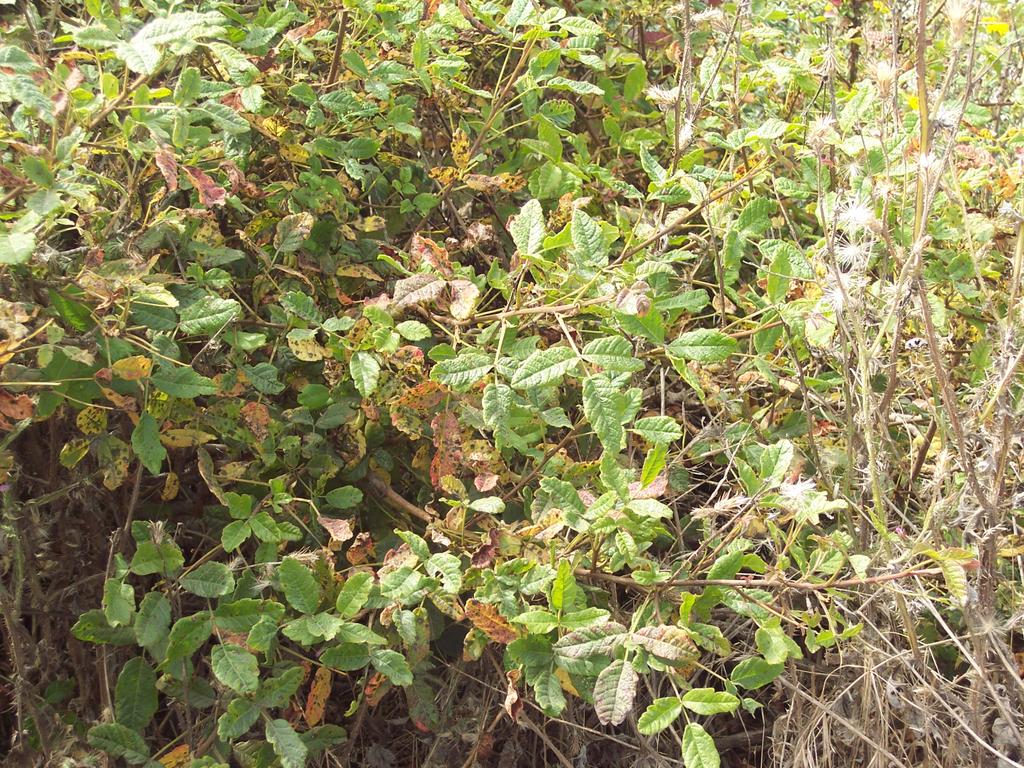
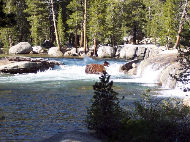
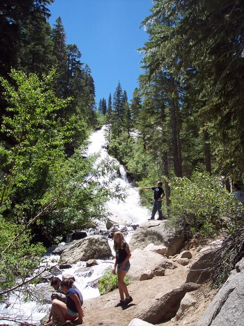
    On the first day, we set off to explore the Tuolumne River trail. This trail was relatively easy, yet, the high altitude makes breathing a bit harder, so frequest rest stops were needed. The trail was full of trees and lush greenery. Nearer to the river, many small streams creaked their way through the terrain, making maneuvering a little more difficult, unless you wanted to get your feet wet - lol. A test of balance came when we had to cross a log to get to the other side of a bigger stream. And yes, I passed the test, crossing the log without falling in (lol). We finally made it to the river, after many mosquito bites ( I think I had over 10 bites on this trip, even with using repellant!). The river was wide, the water was cold, and the current was swift. We stopped and sat by the river's edge and, of course, I took pictures. Several people had ventured down to the river. Some were fishermen, and others, sight-seers like us.

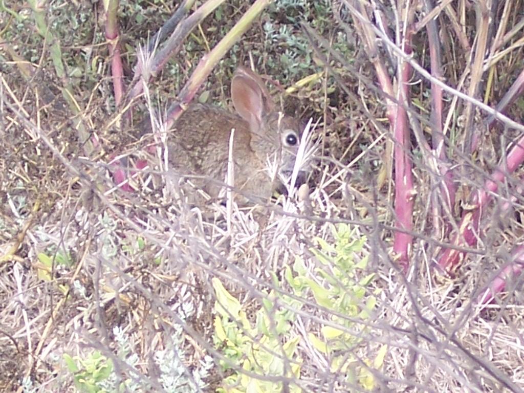
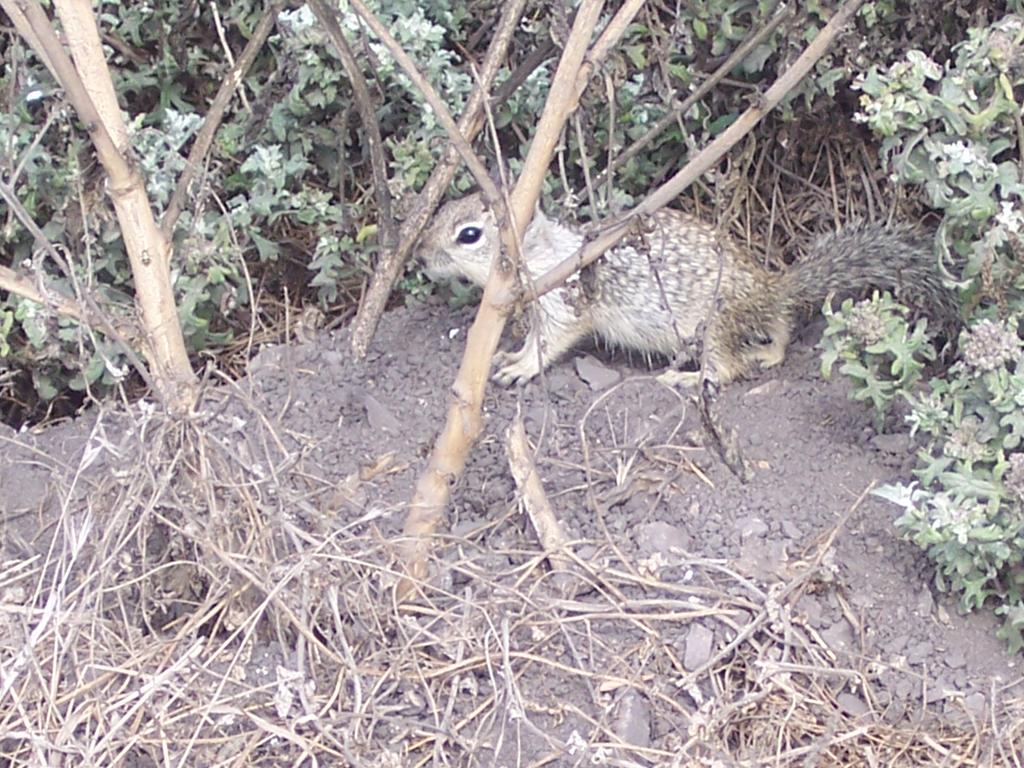
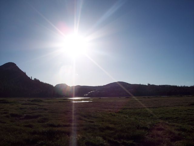
    After the river trail, we decided to check out Tuolumne Meadows. If you have never been there, I suggest you go! The meadows are beautiful. They are green and vast, surrounded by granite domes, and various streams run through them, making them a prime wildlife viewing area. We saw some Belding's Ground Squirrels and some deer drinking out in the streams, as well as many different birds. It is a lovely place to sit and watch the sun set or to just relax.

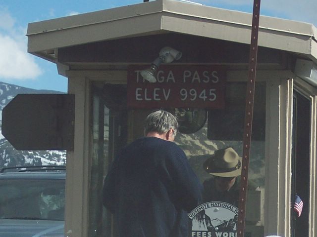
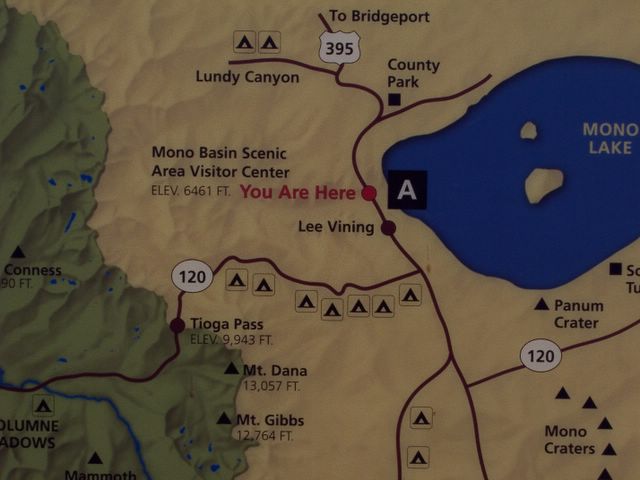
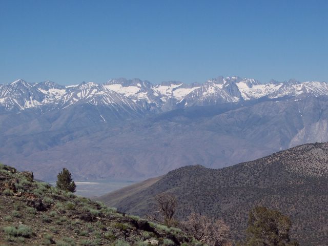
    The next day, we set off early to go to Mono Lake and Bodie State Historic Park. It was quite a drive to Mono Lake, which is located near the town of Lee Vining, CA. This town was named after Leroy Vining, who founded the town in 1852 as a mining camp. Unluckily, his life came to an end when he accidentally shot himself (talk about your bad luck!). Originally, the town was to be named Lake View, but this name was already taken, so the name Lee Vining was used instead.

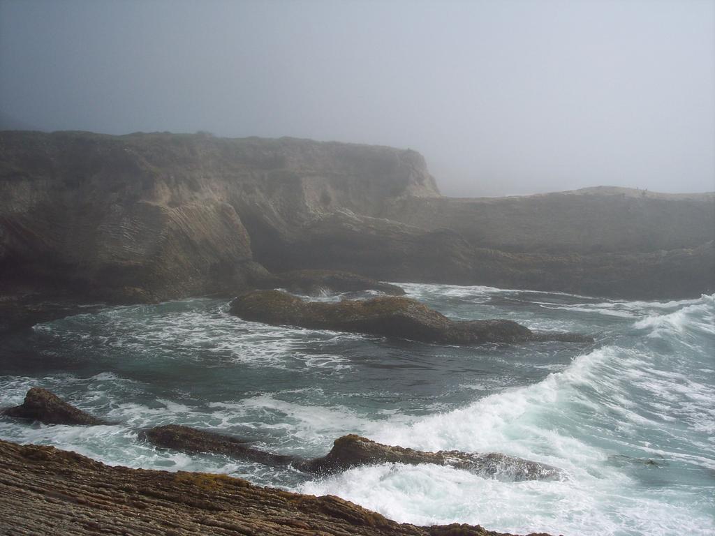
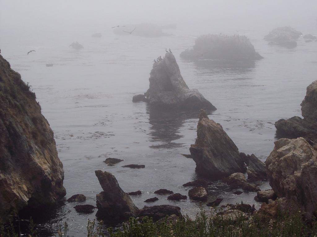
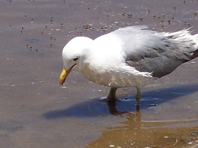
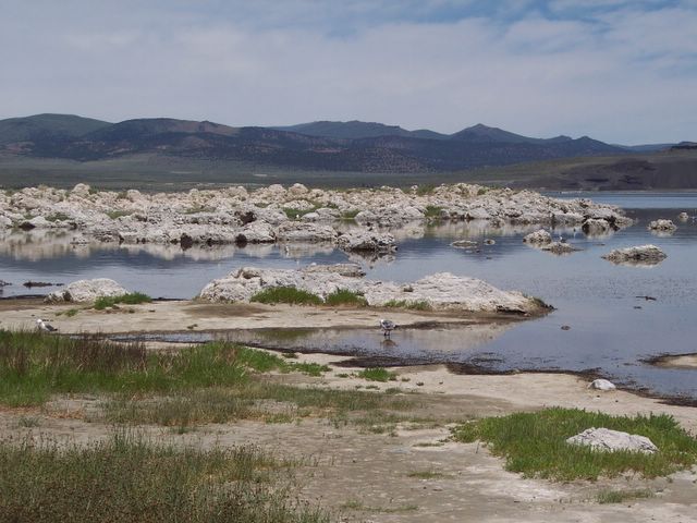
    Mono Lake (elevation 6461 feet) is very unique. It is a large salt lake. In fact, the lake is 3 times as salty as the sea. It is a resort of sorts for various birds, including osprey and sea gulls. It was kind of odd to travel inland and smell the ocean smell and see sea gulls flying overhead. The lake is not particularly suitable for swimming, although you can swim in it. It is very salty, smelly, and there are vast amounts of brine flies along the shores. From what I have read, it is an interesting experience to swim in the water, as the large amounts of salt make you very buoyant. The average depth is around 50 feet, but it can reach up to 150 feet deep in places. There are no fish in the lake. The only creatures that can survive in the lake's alkaline water are brine shrimp, which are found in abundance.

    The lake has some of the most unusual geological features, including the famous Tufa Towers. These towers are formed out of calcium carbonate, and they extend out of the surface of the lake. They are formed by the action of the freshwater streams on the lake's alkaline waters. As the area was formerly volcanically active, there are large amounts of metamorphic rock, including obsidian, pumice and rhyolite.

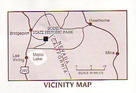
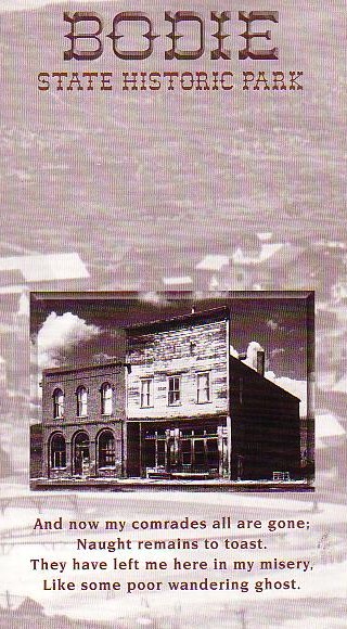
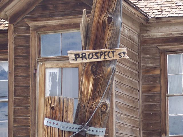
    The next stop on the trip was to Bodie State Historic Park, elevation 8375 feet, located about 31 miles from Lee Vining, CA. The drive is pretty good, but the last 3 miles are accessible only by way of a dirt road. The sign says "very rough road," but I found it to be, well, not so rough. This park is actually the remains of an old ghost town from the late 1800's. The town was named after William Bodey who discovered gold there in 1859. Unfortunately, he died that winter, freezing to death in a snow storm, and never got to see the town take on his name (There are varied accounts to why the town's name is spelled differently from its namesake. One account says that the misspelling was attributed to an illiterate sign painter. Another account says that the sign painter didn't have enough room on the sign for the tail on the lower case "y." Another states that the "misspelling" was actually deliberate to ensure proper pronunciation). A mill was built in 1861 and the town grew from there. At its peak in 1879, the town's population was around 10,000 people. With the numerous saloons and brothels, the town gained a bad reputation as an outlaw town. With so much violence, it would be easy to say that the undertaker was probably the busiest man in town. After the gold strikes began to decline in the 1880's, the town also declined, and people began to leave. Nowadays, you can visit here and see all that is left of this once thriving mining town. All that you have to do is drive there and pay the $3 entrance fee. There is also a museum and a small gift shop in the park, but no other services, except for water fountains and bathrooms, and in the true spirit of the town, they are just outhouses - no flush toilets in the park.

    After we did all of our sight-seeing in Bodie, we drove back to camp, stopping in the Tuolumne Meadows once again to relax. Back at camp, we started a campfire, which was nice since it was chilly (well it was to me! lol). Just before dark, we heard someone yell, "Bear!" At first, I thought it was someone calling their dog, as the voice sounded pretty calm. But after a few more excited shouts of "Bear!" I realized that it was not a dog they were calling for, for no more than 200 feet from me in the distance, I saw a bear coming toward our campsite! I ran to grab my camera out of my car, but it was too dark and the bear was too far away to get his/her picture. I was bummed that the picture didn't come out. The bear seemed to have no interest in us humans. It was probably just looking around to see if any of the stupid humans had left any food out - lol. Luckily for us, we had all of our stuff safely stowed away in the bear box. The people clapped at it, and shouted at it to make it leave. After a few minutes of roaming, the bear decided it didn't want anymore harassment by the people, and it ran off into the woods. It was quite a sight to see.

    Sunday morning, we packed up camp and drove back to Bakersfield, stopping in Oakhurst, CA for some Taco Bell (those Crunch Wrap Supremes are yummy!), and somewhere around 3 pm, we arrived back in town, smelly from mosquito repellant and sunblock, and dying for a shower!

    I don't think I am going anywhere this upcoming weekend, but Chris wants to check out Devil's Postpile in a few weeks. I will keep you posted.

    Destinations:


  • Yosemite National Park

  • Olmstead Point

  • Tenaya Lake

  • Tuolumne Meadows

  • Tioga Pass

  • Mono Lake

  • Bodie State Historic Park (303 miles from Bakersfield, CA)


  • Total miles driven on this trip: 606


    Links:


  • Yosemite National Park

  • Tuolumne Meadows Hikes

  • Mono Lake

  • Bodie State Historic Park

  • Tioga Pass

  • American Black Bear

  • Yellow-Bellied Marmot
  • Sunday, July 10, 2005


    Tioga Pass (Yosemite entrance)

    Yosemite entrance at Tioga Pass

    You are here (at Mono Lake Visitor Center)

    Plaque at Bodie State Historic Park

    Near sunset at Tuolumne Meadows

    Ellery Lake

    Belding's Ground Squirrel

    Bodie map

    Bodie souvenir map

    at Bodie State Historic Park

    Tenaya Lake

    Sea Gull hunting brine flies at Mono Lake

    Mono Lake

    On Tioga Pass

    Cathedral Peak

    Tuolumne River

    Tuolumne Meadows Campground

    Tuolumne Meadows in Yosemite National Park

    Olmstead Point on Tioga Road (the backside of Half Dome is visible on the right)

    Raven at the entrance to Yosemite National Park

    Tuesday, July 05, 2005


    postcard of The Alabama Hills

    postcard I got at the Visitor Center Posted by Picasa

    postcard of Mt Whitney Posted by Picasa

    postcard of The White Mountains  Posted by Picasa

    4th of July Weekend

    It's no big surprise that I went camping over the 4th of July weekend. When the temperature in Bakersfield starts hitting those triple digits, it is the perfect time to get out of dodge and head for the hills...or mountains in my case ;) On Saturday, July 2nd, Chris and I headed on out of Bakersfield...destination: Troy Meadow. It took about 3 hrs to get there, since it is about 150 miles from Bakersfield. We stopped at Sherman Pass (elevation 9200 feet) to take in the scenery at the vista point. There was still some snow up here, and some motorists and bikers had stopped here, also, to look around and play in the patch of snow that was in the small parking lot. I snapped a few pictures and then we continued on our way to the campground. We lucked out, as there were still quite a few empty campsites available. We staked out our campsite, pitched the tent, paid the $10 campsite fee, and then set off down the road to see what the Fish Creek Campsite looked like. There were still quite a few campsites left there as well, which surprised me, as the 4th of July weekend is generally a busy weekend for campers. After we got back to Troy Meadow Campground, we decided to do a little exploring around the meadow. There were quite a few people who had brought their fishing gear and were fishing for Golden Trout in the stream. We talked to one man who said he had caught 60 or so fish out of the stream in a 6 hour period. Most of them were small....6-8 inches long, but he said he caught a few larger ones as well.

    As we explored more of the meadow, I spied a marmot next to the stream. He had probably come down to have a drink of water. Marmots are fairly large rodents...about the size of a housecat. Aside from their tails, they look a lot like beavers. They like to live amongst the rocks in high altitudes. We spent quite a while trying to take this guy's picture. I couldn't get a close-up shot of him, as he kept hiding. He sure was a cute little fellow.

    The Troy Meadow area is quite popular with the off-road vehicle enthusiasts. The whole area was teeming with motorcycles and ATV's. As noisy as it was during the day, it was very quiet at night, save for the wind which was blowing constantly thru the night. I was nice and warm in my new sleeping bag though :)

    The next day, we got up in the morning and walked down to the meadow to see if we could see any wildlife. It seems like all the animals were either sleeping in or hiding from us. We did see a few chipmunks and a lot of birds.

    After we took down the tent and packed up, we drove off down the mountain. Next destination: Whitney Portal. We drove into Lone Pine, CA to gas up and have some lunch. We had lunch at this pizza place called The Pizza Factory. We had a medium combo pizza to split among the 2 of us. After a dinner of trail mix and some nuts the night before, that pizza tasted like the best damned pizza in the world - lol. Bellies full, we took off to Whitney Portal...elevation 8360 feet. This area is the trailhead to Mt Whitney Peak...the tallest peak in the lower 48 states at 14,495 feet. Now, I certainly had no intention of attempting this trail. I am in no shape to do so - lol. Chris has climbed it though. We took it easy and climed a little way up a trail to a cascade (like a mini waterfall). I took some pictures and we stood near the water and the mist spray sure felt good. At this elevation, it was quite a bit cooler than down below in Lone Pine.

    On the way down from Whitney Portal, you can see the famous Alabama Hills, where many western movies were filmed. In fact, each October, movie buffs from all over gather in Lone Pine for the Lone Pine Film Festival. A great many old westen and modern movies have been filmed in this area. If you watch an old western movie sometime, look at the scenery. Maybe you will see Mt Whitney in the background.

    After descending back down to Lone Pine and filling up my gas tank, we took off again. Destination this time: The Ancient Bristlecone Pine Forest in the Inyo National Forest's White Mountains. First off, we stopped to get a campsite at Grandview Campground. Camping here, incredibly, is free, though they do ask for a small $3 donation. There is no water available at this campground, and they have only the old-school outhouse type "bathrooms" (a hole in the ground with a seat on top - lol). There were quite a few sites still available. We couldn't believe our luck! We pitched the tent and set off for Schulman Grove...the sight of the Ancient Bristlecone Pine Forest. We didn't arrive there til almost 5 pm. The Visitor Center closed at 5 pm, so I picked up a few postcards, paid the $5 fee and then we set off on the Discovery Trail. We opted for this trail as it was only a mile round trip versus the 4 mile round trip of the Methuselah Trail. We simply did not have enough daylight left to complete that trail, as it would take about 4 hours to complete. The Discovery Trail was a nice trail. It did get rather strenuous at times for me, as I am not used to the 11000 or so feet altitude. It does have a 200 foot ascent up the mountain and it is mostly uphill. There is such a thing as altitude sickness (yes, there really is - lol)...

    Being at a high elevation is stressful to your body. The concentration of oxygen is 21% at both sea level and at higher altitudes, but the decreasing air pressure at higher elevations means you get significantly fewer oxygen molecules per breath once you go over about 8,000 feet. (from WebMD.com)


    I was feeling some effects from the high altitude, including some dizziness, headache and fatigue. The trail, for me, was difficult at times. But we stopped and rested a little every 20 seconds or so when we were going uphill in order to not overdo it and get full-on sick (puking and all - lol). At the top of the trail, the view down below was incredible. The climate and vegetation is so different from below. On one side of the mountain, there were trees...on the other...none. It looked like arctic tundra...almost like you would expect to see a herd of reindeer coming up over the ridge, or a polar bear basking in the sun. It was vastly different from any other place I have ever been. The trees were not all that tall. Bristlecone Pines have a very short growing season..approximately 45 days out of the whole year. They survive with minimal moisture and in poorly nourished soil. Yet, these trees are some of the oldest living things on the planet. In fact, the oldest tree, the Methuselah Tree, is some 4600 years old!

    After we completed the Discovery Trail, we decided to go on further up the road to the Patriarch Grove. To reach this place, you have to drive on a rough and steep dirt road. Now, I don't have an SUV...I drive a Chevy Cavalier (lol). But my little car made the trek. The Patriarch Grove was closed though, because snow drifts had blocked the road and they don't plow up there. So, we traversed onward to the locked gate at the White Mountain Peak trailhead, which reached an elevation of over 12000 feet. This is the highest point I have ever set my two feet on the ground at. (airplanes don't count - lol). It was absolutely freezing up there, and I was very light-headed by this time. The landscape up here, in subarctic conditions, was vast and treeless. In some parts, it looked almost like a lunar landscape or something out of a desert. The climate is very dry and cold, and very little vegetation grows up there. There were no squirrels or other mammals to be found. Only a few birds flew here and there. I didn't even see any insects. Some people had parked their cars at the gates and set up camp, probably to get a head start on the White Mountain Peak trail in the morning (* White Mountain Peak is 14,426 feet in elevation). It was so cold, one would wonder how those people would feel in the morning when they woke up freezing - lol.

    After a little while, we headed on back, as it would be dark soon, and I wasn't too keen on driving down a dirt road in the dark. After about an hour of driving 15-20 mph, we finally hit the pavement and headed back to the campsite. When we got to the site, Chris started a campfire and we sat out and looked at the stars. The sky was gorgeous. The night sky was moonless and full of stars. The Milky Way was clearly visible. I just stood out there on the dirt road and looked up to the sky, much like I used to do when I was a little girl. I sure wish I would have had a telescope.

    Monday morning, we took down the tent and headed on back to Bakersfield. But first, we went up the mountain a ways to a vista point where you could see the Sierra Nevada range in a panoramic view. It was incredible. You could also see the town of Bishop, CA far down below. It was a fitting end to a great weekend.

    It took over 5 hours to drive home, but the weekend was great. I saw a lot of sights and things I have never seen before. And of course, I took a lot of pictures! I am looking foward to going back to Yosemite this weekend to see Tioga Road, Tenaya Lake, and Mono Lake!

    Destinations on this trip:


  • Troy Meadow (about 270 miles from Bakersfield)

  • Whitney Portal (about 200 miles from Troy Meadow)

  • Ancient Bristlecone Pine Forest (about 55 miles from Lone Pine, CA )


  • Total miles put on my car this weekend ... over 750


    Links:


  • Bristlecone Pine Forest

  • Mt Whitney

  • Troy Meadow

  • Altitude Sickness
  • Monday, July 04, 2005